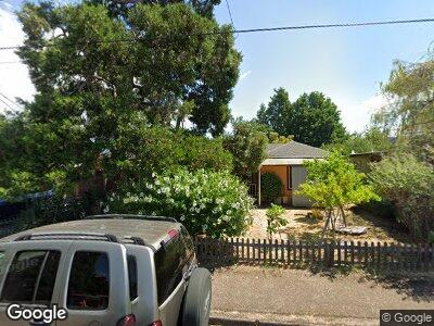
2915 High St Eugene, OR 97405
Southeast Eugene NeighborhoodEstimated Value: $382,000 - $406,416
3
Beds
1
Bath
1,001
Sq Ft
$394/Sq Ft
Est. Value
About This Home
This home is located at 2915 High St, Eugene, OR 97405 and is currently estimated at $394,854, approximately $394 per square foot. 2915 High St is a home located in Lane County with nearby schools including Adams Elementary School, Roosevelt Middle School, and South Eugene High School.
Ownership History
Date
Name
Owned For
Owner Type
Purchase Details
Closed on
Oct 17, 2013
Sold by
Pilibosian Leslie A and Simone Debroah J
Bought by
Guttenberg Patricia and The Patricia Guttenberg Living Trust
Current Estimated Value
Home Financials for this Owner
Home Financials are based on the most recent Mortgage that was taken out on this home.
Original Mortgage
$162,900
Interest Rate
4.13%
Mortgage Type
New Conventional
Purchase Details
Closed on
Aug 9, 2013
Sold by
Nelson Dawn A and Lacki Cathy F
Bought by
Pilibosian Leslie A and Simone Deborah J
Purchase Details
Closed on
Mar 11, 2003
Sold by
Nelson Dawn A
Bought by
Nelson Dawn A and Lacki Cathy F
Home Financials for this Owner
Home Financials are based on the most recent Mortgage that was taken out on this home.
Original Mortgage
$105,600
Interest Rate
5.83%
Create a Home Valuation Report for This Property
The Home Valuation Report is an in-depth analysis detailing your home's value as well as a comparison with similar homes in the area
Home Values in the Area
Average Home Value in this Area
Purchase History
| Date | Buyer | Sale Price | Title Company |
|---|---|---|---|
| Pilibosian Leslie A | $181,000 | Western Title & Escrow |
Source: Public Records
Mortgage History
| Date | Status | Borrower | Loan Amount |
|---|---|---|---|
| Open | Simone Deborah J | $105,600 | |
| Closed | Guttenberg Patricia | $162,900 | |
| Previous Owner | Nelson Dawn A | $105,600 |
Source: Public Records
Tax History Compared to Growth
Tax History
| Year | Tax Paid | Tax Assessment Tax Assessment Total Assessment is a certain percentage of the fair market value that is determined by local assessors to be the total taxable value of land and additions on the property. | Land | Improvement |
|---|---|---|---|---|
| 2023 | $2,955 | $144,777 | $0 | $0 |
| 2022 | $2,769 | $140,561 | $0 | $0 |
| 2021 | $2,600 | $136,467 | $0 | $0 |
| 2020 | $2,610 | $132,493 | $0 | $0 |
| 2019 | $2,520 | $128,634 | $0 | $0 |
| 2018 | $2,372 | $121,250 | $0 | $0 |
| 2017 | $2,266 | $121,250 | $0 | $0 |
| 2016 | $2,210 | $117,718 | $0 | $0 |
| 2015 | $2,146 | $114,289 | $0 | $0 |
| 2014 | $2,103 | $110,960 | $0 | $0 |
Source: Public Records
Map
Nearby Homes
- 2935 Pearl St
- 2940 Pearl St
- 360 E 31st Ave
- 3148 Willamette St
- 45 W 27th Ave Unit B
- 54 W 31st Ave
- 2990 Kincaid St
- 22 Prall Ln
- 2801 Kincaid St
- 2674 Kincaid St
- 206 W 27th Ave
- 3370 Alder St
- 1085 Cannon Ct
- 2795 Potter St
- 2625 Potter St
- 495 W 27th Ave
- 3085 University St
- 601 Lorane Hwy
- 2362 Charnelton St
- 3120 Onyx St