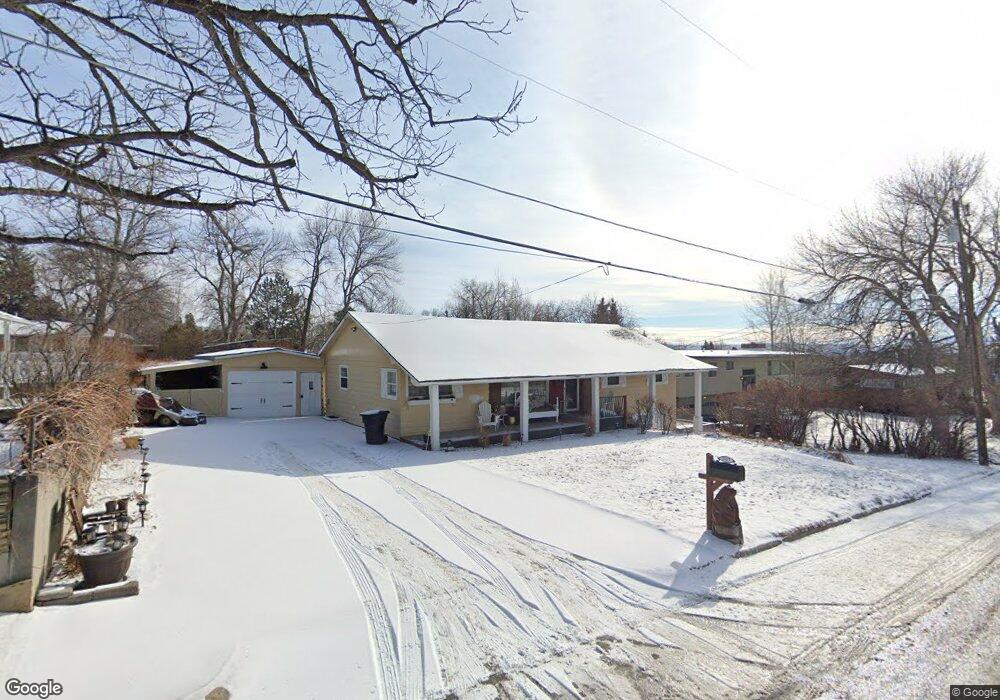
2917 Placer Dr Billings, MT 59102
North Central Billings NeighborhoodEstimated Value: $407,224 - $474,000
4
Beds
2
Baths
2,790
Sq Ft
$158/Sq Ft
Est. Value
About This Home
This home is located at 2917 Placer Dr, Billings, MT 59102 and is currently estimated at $441,056, approximately $158 per square foot. 2917 Placer Dr is a home located in Yellowstone County with nearby schools including Rose Park School, Lewis & Clark Junior High School, and Billings Senior High School.
Ownership History
Date
Name
Owned For
Owner Type
Purchase Details
Closed on
May 14, 2018
Sold by
Hardy David E
Bought by
Stovall Jennifer K
Current Estimated Value
Home Financials for this Owner
Home Financials are based on the most recent Mortgage that was taken out on this home.
Original Mortgage
$152,000
Outstanding Balance
$130,877
Interest Rate
4.4%
Mortgage Type
New Conventional
Estimated Equity
$310,179
Purchase Details
Closed on
Mar 8, 2018
Sold by
Schroeder Scott L
Bought by
Hardy David E
Purchase Details
Closed on
Feb 9, 2017
Sold by
Schroeder Margaret J
Bought by
Schroeder Scott L
Purchase Details
Closed on
Aug 13, 2014
Sold by
Schroeder George L
Bought by
Schroeder Margaret J
Create a Home Valuation Report for This Property
The Home Valuation Report is an in-depth analysis detailing your home's value as well as a comparison with similar homes in the area
Home Values in the Area
Average Home Value in this Area
Purchase History
| Date | Buyer | Sale Price | Title Company |
|---|---|---|---|
| Stovall Jennifer K | -- | -- | |
| Hardy David E | -- | -- | |
| Schroeder Scott L | -- | None Available | |
| Schroeder Margaret J | -- | None Available |
Source: Public Records
Mortgage History
| Date | Status | Borrower | Loan Amount |
|---|---|---|---|
| Open | Stovall Jennifer K | $152,000 |
Source: Public Records
Tax History Compared to Growth
Tax History
| Year | Tax Paid | Tax Assessment Tax Assessment Total Assessment is a certain percentage of the fair market value that is determined by local assessors to be the total taxable value of land and additions on the property. | Land | Improvement |
|---|---|---|---|---|
| 2025 | $3,382 | $378,700 | $59,660 | $319,040 |
| 2024 | $3,382 | $328,500 | $56,608 | $271,892 |
| 2023 | $3,391 | $328,500 | $56,608 | $271,892 |
| 2022 | $3,208 | $274,400 | $54,356 | $220,044 |
| 2021 | $3,047 | $274,400 | $0 | $0 |
| 2020 | $2,889 | $246,800 | $0 | $0 |
| 2019 | $2,764 | $246,800 | $0 | $0 |
| 2018 | $2,817 | $247,800 | $0 | $0 |
| 2017 | $2,703 | $243,700 | $0 | $0 |
| 2016 | $1,559 | $225,500 | $0 | $0 |
| 2015 | $1,528 | $225,500 | $0 | $0 |
| 2014 | $2,176 | $105,629 | $0 | $0 |
Source: Public Records
Map
Nearby Homes
- 1323 Granite Ave
- 1440 Granite Ave
- 2910 Glacier Dr
- 1233 Yale Ave
- 1214 Linhaven Way
- 1133 Rimrock Rd
- 1400 Poly Dr Unit 4D
- 41 Heatherwood Ln
- 1117 Poly Dr
- 1030 Yale Ave
- 1028 Princeton Ave
- 24 Heatherwood Ln Unit 12D
- 6 Heatherwood Ln
- 1212 O Malley Dr
- 46 Shadow Place Unit 6B
- 1010 Poly Dr
- 920 Yale Ave
- 2414 Ivy Ln
- 2718 Terrace Dr
- 1329 Parkhill Dr
- 3005 Placer Dr
- 2911 Placer Dr
- 2922 Smokey Ln
- 2920 Smokey Ln
- 2924 Smokey Ln
- 1402 Cascade Ave
- 3015 Placer Dr
- 2905 Placer Dr
- 1333 Rimrock Rd
- 1401 Cascade Ave
- 0 Placer Dr
- 3006 Smokey Ln
- 1329 Rimrock Rd
- 1411 Cascade Ave
- 3025 Placer Dr
- 1412 Cascade Ave
- 3018 Placer Dr
- 1411 Rimrock Rd
- 2915 Smokey Ln
- 2923 Smokey Ln