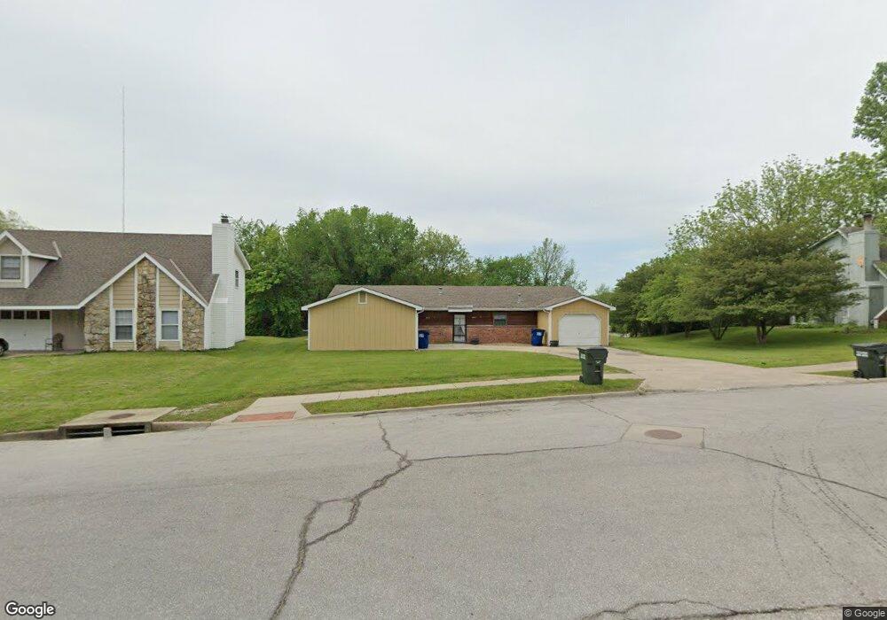
2917 University Dr Lawrence, KS 66049
Sunset Hills NeighborhoodEstimated Value: $301,000 - $485,000
4
Beds
2
Baths
1,941
Sq Ft
$192/Sq Ft
Est. Value
About This Home
This home is located at 2917 University Dr, Lawrence, KS 66049 and is currently estimated at $372,817, approximately $192 per square foot. 2917 University Dr is a home located in Douglas County with nearby schools including Hillcrest Elementary School, West Middle School, and Lawrence Free State High School.
Ownership History
Date
Name
Owned For
Owner Type
Purchase Details
Closed on
Dec 13, 2024
Sold by
Brown Investments Lc
Bought by
Carpentieri John and Carpentieri Ani
Current Estimated Value
Home Financials for this Owner
Home Financials are based on the most recent Mortgage that was taken out on this home.
Original Mortgage
$140,450
Outstanding Balance
$139,330
Interest Rate
6.72%
Mortgage Type
New Conventional
Estimated Equity
$233,487
Create a Home Valuation Report for This Property
The Home Valuation Report is an in-depth analysis detailing your home's value as well as a comparison with similar homes in the area
Home Values in the Area
Average Home Value in this Area
Purchase History
| Date | Buyer | Sale Price | Title Company |
|---|---|---|---|
| Carpentieri John | -- | Kansas Secured Title | |
| Carpentieri John | -- | Kansas Secured Title |
Source: Public Records
Mortgage History
| Date | Status | Borrower | Loan Amount |
|---|---|---|---|
| Open | Carpentieri John | $140,450 | |
| Closed | Carpentieri John | $140,450 |
Source: Public Records
Tax History Compared to Growth
Tax History
| Year | Tax Paid | Tax Assessment Tax Assessment Total Assessment is a certain percentage of the fair market value that is determined by local assessors to be the total taxable value of land and additions on the property. | Land | Improvement |
|---|---|---|---|---|
| 2025 | $4,414 | $35,765 | $7,475 | $28,290 |
| 2024 | $4,381 | $35,489 | $7,475 | $28,014 |
| 2023 | $4,302 | $33,546 | $7,475 | $26,071 |
| 2022 | $4,063 | $31,477 | $6,900 | $24,577 |
| 2021 | $3,587 | $26,903 | $5,031 | $21,872 |
| 2020 | $3,397 | $25,622 | $5,031 | $20,591 |
| 2019 | $3,228 | $24,387 | $4,598 | $19,789 |
| 2018 | $3,184 | $23,888 | $4,598 | $19,290 |
| 2017 | $3,203 | $23,762 | $4,598 | $19,164 |
| 2016 | $2,974 | $23,058 | $4,598 | $18,460 |
| 2015 | -- | $22,184 | $4,598 | $17,586 |
| 2014 | -- | $20,585 | $4,598 | $15,987 |
Source: Public Records
Map
Nearby Homes
- 2901 University Dr
- 2901 University Dr Unit A, B, C, D, E, F
- 1439 Applegate Ct
- 1304 Lawrence Ave
- 2609 Westdale Rd
- 1014 Lawrence Ave
- 1008 Lawrence Ave
- 1507 Medinah Cir
- 1021 Holiday Dr
- 923 Crestline Dr
- 1321 Raintree Place
- 1168 Parkside Cir
- 800 Madeline Ln
- 3507 W 10th St
- 1840 Quail Creek Dr
- 1336 Spencer Dr
- 3510 W 9th Ct
- 917 Sunset Dr
- 3700 Quail Creek Ct
- 2139 Quail Creek Dr
- 2915 University Dr
- 3001 University Dr
- 2913 University Dr
- 2911 University Dr
- 2912 Stratford Rd
- 2909 University Dr
- 2913 Stratford Rd
- 1355 Westbrooke St
- 3005 University Dr
- 1357 Westbrooke St
- 1359 Westbrooke St
- 1354 Westbrooke St
- 1356 Westbrooke St
- 1349 Westbrooke St
- 1351 Westbrooke St
- 3000 University Dr
- 1353 Westbrooke St
- 1348 Westbrooke St
- 1350 Westbrooke St
- 1352 Westbrooke St