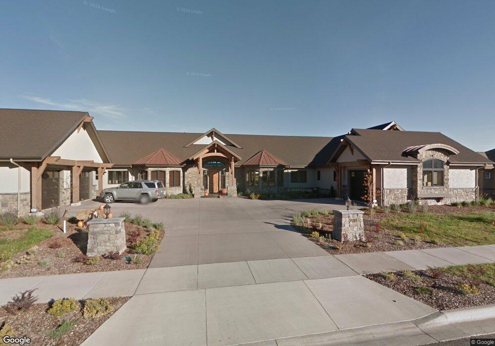
2918 Campsite Place Missoula, MT 59808
Captain John Mullan NeighborhoodEstimated Value: $1,917,112 - $2,458,000
5
Beds
6
Baths
5,370
Sq Ft
$415/Sq Ft
Est. Value
About This Home
This home is located at 2918 Campsite Place, Missoula, MT 59808 and is currently estimated at $2,227,704, approximately $414 per square foot. 2918 Campsite Place is a home with nearby schools including Hellgate Elementary Lower Grades, Hellgate Middle School, and Big Sky High School.
Ownership History
Date
Name
Owned For
Owner Type
Purchase Details
Closed on
Dec 18, 2009
Sold by
The Ranch Club Realty Llc
Bought by
Dale Elizabeth G
Current Estimated Value
Home Financials for this Owner
Home Financials are based on the most recent Mortgage that was taken out on this home.
Original Mortgage
$150,000
Interest Rate
4.78%
Mortgage Type
Purchase Money Mortgage
Create a Home Valuation Report for This Property
The Home Valuation Report is an in-depth analysis detailing your home's value as well as a comparison with similar homes in the area
Home Values in the Area
Average Home Value in this Area
Purchase History
| Date | Buyer | Sale Price | Title Company |
|---|---|---|---|
| Dale Elizabeth G | -- | Mt | |
| Dale Elizabeth G | -- | Mt |
Source: Public Records
Mortgage History
| Date | Status | Borrower | Loan Amount |
|---|---|---|---|
| Closed | Dale Elizabeth G | $150,000 |
Source: Public Records
Tax History Compared to Growth
Tax History
| Year | Tax Paid | Tax Assessment Tax Assessment Total Assessment is a certain percentage of the fair market value that is determined by local assessors to be the total taxable value of land and additions on the property. | Land | Improvement |
|---|---|---|---|---|
| 2025 | $21,791 | $2,465,100 | $309,659 | $2,155,441 |
| 2024 | $21,611 | $1,788,000 | $214,646 | $1,573,354 |
| 2023 | $20,177 | $1,788,000 | $214,646 | $1,573,354 |
| 2022 | $21,885 | $1,639,400 | $0 | $0 |
| 2021 | $32,545 | $2,423,777 | $0 | $0 |
| 2020 | $27,985 | $2,033,756 | $0 | $0 |
| 2019 | $30,714 | $2,206,036 | $0 | $0 |
| 2018 | $27,598 | $1,982,127 | $0 | $0 |
| 2017 | $24,289 | $1,982,127 | $0 | $0 |
| 2016 | $22,228 | $1,696,479 | $0 | $0 |
| 2015 | $19,502 | $1,920,759 | $0 | $0 |
| 2014 | $5,454 | $262,081 | $0 | $0 |
Source: Public Records
Map
Nearby Homes
- 2911 Bunkhouse Place
- 2625 Tanbark Way Unit A
- 2626 Muirfield Ct
- 2669 Bunkhouse Place
- 2645 Bunkhouse Place
- 2789 Paniolo Place
- 2783 Paniolo Place
- 2736 Paniolo Place
- 2729 Paniolo Place
- 8245 Pheasant Dr
- 2310 Sage Hen Ct
- 2340 Bob White Ct
- 8105 Pheasant Dr
- 8645 Mourning Dove Dr
- 2100 Hummingbird Dr
- 1935 Oriole Dr
- 121 New Meadows Dr
- 10190 Kona Ranch Rd
- NHN Haven Heights Rd
- 2426 Pale Evening Ct
- 2910 Campsite Place
- Lot 123 Campsite Place the Ranch Club
- 2902 Campsite Place
- 2934 Campsite Place
- Lot 128 Campsite
- Lot 119 Campsite
- Lot 130 Campsite
- Lot 120 Campsite
- Lot 127 Campsite Dr
- 2850 Campsite Place
- 2942 Campsite Place
- 2833 Campsite Place
- 3085 Trading Post Place
- 3043 Rustler Dr
- 3069 Trading Post Place
- 2834 Campsite Place
- 3051 Rustler Dr
- Lot 110 Rustler Dr
- 3035 Rustler Dr
- 3086 Bunkhouse Place