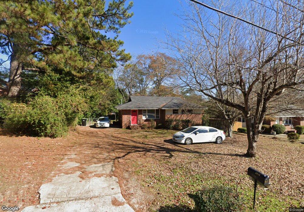
2919 W Britt David Rd Columbus, GA 31909
Estimated Value: $141,000 - $162,000
3
Beds
1
Bath
966
Sq Ft
$155/Sq Ft
Est. Value
About This Home
This home is located at 2919 W Britt David Rd, Columbus, GA 31909 and is currently estimated at $149,786, approximately $155 per square foot. 2919 W Britt David Rd is a home located in Muscogee County with nearby schools including Allen Elementary School, Arnold Middle School, and Jordan Vocational High School.
Ownership History
Date
Name
Owned For
Owner Type
Purchase Details
Closed on
Aug 29, 2019
Sold by
Dallas Joseph C
Bought by
Pool Aaron W
Current Estimated Value
Home Financials for this Owner
Home Financials are based on the most recent Mortgage that was taken out on this home.
Original Mortgage
$74,000
Outstanding Balance
$64,951
Interest Rate
3.7%
Mortgage Type
New Conventional
Estimated Equity
$84,835
Create a Home Valuation Report for This Property
The Home Valuation Report is an in-depth analysis detailing your home's value as well as a comparison with similar homes in the area
Home Values in the Area
Average Home Value in this Area
Purchase History
| Date | Buyer | Sale Price | Title Company |
|---|---|---|---|
| Pool Aaron W | $92,500 | -- |
Source: Public Records
Mortgage History
| Date | Status | Borrower | Loan Amount |
|---|---|---|---|
| Open | Pool Aaron W | $74,000 |
Source: Public Records
Tax History Compared to Growth
Tax History
| Year | Tax Paid | Tax Assessment Tax Assessment Total Assessment is a certain percentage of the fair market value that is determined by local assessors to be the total taxable value of land and additions on the property. | Land | Improvement |
|---|---|---|---|---|
| 2025 | $1,399 | $35,736 | $8,384 | $27,352 |
| 2024 | $1,399 | $35,736 | $8,384 | $27,352 |
| 2023 | $1,408 | $35,736 | $8,384 | $27,352 |
| 2022 | $1,213 | $29,708 | $8,384 | $21,324 |
| 2021 | $1,288 | $31,540 | $8,384 | $23,156 |
| 2020 | $1,288 | $31,540 | $8,384 | $23,156 |
| 2019 | $1,285 | $31,364 | $8,384 | $22,980 |
| 2018 | $1,285 | $31,364 | $8,384 | $22,980 |
| 2017 | $1,289 | $31,364 | $8,384 | $22,980 |
| 2016 | $1,501 | $36,377 | $4,507 | $31,870 |
| 2015 | $1,502 | $36,377 | $4,507 | $31,870 |
| 2014 | $1,504 | $36,377 | $4,507 | $31,870 |
| 2013 | -- | $36,377 | $4,507 | $31,870 |
Source: Public Records
Map
Nearby Homes
- 5552 Perry Ave
- 5829 Ventura Dr
- 3308 Mustang Dr
- 2528 Lorraine St
- 2516 Lorraine St
- 6226 Westbrook Dr
- 5817 Sherborne Dr
- 6225 Westbrook Dr
- 6232 Westbrook Dr
- 5435 Wayne Dr
- 6231 Westbrook Dr
- 5836 Sherborne Dr
- 6308 Adams Park Dr
- 2208 Airport Thruway
- 6138 Seaton Dr
- 3618 Grier Ave
- 2325 Coventry Dr
- 3325 N North Quay Dr
- 5239 23rd Ave
- 3120 Weems Rd
- 2927 W Britt David Rd
- 2913 W Britt David Rd
- 2907 W Britt David Rd
- 5519 Perry Ave
- 2909 Piper St
- 5513 Perry Ave
- 2935 W Britt David Rd
- 5525 Perry Ave
- 2901 W Britt David Rd
- 5503 Perry Ave
- 5529 Perry Ave
- 2899 W Britt David Rd
- 2900 Piper St
- 2895 W Britt David Rd
- 5533 Perry Ave
- 5516 Perry Ave
- 5524 Perry Ave
- 5510 Perry Ave
- 2918 Piper St
- 5502 Perry Ave