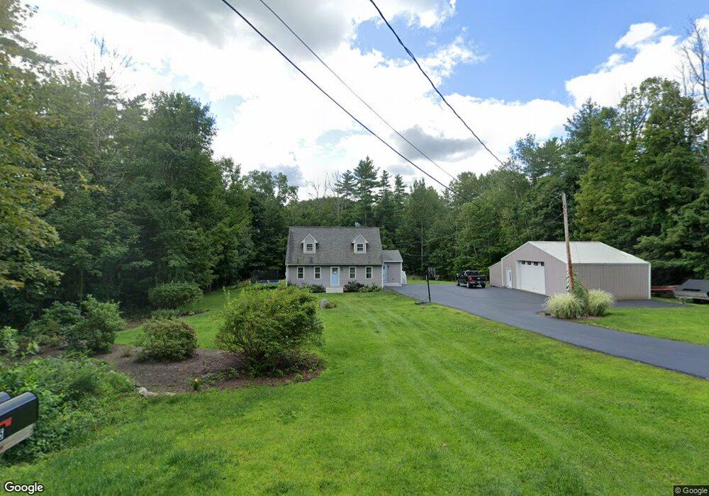
292 Prescott Rd Epping, NH 03042
Estimated Value: $554,000 - $669,000
3
Beds
3
Baths
1,758
Sq Ft
$343/Sq Ft
Est. Value
About This Home
This home is located at 292 Prescott Rd, Epping, NH 03042 and is currently estimated at $602,592, approximately $342 per square foot. 292 Prescott Rd is a home located in Rockingham County with nearby schools including Epping Elementary School, Epping Middle School, and Epping High School.
Ownership History
Date
Name
Owned For
Owner Type
Purchase Details
Closed on
Mar 17, 2014
Sold by
Schmal Douglas A and Schmal Sarah E
Bought by
Schmal Ft and Schmal Douglas A
Current Estimated Value
Purchase Details
Closed on
Sep 6, 2006
Sold by
Jansen Elizabeth A
Bought by
Roy Sarah E
Home Financials for this Owner
Home Financials are based on the most recent Mortgage that was taken out on this home.
Original Mortgage
$259,350
Interest Rate
6.79%
Mortgage Type
Purchase Money Mortgage
Create a Home Valuation Report for This Property
The Home Valuation Report is an in-depth analysis detailing your home's value as well as a comparison with similar homes in the area
Home Values in the Area
Average Home Value in this Area
Purchase History
| Date | Buyer | Sale Price | Title Company |
|---|---|---|---|
| Schmal Ft | -- | -- | |
| Roy Sarah E | $273,000 | -- |
Source: Public Records
Mortgage History
| Date | Status | Borrower | Loan Amount |
|---|---|---|---|
| Previous Owner | Roy Sarah E | $246,950 | |
| Previous Owner | Roy Sarah E | $259,350 |
Source: Public Records
Tax History
| Year | Tax Paid | Tax Assessment Tax Assessment Total Assessment is a certain percentage of the fair market value that is determined by local assessors to be the total taxable value of land and additions on the property. | Land | Improvement |
|---|---|---|---|---|
| 2024 | $7,645 | $303,000 | $106,100 | $196,900 |
| 2023 | $7,090 | $303,000 | $106,100 | $196,900 |
| 2022 | $6,814 | $303,000 | $106,100 | $196,900 |
| 2021 | $6,793 | $303,000 | $106,100 | $196,900 |
| 2020 | $7,163 | $303,000 | $106,100 | $196,900 |
| 2019 | $4,185 | $230,600 | $92,300 | $138,300 |
| 2018 | $10,684 | $230,600 | $92,300 | $138,300 |
| 2017 | $5,982 | $230,600 | $92,300 | $138,300 |
| 2016 | $5,982 | $230,600 | $92,300 | $138,300 |
| 2015 | $5,982 | $230,600 | $92,300 | $138,300 |
| 2014 | $5,438 | $222,700 | $92,300 | $130,400 |
| 2013 | $5,405 | $222,700 | $92,300 | $130,400 |
Source: Public Records
Map
Nearby Homes
- 277 Prescott Rd
- 104 Olde Bridge Ln
- 16 Molly Way
- 1 Olde Bridge Ln
- 27 Old State Rd
- 8 Megans Way Unit 95
- lot 103 Megans Way Unit 103
- 100 Megans Way
- 101 Megans Way Unit 101
- 96 Megans Way
- 97 Megans Way Unit 97
- 11 Gable Dr
- 3B Connor Ct Unit 3B
- 55 Sunset Ridge Rd Unit 55A
- 55 Sunset Ridge Rd Unit 55B
- 9B Connor Ct Unit 9B
- 54 Sunset Ridge Rd Unit 54B
- 3A Connor Ct Unit 3A
- 1A Connor Ct Unit 1A
- 5B Connor Ct Unit 5B
- 296 Prescott Rd
- 295 Prescott Rd
- 286 Prescott Rd
- 14 Rosewood Ct
- 300 Prescott Rd
- 17 Ironwood Dr
- 285 Prescott Rd
- 304 Prescott Rd
- 299 Prescott Rd
- 9 Ironwood Dr
- 21 Ironwood Dr
- 15 Rosewood Ct
- 307 Prescott Rd
- 20 Debbi Ln
- 14 Debbi Ln
- 14 Debbi Ln Unit 34
- 16 Debbi Ln
- 25 Ironwood Dr
- 10 Ironwood Dr
- 11 Rosewood Ct
Your Personal Tour Guide
Ask me questions while you tour the home.