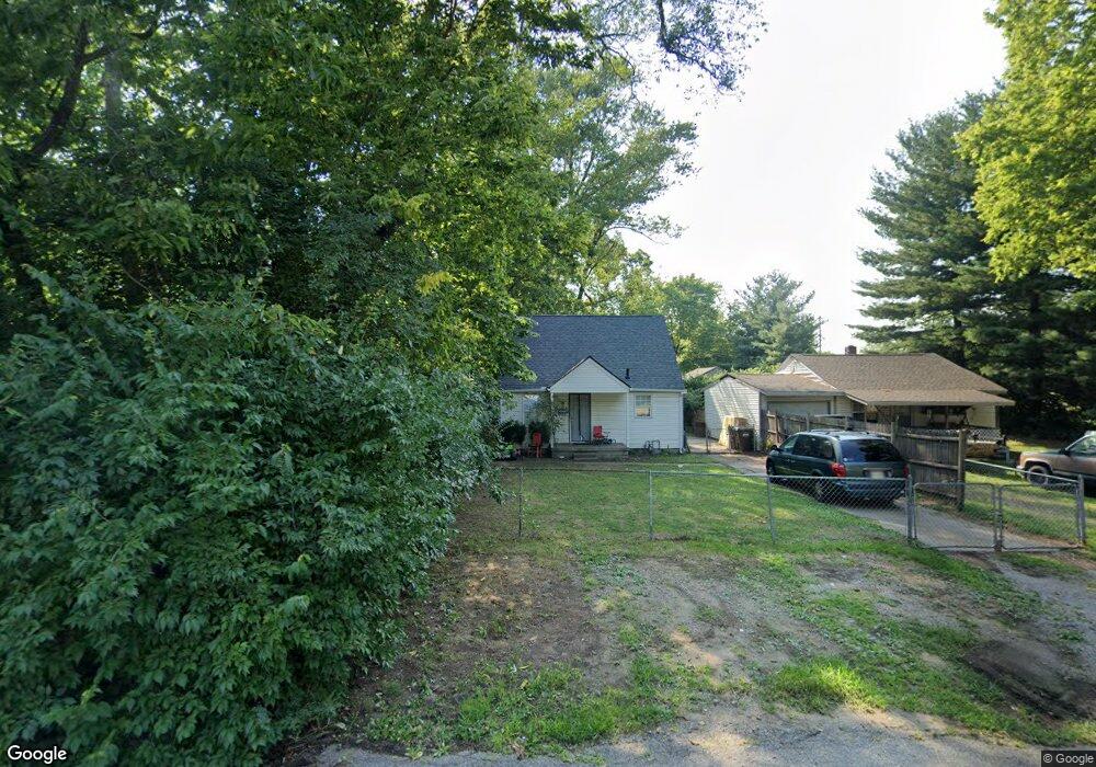
2922 Mohawk St Middletown, OH 45044
Amanda-Oneida NeighborhoodEstimated Value: $64,000 - $117,000
3
Beds
2
Baths
946
Sq Ft
$105/Sq Ft
Est. Value
About This Home
This home is located at 2922 Mohawk St, Middletown, OH 45044 and is currently estimated at $99,155, approximately $104 per square foot. 2922 Mohawk St is a home located in Butler County with nearby schools including Amanda Elementary School, Highview 6th Grade Center, and Middletown Middle School.
Ownership History
Date
Name
Owned For
Owner Type
Purchase Details
Closed on
Mar 10, 2022
Sold by
Agee James T and Agee Sheila J
Bought by
Hausberg Acquisitions Llc
Current Estimated Value
Home Financials for this Owner
Home Financials are based on the most recent Mortgage that was taken out on this home.
Original Mortgage
$92,260
Interest Rate
3.09%
Mortgage Type
Construction
Purchase Details
Closed on
Dec 22, 2021
Sold by
Hollon Michelle A
Bought by
Agee James T and Agee Sheila J
Purchase Details
Closed on
May 30, 2021
Sold by
Hollon Michelle
Bought by
Wells Dale
Home Financials for this Owner
Home Financials are based on the most recent Mortgage that was taken out on this home.
Original Mortgage
$310,000
Interest Rate
2.9%
Mortgage Type
Land Contract Argmt. Of Sale
Purchase Details
Closed on
Nov 4, 2010
Sold by
Triad Dominion Equities Llc
Bought by
Hollon Donald L and Hollon Michelle A
Purchase Details
Closed on
Oct 14, 2009
Sold by
Bulot Marie A
Bought by
Triad Dominion Equities Llc
Purchase Details
Closed on
Aug 12, 2005
Sold by
Brindle James A
Bought by
Bulot Marie A
Home Financials for this Owner
Home Financials are based on the most recent Mortgage that was taken out on this home.
Original Mortgage
$63,000
Interest Rate
5.69%
Mortgage Type
Fannie Mae Freddie Mac
Purchase Details
Closed on
Dec 3, 2004
Sold by
I P Risk Enterprises Llc
Bought by
Brindle James A
Home Financials for this Owner
Home Financials are based on the most recent Mortgage that was taken out on this home.
Original Mortgage
$45,500
Interest Rate
5.5%
Mortgage Type
Purchase Money Mortgage
Purchase Details
Closed on
Jan 16, 2003
Sold by
Mason Yvonne
Bought by
I P Risk Enterprises Llc
Purchase Details
Closed on
Dec 24, 2002
Sold by
Spicer Marie and Cruse Norma
Bought by
Mason Yvonne
Purchase Details
Closed on
Nov 13, 2001
Sold by
Tabor James
Bought by
Mason Yvonne
Create a Home Valuation Report for This Property
The Home Valuation Report is an in-depth analysis detailing your home's value as well as a comparison with similar homes in the area
Home Values in the Area
Average Home Value in this Area
Purchase History
| Date | Buyer | Sale Price | Title Company |
|---|---|---|---|
| Hausberg Acquisitions Llc | $65,000 | Fingerman Debra M | |
| Agee James T | $14,000 | None Available | |
| Agee James T | $14,000 | Holman Frank | |
| Wells Dale | -- | None Available | |
| Wells Dale | $31,000 | None Available | |
| Hollon Donald L | $19,500 | Attorney | |
| Triad Dominion Equities Llc | -- | Attorney | |
| Bulot Marie A | $78,750 | -- | |
| Brindle James A | -- | -- | |
| I P Risk Enterprises Llc | $30,000 | -- | |
| Mason Yvonne | -- | -- | |
| Mason Yvonne | -- | -- |
Source: Public Records
Mortgage History
| Date | Status | Borrower | Loan Amount |
|---|---|---|---|
| Closed | Hausberg Acquisitions Llc | $92,260 | |
| Previous Owner | Wells Dale | $310,000 | |
| Previous Owner | Bulot Marie A | $63,000 | |
| Previous Owner | Brindle James A | $45,500 | |
| Closed | Wells Dale | $0 |
Source: Public Records
Tax History
| Year | Tax Paid | Tax Assessment Tax Assessment Total Assessment is a certain percentage of the fair market value that is determined by local assessors to be the total taxable value of land and additions on the property. | Land | Improvement |
|---|---|---|---|---|
| 2025 | $1,077 | $20,330 | $3,140 | $17,190 |
| 2024 | $1,077 | $20,330 | $3,140 | $17,190 |
| 2023 | $1,071 | $23,200 | $3,140 | $20,060 |
| 2022 | $867 | $14,550 | $3,140 | $11,410 |
| 2021 | $835 | $14,550 | $3,140 | $11,410 |
| 2020 | $870 | $14,550 | $3,140 | $11,410 |
| 2019 | $731 | $11,540 | $2,840 | $8,700 |
| 2018 | $747 | $11,540 | $2,840 | $8,700 |
| 2017 | $749 | $11,540 | $2,840 | $8,700 |
| 2016 | $681 | $10,060 | $2,840 | $7,220 |
| 2015 | $672 | $10,060 | $2,840 | $7,220 |
| 2014 | $799 | $10,060 | $2,840 | $7,220 |
| 2013 | $799 | $13,370 | $2,840 | $10,530 |
Source: Public Records
Map
Nearby Homes
- 2804 Yankee Rd
- 3102 Omaha St
- 1613 Sheridan Ave
- 2924 Seneca St
- 3210 Finley St
- 3221 Yankee Rd
- 3113 Rufus St
- 1505 Pershing Ave
- 3106 Rufus St
- 3209 Seneca St
- 1808 Meadow Ave
- 1621 Lafayette Ave
- 1619 Lafayette Ave
- 3202 Ben Harrison St
- 2216 Carolina St
- 1503 Brown St
- 2237 Carolina St
- 1815 Baltimore St
- 712 Buena Ave
- 3218 Keays Ave
Your Personal Tour Guide
Ask me questions while you tour the home.