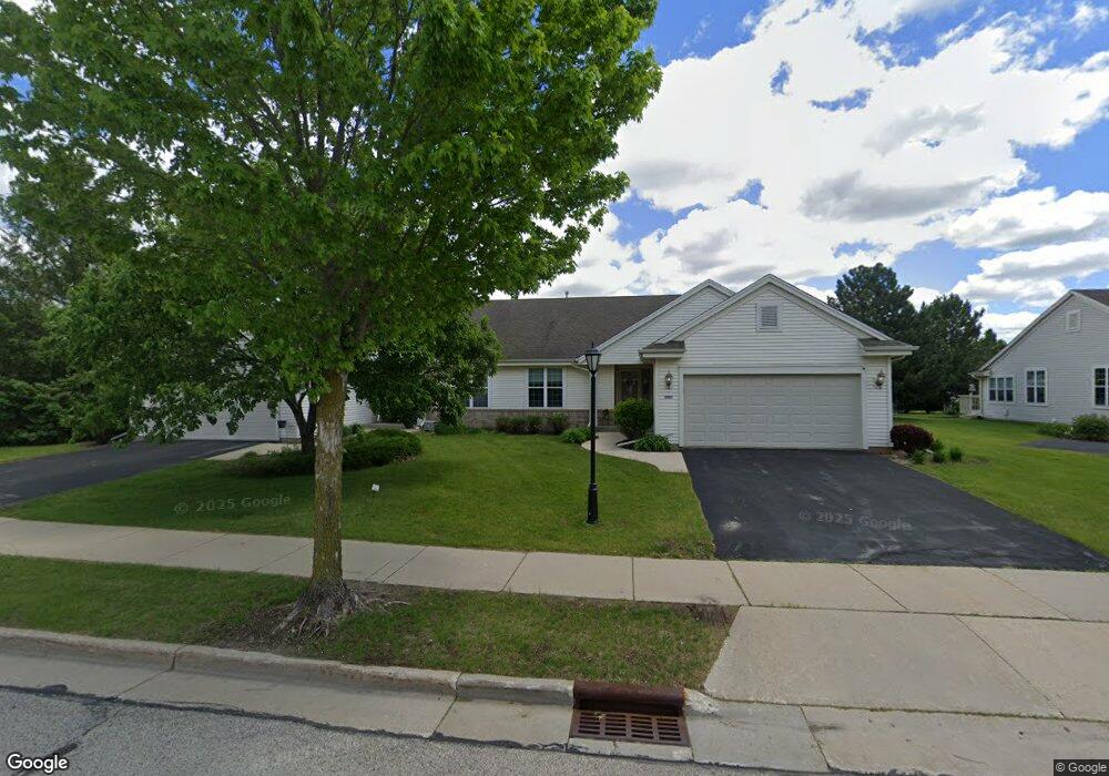
2923 Clearwater Ln Unit 141 Waukesha, WI 53189
Estimated Value: $338,000 - $452,000
2
Beds
2
Baths
1,456
Sq Ft
$273/Sq Ft
Est. Value
About This Home
This home is located at 2923 Clearwater Ln Unit 141, Waukesha, WI 53189 and is currently estimated at $396,949, approximately $272 per square foot. 2923 Clearwater Ln Unit 141 is a home located in Waukesha County with nearby schools including Rose Glen Elementary School, Les Paul Middle School - Central Campus, and West High School.
Ownership History
Date
Name
Owned For
Owner Type
Purchase Details
Closed on
Mar 26, 2015
Sold by
Rasmussen Todd A and Rasmusse Kathleen A
Bought by
Rasmussen Raymond T and Rasmussen Joy L
Current Estimated Value
Purchase Details
Closed on
Jul 22, 2014
Sold by
Taylor Mary Jo C
Bought by
Rasmussen Todd A and Rasmusse Kathleen A
Purchase Details
Closed on
Jun 29, 2012
Sold by
Gross Nicolette M
Bought by
Hamann Phyllis
Purchase Details
Closed on
Aug 11, 2004
Sold by
Gross Erma B
Bought by
Gross Erma B and Erma B Gross Revocable Trust Of 2004
Purchase Details
Closed on
Nov 13, 2002
Sold by
Bielinski Holdings Llc
Bought by
Gross Frank J and Gross Erma B
Create a Home Valuation Report for This Property
The Home Valuation Report is an in-depth analysis detailing your home's value as well as a comparison with similar homes in the area
Home Values in the Area
Average Home Value in this Area
Purchase History
| Date | Buyer | Sale Price | Title Company |
|---|---|---|---|
| Rasmussen Raymond T | -- | None Available | |
| Rasmussen Todd A | $204,000 | None Available | |
| Hamann Phyllis | $199,900 | None Available | |
| Gross Erma B | -- | -- | |
| Gross Erma B | -- | -- | |
| Gross Frank J | $185,900 | -- |
Source: Public Records
Tax History Compared to Growth
Tax History
| Year | Tax Paid | Tax Assessment Tax Assessment Total Assessment is a certain percentage of the fair market value that is determined by local assessors to be the total taxable value of land and additions on the property. | Land | Improvement |
|---|---|---|---|---|
| 2024 | $5,266 | $354,100 | $67,900 | $286,200 |
| 2023 | $5,123 | $354,100 | $67,900 | $286,200 |
| 2022 | $4,904 | $255,200 | $43,000 | $212,200 |
| 2021 | $5,022 | $255,200 | $43,000 | $212,200 |
| 2020 | $4,849 | $255,200 | $43,000 | $212,200 |
| 2019 | $4,700 | $255,200 | $43,000 | $212,200 |
| 2018 | $4,232 | $225,800 | $43,000 | $182,800 |
| 2017 | $4,220 | $225,800 | $43,000 | $182,800 |
| 2016 | $4,033 | $202,800 | $43,000 | $159,800 |
| 2015 | $4,104 | $202,800 | $43,000 | $159,800 |
| 2014 | $4,059 | $196,900 | $43,000 | $153,900 |
| 2013 | $4,055 | $196,900 | $43,000 | $153,900 |
Source: Public Records
Map
Nearby Homes
- Lt1 Saylesville Rd
- 2708 Portage Cir
- 3836 Creekside Dr
- 3823 Valley Creek Dr
- 3835 Valley Creek Dr
- 4106 Stillwater Cir
- 3207 Fox Ridge Dr
- 2700 Wyngate Way
- 4143 Stillwater Cir
- 2946 Makou Trail
- 2708 Fox Hill Dr
- 1629 Mohican Trail
- S38W27056 Cider Hills Dr
- 2802 Huron Ln
- 2426 Fox River Pkwy Unit G
- 2853 Fox Lake Cir Unit 201
- 2848 Fox Lake Cir Unit 10/201
- 2415 Fox River Pkwy Unit H
- LtD60 White Deer Trail
- LtD57 White Deer Trail
- 2925 Clearwater Ln Unit 142
- 2915 Clearwater Ln Unit 132
- 2911 Clearwater Ln Unit 131
- 2931 Clearwater Ln Unit 151
- 2933 Clearwater Ln Unit 152
- 2937 Clearwater Ln Unit 161
- 2900 Stillwater Cir
- 2904 Stillwater Cir
- 2908 Stillwater Cir
- 2939 Clearwater Ln Unit 162
- 2912 Stillwater Cir
- 2950 Clearwater Ln
- 3544 Rapids Trail
- 9 Clearwater Tr
- 2916 Stillwater Cir
- 2941 Clearwater Ln Unit 171
- 2901 Stillwater Cir
- 2909 Stillwater Cir
- 2943 Clearwater Ln Unit 172
- 2920 Stillwater Cir