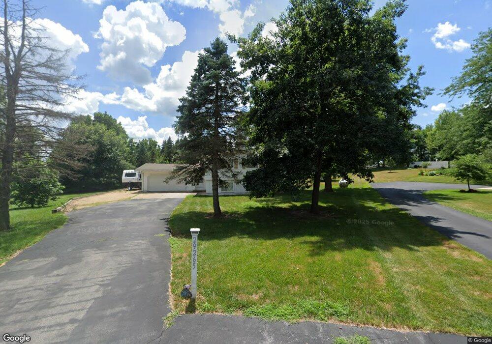
29265 171st Ave Long Grove, IA 52756
Estimated Value: $187,000 - $271,000
3
Beds
3
Baths
1,111
Sq Ft
$217/Sq Ft
Est. Value
About This Home
This home is located at 29265 171st Ave, Long Grove, IA 52756 and is currently estimated at $241,566, approximately $217 per square foot. 29265 171st Ave is a home located in Scott County with nearby schools including John Glenn Elementary School, North Scott Junior High School, and North Scott Senior High School.
Ownership History
Date
Name
Owned For
Owner Type
Purchase Details
Closed on
Mar 18, 2024
Sold by
Twpb Llc
Bought by
Aspen Homes Llc
Current Estimated Value
Home Financials for this Owner
Home Financials are based on the most recent Mortgage that was taken out on this home.
Original Mortgage
$242,250
Outstanding Balance
$238,450
Interest Rate
6.94%
Mortgage Type
New Conventional
Estimated Equity
$3,116
Purchase Details
Closed on
Sep 13, 2022
Sold by
Learn Harold E
Bought by
Oechsner Property Group Llc
Home Financials for this Owner
Home Financials are based on the most recent Mortgage that was taken out on this home.
Original Mortgage
$148,000
Interest Rate
5.13%
Mortgage Type
Construction
Create a Home Valuation Report for This Property
The Home Valuation Report is an in-depth analysis detailing your home's value as well as a comparison with similar homes in the area
Home Values in the Area
Average Home Value in this Area
Purchase History
| Date | Buyer | Sale Price | Title Company |
|---|---|---|---|
| Aspen Homes Llc | $126,500 | None Listed On Document | |
| Oechsner Property Group Llc | $185,000 | -- |
Source: Public Records
Mortgage History
| Date | Status | Borrower | Loan Amount |
|---|---|---|---|
| Open | Aspen Homes Llc | $242,250 | |
| Previous Owner | Oechsner Property Group Llc | $148,000 |
Source: Public Records
Tax History Compared to Growth
Tax History
| Year | Tax Paid | Tax Assessment Tax Assessment Total Assessment is a certain percentage of the fair market value that is determined by local assessors to be the total taxable value of land and additions on the property. | Land | Improvement |
|---|---|---|---|---|
| 2025 | $2,106 | $251,900 | $71,800 | $180,100 |
| 2024 | $2,174 | $209,800 | $71,800 | $138,000 |
| 2023 | $1,786 | $209,800 | $71,800 | $138,000 |
| 2022 | $1,770 | $156,810 | $46,700 | $110,110 |
| 2021 | $1,770 | $156,810 | $46,700 | $110,110 |
| 2020 | $1,604 | $145,670 | $46,700 | $98,970 |
| 2019 | $1,680 | $135,780 | $46,700 | $89,080 |
| 2018 | $1,724 | $135,780 | $46,700 | $89,080 |
| 2017 | $755 | $135,780 | $46,700 | $89,080 |
| 2016 | $1,764 | $137,810 | $0 | $0 |
| 2015 | $1,764 | $0 | $0 | $0 |
| 2014 | $1,732 | $133,250 | $0 | $0 |
| 2013 | $1,708 | $0 | $0 | $0 |
| 2012 | -- | $134,360 | $46,700 | $87,660 |
Source: Public Records
Map
Nearby Homes
- 0 285th St Old Hwy 61
- 301 N 1st St
- 27007 182nd Avenue Ct
- 118 S 1st St
- 27103 181st Ave
- 27111 181st Ave
- 102 E Grove Rd
- 205 W Oak St
- 21 Manor Dr
- 605 W Main St
- 18599 317th St
- 208 Shawnee Ct
- 41 Jacob Ct
- 115 S Parkview Dr
- 0 140th Ave
- 128 Parkview Dr
- 0 270th Unit RMAQC4260618
- 0 270th Unit 6324931
- 20830 270th St
- Lot 003 270th St
- 29281 171st Ave
- 29290 171st Ave
- 17099 293rd St
- 29318 171st Ave
- 29199 170th Ave
- 29298 172nd Ave
- 17021 293rd St
- 29330 172nd Ave
- 29270 172nd Ave
- 17125 293rd St
- 17030 293rd St
- 17120 293rd St
- 17110 293rd St
- 29329 172nd Ave
- 17159 293rd St
- 29307 172nd Ave
- 29145 170th Ave
- 29395 170th Ave
- 17152 293rd St
- 17185 293rd St