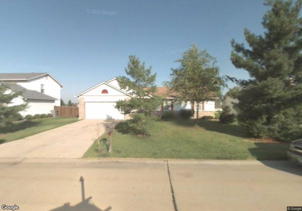
2929 White Stable Dr O Fallon, MO 63368
Estimated Value: $310,000 - $342,000
3
Beds
2
Baths
1,363
Sq Ft
$240/Sq Ft
Est. Value
About This Home
This home is located at 2929 White Stable Dr, O Fallon, MO 63368 and is currently estimated at $327,393, approximately $240 per square foot. 2929 White Stable Dr is a home located in St. Charles County with nearby schools including Pheasant Point Elementary School, Fort Zumwalt South Middle School, and Fort Zumwalt South High School.
Ownership History
Date
Name
Owned For
Owner Type
Purchase Details
Closed on
Apr 18, 2001
Sold by
Tullock Thomas N and Landon Patricia A
Bought by
Tullock Thomas N and Tullock Patricia A
Current Estimated Value
Home Financials for this Owner
Home Financials are based on the most recent Mortgage that was taken out on this home.
Original Mortgage
$75,000
Interest Rate
6.89%
Create a Home Valuation Report for This Property
The Home Valuation Report is an in-depth analysis detailing your home's value as well as a comparison with similar homes in the area
Home Values in the Area
Average Home Value in this Area
Purchase History
| Date | Buyer | Sale Price | Title Company |
|---|---|---|---|
| Tullock Thomas N | -- | -- |
Source: Public Records
Mortgage History
| Date | Status | Borrower | Loan Amount |
|---|---|---|---|
| Closed | Tullock Thomas N | $75,000 |
Source: Public Records
Tax History
| Year | Tax Paid | Tax Assessment Tax Assessment Total Assessment is a certain percentage of the fair market value that is determined by local assessors to be the total taxable value of land and additions on the property. | Land | Improvement |
|---|---|---|---|---|
| 2025 | $3,305 | $57,261 | -- | -- |
| 2023 | $3,308 | $50,099 | $0 | $0 |
| 2022 | $2,761 | $38,919 | $0 | $0 |
| 2021 | $2,768 | $38,919 | $0 | $0 |
| 2020 | $2,701 | $36,556 | $0 | $0 |
| 2019 | $2,707 | $36,556 | $0 | $0 |
| 2018 | $2,530 | $32,677 | $0 | $0 |
| 2017 | $2,488 | $32,677 | $0 | $0 |
| 2016 | $2,302 | $29,040 | $0 | $0 |
| 2015 | $2,145 | $29,040 | $0 | $0 |
| 2014 | $2,032 | $27,120 | $0 | $0 |
Source: Public Records
Map
Nearby Homes
- 178 Christina Marie Dr
- 249 Dardenne Farms Dr
- 26 Dalton Valley Dr
- 67 Simeon Ct
- 661 Clifton Hill Dr
- 93 Arapahoe Basin Ct
- 3 Royallbend Ct
- 367 Shamrock St
- 361 Shamrock St
- 2628 Breckenridge Cir
- 2726 Brook Meadow Ln
- 1319 Commons Cir
- 1313 Commons Cir
- 14 Sea Pines Ct
- 2136 Farnsworth Dr Unit D
- 10 Muir Trail Ct
- 83 Foxgate Ct
- 6025 Mo-N Unit # 1
- 44 Pheasant Ring Dr
- 2 the Durango at the Grove
- 2925 White Stable Dr
- 2933 White Stable Dr
- 1044 Golden Orchard Dr
- 1046 Golden Orchard Dr
- 1046 Golden Orchard Dr
- 1046 Golden Orchard Dr
- 1042 Golden Orchard Dr
- 2937 White Stable Dr
- 2921 White Stable Dr
- 2932 White Stable Dr
- 1048 Golden Orchard Dr
- 6447 Windy Wheat Dr
- 1040 Golden Orchard Dr
- 2941 White Stable Dr
- 2917 White Stable Dr
- 2936 White Stable Dr
- 2 White Stable Ct
- 1050 Golden Orchard Dr
- 1038 Golden Orchard Dr
- 6444 Windy Wheat Dr
Your Personal Tour Guide
Ask me questions while you tour the home.