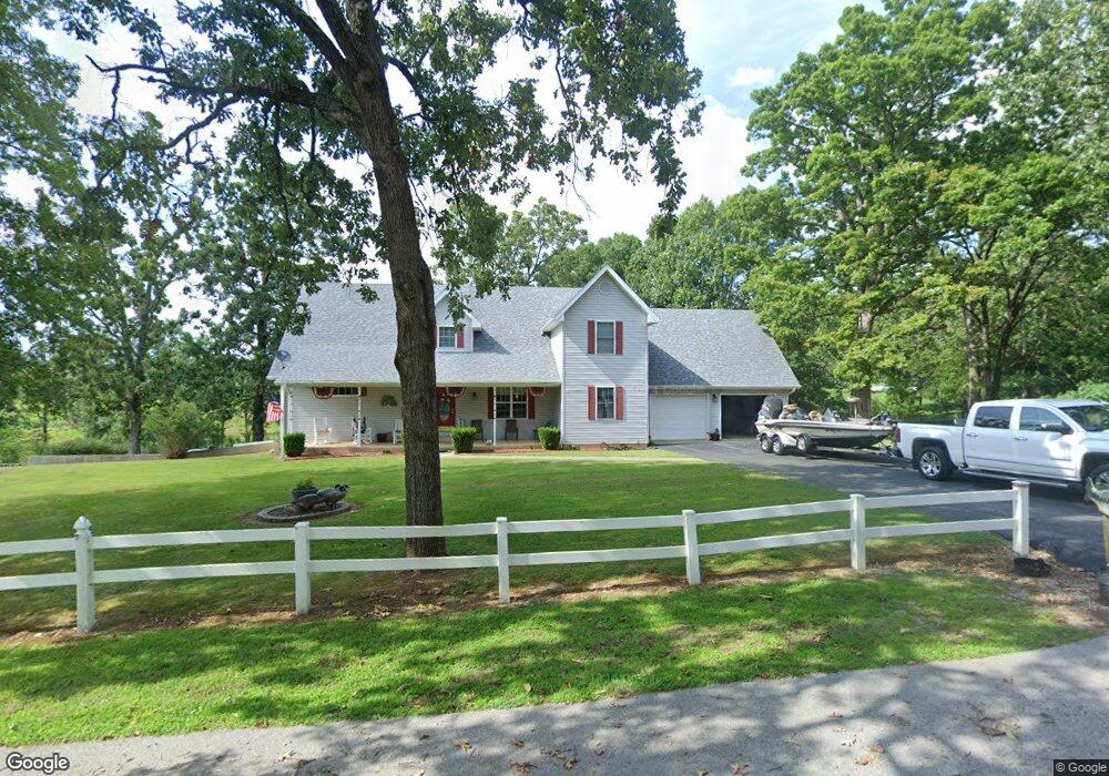
293 Rader Dr West Plains, MO 65775
Estimated Value: $230,451 - $354,000
--
Bed
--
Bath
1,708
Sq Ft
$172/Sq Ft
Est. Value
About This Home
This home is located at 293 Rader Dr, West Plains, MO 65775 and is currently estimated at $293,113, approximately $171 per square foot. 293 Rader Dr is a home.
Ownership History
Date
Name
Owned For
Owner Type
Purchase Details
Closed on
Oct 26, 2010
Sold by
Coffman Larry W and Coffman Pamela A
Bought by
Coffman Larry W and Coffman Pamela A
Current Estimated Value
Home Financials for this Owner
Home Financials are based on the most recent Mortgage that was taken out on this home.
Original Mortgage
$164,000
Interest Rate
4.41%
Mortgage Type
New Conventional
Purchase Details
Closed on
Oct 25, 2010
Sold by
Coffman Larry W and Coffman Pamela A
Bought by
Coffman Larry W and Coffman Pamela A
Home Financials for this Owner
Home Financials are based on the most recent Mortgage that was taken out on this home.
Original Mortgage
$164,000
Interest Rate
4.41%
Mortgage Type
New Conventional
Create a Home Valuation Report for This Property
The Home Valuation Report is an in-depth analysis detailing your home's value as well as a comparison with similar homes in the area
Home Values in the Area
Average Home Value in this Area
Purchase History
| Date | Buyer | Sale Price | Title Company |
|---|---|---|---|
| Coffman Larry W | -- | Btc | |
| Coffman Larry W | -- | None Available |
Source: Public Records
Mortgage History
| Date | Status | Borrower | Loan Amount |
|---|---|---|---|
| Closed | Coffman Larry W | $164,000 |
Source: Public Records
Tax History Compared to Growth
Tax History
| Year | Tax Paid | Tax Assessment Tax Assessment Total Assessment is a certain percentage of the fair market value that is determined by local assessors to be the total taxable value of land and additions on the property. | Land | Improvement |
|---|---|---|---|---|
| 2025 | $1,241 | $38,440 | $5,270 | $33,170 |
| 2024 | $1,240 | $34,320 | -- | -- |
| 2023 | $1,240 | $34,320 | $0 | $0 |
| 2022 | $1,176 | $32,540 | $0 | $0 |
| 2021 | $1,081 | $32,540 | $0 | $0 |
| 2020 | $1,081 | $29,790 | $0 | $0 |
| 2019 | $1,141 | $29,790 | $0 | $0 |
| 2018 | $1,141 | $29,790 | $0 | $0 |
| 2017 | $1,140 | $29,790 | $0 | $0 |
| 2015 | -- | $28,850 | $0 | $0 |
| 2014 | -- | $28,850 | $0 | $0 |
| 2013 | -- | $28,850 | $0 | $0 |
Source: Public Records
Map
Nearby Homes
- 203 Rader Dr
- Tbd Rader Dr
- 1718 Luna Dr
- 326 Rader Dr
- 1612 Luna Dr
- 1604 Luna Dr
- 1708 Tiffany St
- 9648 Private Road 6543
- 000 Jon Streeet
- 000 U S 160
- 000 Freedom & Goodhard
- 1263 Jackson St
- 1231 Jefferson Ave
- 1235 Columbus St
- 1110 Lincoln Ave
- 1221 Jefferson Ave
- 1058 Lincoln Ave
- 1215 Jefferson Ave
- 000 Old Airport Rd
- 1224 Columbus St