Estimated Value: $433,326 - $526,000
3
Beds
3
Baths
2,738
Sq Ft
$174/Sq Ft
Est. Value
About This Home
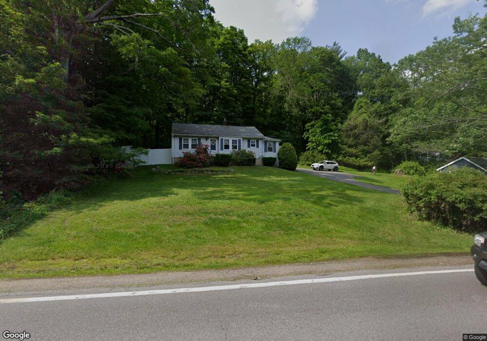
This home is located at 294 Hampstead Rd, Derry, NH 03038 and is currently estimated at $477,582, approximately $174 per square foot. 294 Hampstead Rd is a home located in Rockingham County with nearby schools including East Derry Memorial Elementary School, Gilbert H. Hood Middle School, and Pinkerton Academy.
Ownership History
Date
Name
Owned For
Owner Type
Purchase Details
Closed on
Feb 17, 2017
Sold by
Nunes Edward L
Bought by
Nunes Edward L and Deangelis Corilee
Current Estimated Value
Purchase Details
Closed on
Mar 14, 2016
Sold by
Lucia Thomas A
Bought by
Nunes Edward L
Home Financials for this Owner
Home Financials are based on the most recent Mortgage that was taken out on this home.
Original Mortgage
$171,830
Interest Rate
4.5%
Mortgage Type
FHA
Create a Home Valuation Report for This Property
The Home Valuation Report is an in-depth analysis detailing your home's value as well as a comparison with similar homes in the area
Home Values in the Area
Average Home Value in this Area
Purchase History
| Date | Buyer | Sale Price | Title Company |
|---|---|---|---|
| Nunes Edward L | -- | -- | |
| Nunes Edward L | $175,000 | -- |
Source: Public Records
Mortgage History
| Date | Status | Borrower | Loan Amount |
|---|---|---|---|
| Previous Owner | Nunes Edward L | $171,830 |
Source: Public Records
Tax History Compared to Growth
Tax History
| Year | Tax Paid | Tax Assessment Tax Assessment Total Assessment is a certain percentage of the fair market value that is determined by local assessors to be the total taxable value of land and additions on the property. | Land | Improvement |
|---|---|---|---|---|
| 2024 | $7,355 | $393,500 | $203,600 | $189,900 |
| 2023 | $7,058 | $341,300 | $173,000 | $168,300 |
| 2022 | $6,498 | $341,300 | $173,000 | $168,300 |
| 2021 | $6,418 | $259,200 | $132,900 | $126,300 |
| 2020 | $6,309 | $259,200 | $132,900 | $126,300 |
| 2019 | $4,670 | $212,100 | $103,300 | $108,800 |
| 2018 | $3,830 | $212,100 | $103,300 | $108,800 |
| 2017 | $5,455 | $189,000 | $96,300 | $92,700 |
| 2016 | $3,778 | $189,000 | $96,300 | $92,700 |
| 2015 | $5,045 | $172,600 | $96,300 | $76,300 |
| 2014 | $5,078 | $172,600 | $96,300 | $76,300 |
| 2013 | $4,796 | $152,300 | $86,300 | $66,000 |
Source: Public Records
Map
Nearby Homes
- 294.5 Hampstead Rd
- 4 Sheldon Rd
- 1 Cameron Ct Unit 1
- 5 Sheldon Rd
- 45 Damren Rd
- 11 Tenney Rd
- 50 Page Ln
- 72 Jenkins Farm Rd
- 121 Hampstead Rd
- 211 Hampstead Rd
- 209 Hampstead Rd
- 18 Lorri Rd
- 8 Ians Path
- 12 Halls Village Rd
- 48 Redfield Cir
- 30 Pondview Dr
- 0 Jack Rd
- 3 Cameron Ct Unit 3
- 35 Steele Rd
- 343 Island Pond Rd
- 294 Hampstead Rd
- 294 Hampstead Rd
- 294 Hampstead Rd
- 292 Hampstead Rd
- 299 Hampstead Rd
- 303 Hampstead Rd R 151
- 303 Hampstead Rd
- 300 Hampstead Rd
- 301 Hampstead Rd
- 305 Hampstead Rd
- 11 Derry Rd
- 295 Hampstead Rd
- 284 Hampstead Rd
- 620 Main St
- 620 Main St Unit B
- 620 Main St Unit 1
- 620 Main St Unit 2
- 620A Main St
- 7 Derry Rd
- 628 Main St