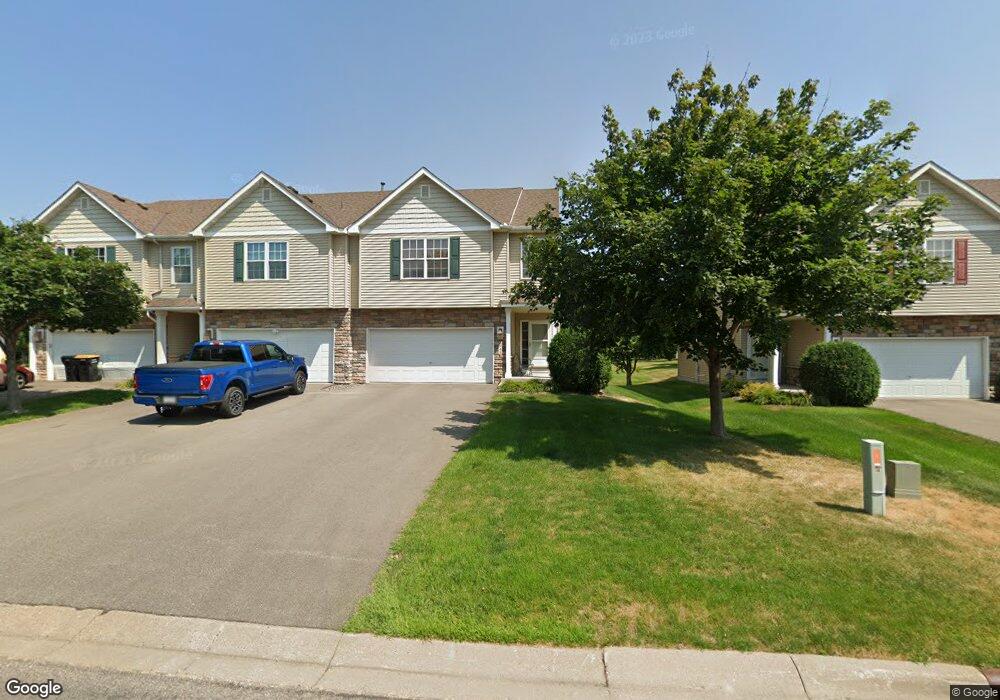
2945 18th Ave E Shakopee, MN 55379
Estimated Value: $298,036 - $328,000
3
Beds
2
Baths
1,232
Sq Ft
$252/Sq Ft
Est. Value
About This Home
This home is located at 2945 18th Ave E, Shakopee, MN 55379 and is currently estimated at $311,009, approximately $252 per square foot. 2945 18th Ave E is a home located in Scott County with nearby schools including Eagle Creek Elementary School, East Middle School, and Shakopee Senior High School.
Ownership History
Date
Name
Owned For
Owner Type
Purchase Details
Closed on
Oct 15, 2013
Sold by
Dignan Renee L and Dignan Renee
Bought by
Intervi Dignan Renee and Intervi Renee Dignan Revocable
Current Estimated Value
Purchase Details
Closed on
Jul 7, 2009
Sold by
Buboltz Michael S and Bulboltz Lindsey
Bought by
Dignan Renee L
Purchase Details
Closed on
Apr 10, 2006
Sold by
Donnay Homes Inc
Bought by
Buboltz Michael S and Buboltz Lindsey
Purchase Details
Closed on
Sep 1, 2004
Sold by
Plawshares Development Llc
Bought by
Donnay Homes Inc
Create a Home Valuation Report for This Property
The Home Valuation Report is an in-depth analysis detailing your home's value as well as a comparison with similar homes in the area
Home Values in the Area
Average Home Value in this Area
Purchase History
| Date | Buyer | Sale Price | Title Company |
|---|---|---|---|
| Intervi Dignan Renee | -- | None Available | |
| Dignan Renee L | $188,000 | -- | |
| Buboltz Michael S | $224,370 | -- | |
| Donnay Homes Inc | $2,523,000 | -- |
Source: Public Records
Tax History
| Year | Tax Paid | Tax Assessment Tax Assessment Total Assessment is a certain percentage of the fair market value that is determined by local assessors to be the total taxable value of land and additions on the property. | Land | Improvement |
|---|---|---|---|---|
| 2025 | $2,874 | $302,500 | $83,800 | $218,700 |
| 2024 | $2,956 | $288,600 | $79,800 | $208,800 |
| 2023 | $3,040 | $284,500 | $78,300 | $206,200 |
| 2022 | $2,916 | $287,300 | $80,100 | $207,200 |
| 2021 | $2,524 | $240,600 | $62,700 | $177,900 |
| 2020 | $2,314 | $230,300 | $55,100 | $175,200 |
| 2019 | $2,320 | $191,300 | $47,200 | $144,100 |
| 2018 | $2,264 | $0 | $0 | $0 |
| 2016 | $2,122 | $0 | $0 | $0 |
| 2014 | -- | $0 | $0 | $0 |
Source: Public Records
Map
Nearby Homes
- 1545 Philipp Way
- 1515 Philipp Way
- 1491 Philipp Way
- 1473 Philipp Way
- 1624 Philipp Way
- 2942 Trinity Dr
- 2655 King Ave
- 2931 Trinity Dr
- 2868 Trinity Dr
- 3067 Trinity Dr
- 2871 Trinity Dr
- 1691 Tyrone Dr
- 1705 Tyrone Dr
- 1542 Philipp Way
- 2817 Downing Ave
- 2795 Downing Ave
- 3635 Wren Ave
- 2006 Tyrone Dr
- 1843 Archer St
- 3660 Coral Bell Dr
- 2943 18th Ave E
- 1915 Tyrone Dr
- 1901 Tyrone Dr
- 1988 Dahlia Dr
- 1991 Dahlia Dr
- 1968 Dahlia Dr
- 1961 Dahlia Dr
- 1985 Dahlia Dr
- 2953 18th Ave E
- 2941 18th Ave E
- 2957 18th Ave E
- 2961 18th Ave E
- 2975 Wyndam Ct
- 2971 Wyndam Ct
- 2965 18th Ave E
- 1762 Philipp Dr
- 2967 Wyndam Ct
- 1760 Philipp Dr
- 2950 18th Ave E
- 2948 18th Ave E
Your Personal Tour Guide
Ask me questions while you tour the home.