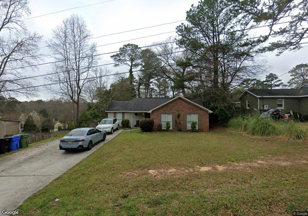
2947 Grant Rd Columbus, GA 31907
North Columbus NeighborhoodEstimated Value: $177,000 - $211,000
3
Beds
3
Baths
1,405
Sq Ft
$139/Sq Ft
Est. Value
About This Home
This home is located at 2947 Grant Rd, Columbus, GA 31907 and is currently estimated at $195,685, approximately $139 per square foot. 2947 Grant Rd is a home located in Muscogee County with nearby schools including Reese Road Leadership Academy, Fort Middle School, and Hardaway High School.
Ownership History
Date
Name
Owned For
Owner Type
Purchase Details
Closed on
Jun 30, 2021
Sold by
Welch Mike
Bought by
Irvin Erica Olivia
Current Estimated Value
Home Financials for this Owner
Home Financials are based on the most recent Mortgage that was taken out on this home.
Original Mortgage
$136,972
Outstanding Balance
$124,281
Interest Rate
2.9%
Mortgage Type
FHA
Estimated Equity
$71,404
Purchase Details
Closed on
Oct 16, 2020
Sold by
Lockett Tim D
Bought by
Welch Mike and Wyrick Kelli
Create a Home Valuation Report for This Property
The Home Valuation Report is an in-depth analysis detailing your home's value as well as a comparison with similar homes in the area
Home Values in the Area
Average Home Value in this Area
Purchase History
| Date | Buyer | Sale Price | Title Company |
|---|---|---|---|
| Irvin Erica Olivia | $139,500 | -- | |
| Welch Mike | $60,000 | -- |
Source: Public Records
Mortgage History
| Date | Status | Borrower | Loan Amount |
|---|---|---|---|
| Open | Irvin Erica Olivia | $136,972 |
Source: Public Records
Tax History
| Year | Tax Paid | Tax Assessment Tax Assessment Total Assessment is a certain percentage of the fair market value that is determined by local assessors to be the total taxable value of land and additions on the property. | Land | Improvement |
|---|---|---|---|---|
| 2025 | $1,668 | $76,556 | $7,364 | $69,192 |
| 2024 | $1,667 | $76,556 | $7,364 | $69,192 |
| 2023 | $983 | $76,556 | $7,364 | $69,192 |
| 2022 | $1,738 | $55,800 | $6,800 | $49,000 |
| 2021 | $980 | $24,000 | $4,720 | $19,280 |
| 2020 | $1,669 | $40,868 | $7,364 | $33,504 |
| 2019 | $1,674 | $40,868 | $7,364 | $33,504 |
| 2018 | $1,674 | $40,868 | $7,364 | $33,504 |
| 2017 | $1,680 | $40,868 | $7,364 | $33,504 |
| 2016 | $1,276 | $30,928 | $3,600 | $27,328 |
| 2015 | $1,277 | $30,928 | $3,600 | $27,328 |
| 2014 | $1,279 | $30,928 | $3,600 | $27,328 |
| 2013 | -- | $30,928 | $3,600 | $27,328 |
Source: Public Records
Map
Nearby Homes
- 2871 Barbara Rd
- 2973 Grant Rd
- 2841 Christine Rd
- 2951 Florence Dr
- 4732 Delfair Dr
- 4407 Florence Dr
- 4444 Norcross Dr
- 4312 Old MacOn Rd Unit 46
- 4118 Fairview Dr
- 4120 Fairview Dr
- 4032 Pickering Dr
- 4524 Hedingham Ln
- 2615 Reese Rd
- 4738 Shenandoah Dr
- 2608 Juniper Ave
- 4248 Yates Dr
- 4133 Pickering Dr
- 4237 Fort St
- 4819 Yosemite Dr
- 4004 Tifton Dr
Your Personal Tour Guide
Ask me questions while you tour the home.