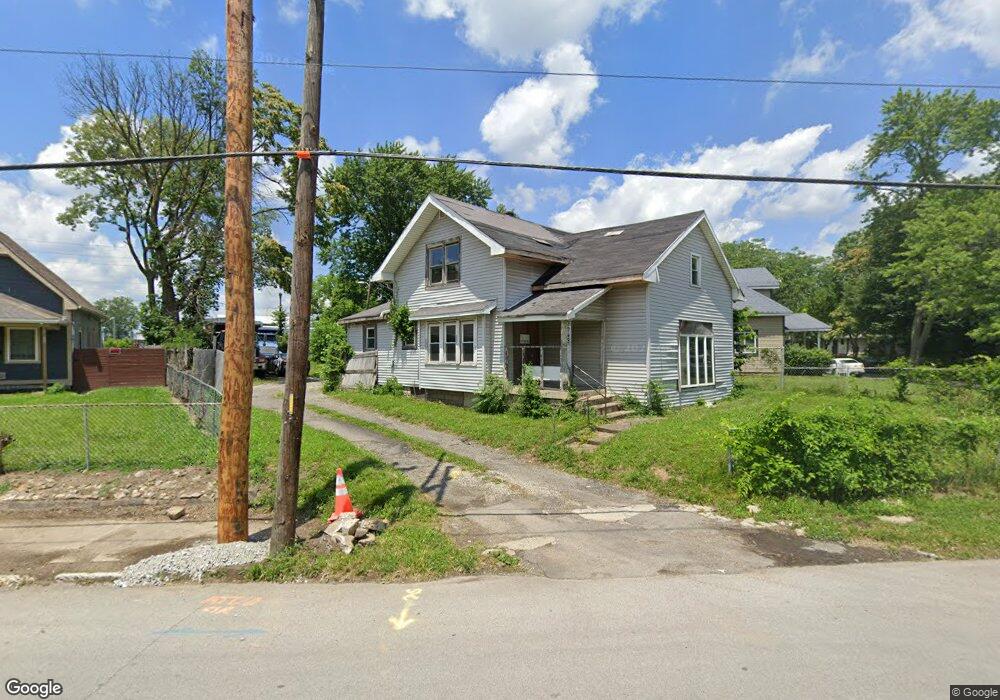
2948 Brookside Ave Indianapolis, IN 46218
Near Eastside NeighborhoodEstimated Value: $119,015 - $162,000
4
Beds
1
Bath
1,038
Sq Ft
$141/Sq Ft
Est. Value
About This Home
This home is located at 2948 Brookside Ave, Indianapolis, IN 46218 and is currently estimated at $146,005, approximately $140 per square foot. 2948 Brookside Ave is a home located in Marion County with nearby schools including Thomas D. Gregg School No. 15, Washington Irving School 14, and Brookside School 54.
Ownership History
Date
Name
Owned For
Owner Type
Purchase Details
Closed on
Dec 28, 2012
Sold by
Mitchell Damein and Easley Rhea
Bought by
Martin Tina
Current Estimated Value
Purchase Details
Closed on
May 10, 2012
Sold by
Right Start Outreach Nfp Inc
Bought by
Mitchell Damein and Easley Rhea
Purchase Details
Closed on
Nov 29, 2011
Sold by
Hsbc Bank Usa
Bought by
Right Star Outreach Center
Purchase Details
Closed on
Sep 23, 2011
Sold by
Carroll Virgil H
Bought by
Hsbc Bank Usa
Create a Home Valuation Report for This Property
The Home Valuation Report is an in-depth analysis detailing your home's value as well as a comparison with similar homes in the area
Home Values in the Area
Average Home Value in this Area
Purchase History
| Date | Buyer | Sale Price | Title Company |
|---|---|---|---|
| Martin Tina | -- | -- | |
| Mitchell Damein | -- | None Available | |
| Right Star Outreach Center | -- | None Available | |
| Hsbc Bank Usa | $15,500 | None Available |
Source: Public Records
Tax History
| Year | Tax Paid | Tax Assessment Tax Assessment Total Assessment is a certain percentage of the fair market value that is determined by local assessors to be the total taxable value of land and additions on the property. | Land | Improvement |
|---|---|---|---|---|
| 2024 | $1,429 | $60,200 | $10,000 | $50,200 |
| 2023 | $1,821 | $55,800 | $10,000 | $45,800 |
| 2022 | $1,355 | $54,500 | $10,000 | $44,500 |
| 2021 | $1,027 | $43,000 | $10,000 | $33,000 |
| 2020 | $915 | $36,700 | $3,700 | $33,000 |
| 2019 | $902 | $35,500 | $3,700 | $31,800 |
| 2018 | $296 | $29,500 | $3,700 | $25,800 |
| 2017 | $261 | $28,700 | $3,700 | $25,000 |
| 2016 | $695 | $39,900 | $3,700 | $36,200 |
| 2014 | $276 | $37,800 | $3,700 | $34,100 |
| 2013 | $269 | $36,600 | $3,700 | $32,900 |
Source: Public Records
Map
Nearby Homes
- 2941 E Brookside Ave
- 2921 E Brookside Ave
- 2915 Brookside Ave
- 2007 N Oxford St
- 1931 N Oxford St
- 1925 N Oxford St
- 1940 N Dearborn St
- 2050 N Dearborn St
- 2838 E 19th St
- 2729 Massachusetts Ave
- 2030 Houston St
- 2037 Houston St
- 2921 E 18th St
- 1738 N Parker Ave
- 2624 E 18th St
- 1929 Roosevelt Ave
- 1771 Roosevelt Ave
- 2818 E 17th St
- 2625 E 18th St
- 2612 Brookway St
- 2008 N Parker Ave
- 2942 Brookside Ave
- 2016 N Parker Ave
- 2934 Brookside Park
- 2934 Brookside Ave
- 2020 N Parker Ave
- 2930 E Brookside Ave
- 2930 Brookside Ave
- 2945 Brookside Ave
- 2024 N Parker Ave
- 2945 E Brookside Ave
- 2941 Brookside Ave
- 2918 E Brookside Ave
- 2931 Brookside Ave
- 2918 Brookside Ave
- 2028 N Parker Ave
- 2007 N Parker Ave
- 2009 N Parker Ave
- 2041 N Parker Ave
- 2013 N Parker Ave
Your Personal Tour Guide
Ask me questions while you tour the home.