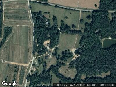
295 Blount Rd Meansville, GA 30256
Estimated Value: $183,000
--
Bed
1
Bath
1,871
Sq Ft
$98/Sq Ft
Est. Value
About This Home
This home is located at 295 Blount Rd, Meansville, GA 30256 and is currently estimated at $183,000, approximately $97 per square foot. 295 Blount Rd is a home located in Pike County with nearby schools including Pike County Primary School, Pike County Elementary School, and Pike County Middle School.
Ownership History
Date
Name
Owned For
Owner Type
Purchase Details
Closed on
Jan 4, 2022
Sold by
Blount Bobby H
Bought by
Stonecipher Kyle Robert and Stonecipher Anna Rebecca
Current Estimated Value
Purchase Details
Closed on
Dec 6, 2021
Sold by
Blount Bobby H
Bought by
Blount Joshua H and Blount Stephanie Wade
Purchase Details
Closed on
Dec 28, 2007
Sold by
Blount Bobby H
Bought by
Blount Joshua H and Blount Stephanie Wade
Purchase Details
Closed on
Apr 8, 2002
Sold by
Blount Bobby H
Bought by
Blount Bobby H
Create a Home Valuation Report for This Property
The Home Valuation Report is an in-depth analysis detailing your home's value as well as a comparison with similar homes in the area
Home Values in the Area
Average Home Value in this Area
Purchase History
| Date | Buyer | Sale Price | Title Company |
|---|---|---|---|
| Stonecipher Kyle Robert | -- | -- | |
| Blount Reginald Howard | -- | -- | |
| Blount Joshua H | -- | -- | |
| Blount Joshua H | -- | -- | |
| Blount Bobby H | -- | -- |
Source: Public Records
Tax History Compared to Growth
Tax History
| Year | Tax Paid | Tax Assessment Tax Assessment Total Assessment is a certain percentage of the fair market value that is determined by local assessors to be the total taxable value of land and additions on the property. | Land | Improvement |
|---|---|---|---|---|
| 2024 | $285 | $63,070 | $57,243 | $5,827 |
| 2023 | $329 | $63,070 | $57,243 | $5,827 |
| 2022 | $2,457 | $106,288 | $63,018 | $43,270 |
| 2021 | $1,075 | $103,021 | $59,751 | $43,270 |
| 2020 | $1,075 | $103,021 | $59,751 | $43,270 |
| 2019 | $908 | $94,164 | $59,751 | $34,413 |
| 2018 | $895 | $94,164 | $59,751 | $34,413 |
| 2017 | $873 | $94,164 | $59,751 | $34,413 |
| 2016 | $812 | $94,164 | $59,751 | $34,413 |
| 2015 | $771 | $94,164 | $59,751 | $34,413 |
| 2014 | $769 | $94,163 | $59,751 | $34,412 |
| 2013 | -- | $94,162 | $59,750 | $34,412 |
Source: Public Records
Map
Nearby Homes
- 514 Adams Rd
- 1325 Adams Rd
- 967 Vega Rd
- 237 Sandefur Rd
- 91 Reeves Rd
- 12471 Ga Highway 109
- 67 Vega Rd
- 2566 U S 19
- 1940 Vega Rd
- 37 Adams Rd
- 54 Adams Rd
- 0 Bankston Rd
- 1046 Rose Hill Rd
- 928 U S 19
- 928 Hwy 19
- 4187 U S Highway 19
- 0 Leach Rd Unit 10470602
- 0 Billies Way Unit 10435066
- 76 Creekside Ct
- 84 Creekside Ct
- 295 Blount Rd
- 295 Blount Rd
- 373 Blount Rd
- 475 Blount Rd
- 1310 Adams Rd
- 65 Blount Rd
- 200 Myrtle Ln
- 315 Blount Rd
- 47 Myrtle Ln
- 545 Blount Rd
- 0 Blount Rd Unit 8959855
- 0 Blount Rd Unit 9077649
- 0 Blount Rd Unit Tract F 8512377
- 0 Blount Rd Unit 8889980
- 0 Blount Rd Unit 7206572
- 0 Blount Rd Unit 7315577
- 0 Blount Rd Unit 8049045
- 0 Blount Rd Unit 8217212
- 0 Blount Rd Unit 8542736
- 0 Blount Rd Unit Tract F 8671581
