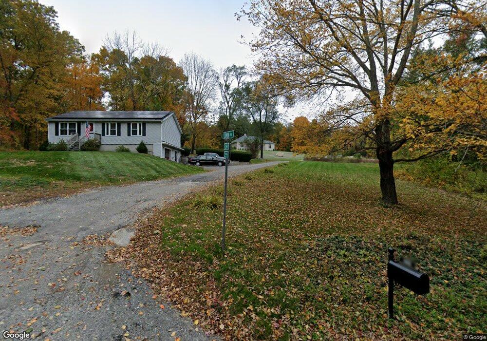
295 Manchaug Rd Sutton, MA 01590
Estimated Value: $608,000 - $1,123,104
3
Beds
4
Baths
2,796
Sq Ft
$310/Sq Ft
Est. Value
About This Home
This home is located at 295 Manchaug Rd, Sutton, MA 01590 and is currently estimated at $865,776, approximately $309 per square foot. 295 Manchaug Rd is a home located in Worcester County with nearby schools including Sutton Elementary School, Sutton Middle School, and Sutton High School.
Ownership History
Date
Name
Owned For
Owner Type
Purchase Details
Closed on
Apr 13, 2023
Sold by
Conte Pina and Bezhani Tatiana A
Bought by
Pj Conte Ret and Conte
Current Estimated Value
Purchase Details
Closed on
Sep 12, 2014
Sold by
Conte Pina
Bought by
Conte Pina and Bezhani Tatiana A
Purchase Details
Closed on
Jul 19, 2013
Sold by
Conley Shawn R and Springleaf Financial S
Bought by
Springleaf Financial S
Purchase Details
Closed on
Oct 25, 1999
Sold by
Anderson Shirley B and Norwest Bk Minnesota
Bought by
Conley Shawn R and Conley Susan M
Home Financials for this Owner
Home Financials are based on the most recent Mortgage that was taken out on this home.
Original Mortgage
$104,975
Interest Rate
7.83%
Create a Home Valuation Report for This Property
The Home Valuation Report is an in-depth analysis detailing your home's value as well as a comparison with similar homes in the area
Home Values in the Area
Average Home Value in this Area
Purchase History
| Date | Buyer | Sale Price | Title Company |
|---|---|---|---|
| Pj Conte Ret | -- | None Available | |
| Conte Pina | -- | -- | |
| Springleaf Financial S | $153,300 | -- | |
| Conley Shawn R | $110,500 | -- |
Source: Public Records
Mortgage History
| Date | Status | Borrower | Loan Amount |
|---|---|---|---|
| Previous Owner | Conley Shawn R | $130,000 | |
| Previous Owner | Conley Shawn R | $104,975 |
Source: Public Records
Tax History
| Year | Tax Paid | Tax Assessment Tax Assessment Total Assessment is a certain percentage of the fair market value that is determined by local assessors to be the total taxable value of land and additions on the property. | Land | Improvement |
|---|---|---|---|---|
| 2025 | $12,064 | $1,003,700 | $229,000 | $774,700 |
| 2024 | $12,396 | $977,600 | $213,300 | $764,300 |
| 2023 | $11,911 | $860,000 | $197,300 | $662,700 |
| 2022 | $12,906 | $850,200 | $166,100 | $684,100 |
| 2021 | $4,279 | $724,700 | $166,100 | $558,600 |
| 2020 | $11,494 | $724,700 | $166,100 | $558,600 |
| 2019 | $6,950 | $420,700 | $166,100 | $254,600 |
| 2018 | $2,951 | $178,300 | $147,500 | $30,800 |
| 2017 | $2,742 | $166,200 | $134,600 | $31,600 |
| 2016 | $2,772 | $166,200 | $134,600 | $31,600 |
| 2015 | $2,744 | $164,500 | $134,600 | $29,900 |
| 2014 | $3,742 | $221,700 | $136,000 | $85,700 |
Source: Public Records
Map
Nearby Homes
- 108 Mumford St
- 19 Birch St
- 266 Putnam Hill Rd
- 18 Lakeshore Dr
- 24 Manchaug Rd
- 33 Nautical Way Unit 107
- 26 Compass Point Dr Unit 26
- 109 Mendon Rd
- 265 Mendon Rd
- 8 Hough Rd
- 198 Uxbridge Rd
- 5 Hamlets Way
- 80 Barnett Rd
- 22 Gilboa St
- 5 B St
- Lot 27 Cedar St
- 31 Central Turnpike
- 51 Central Turnpike
- 9 Church St
- 60 Webster St
- 291 Manchaug Rd
- 299 Manchaug Rd
- 294 Manchaug Rd
- 283 Manchaug Rd
- 297 Manchaug Rd
- 305 Manchaug Rd
- 284 Manchaug Rd
- 306 Manchaug Rd
- 282 Manchaug Rd
- 309 Manchaug Rd
- 313 Manchaug Rd
- 275 Manchaug Rd
- 316 Manchaug Rd
- 317 Manchaug Rd
- 6 Parker Rd
- 318 Manchaug Rd
- 319 Manchaug Rd
- 267 Manchaug Rd
- 320 Manchaug Rd
- 268 Manchaug Rd
Your Personal Tour Guide
Ask me questions while you tour the home.