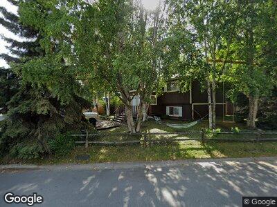
2956 Leawood Dr Anchorage, AK 99502
Sand Lake NeighborhoodEstimated Value: $265,000 - $455,640
5
Beds
2
Baths
1,928
Sq Ft
$193/Sq Ft
Est. Value
About This Home
This home is located at 2956 Leawood Dr, Anchorage, AK 99502 and is currently estimated at $372,547, approximately $193 per square foot. 2956 Leawood Dr is a home located in Anchorage Municipality with nearby schools including Kincaid Elementary, Mears Middle School, and Dimond High School.
Ownership History
Date
Name
Owned For
Owner Type
Purchase Details
Closed on
Oct 28, 2008
Sold by
Conley Andrew F
Bought by
Tierese Ingrid
Current Estimated Value
Home Financials for this Owner
Home Financials are based on the most recent Mortgage that was taken out on this home.
Original Mortgage
$262,820
Outstanding Balance
$173,407
Interest Rate
5.77%
Mortgage Type
FHA
Estimated Equity
$199,140
Purchase Details
Closed on
May 31, 2002
Sold by
Stilger John and Stilger Linda
Bought by
Conley Andrew F
Home Financials for this Owner
Home Financials are based on the most recent Mortgage that was taken out on this home.
Original Mortgage
$234,840
Interest Rate
6.89%
Mortgage Type
VA
Purchase Details
Closed on
Aug 7, 1997
Sold by
Clark Susan E and Clark Sidney E
Bought by
Stilger John and Stilger Linda
Home Financials for this Owner
Home Financials are based on the most recent Mortgage that was taken out on this home.
Original Mortgage
$0
Interest Rate
7.43%
Mortgage Type
New Conventional
Create a Home Valuation Report for This Property
The Home Valuation Report is an in-depth analysis detailing your home's value as well as a comparison with similar homes in the area
Home Values in the Area
Average Home Value in this Area
Purchase History
| Date | Buyer | Sale Price | Title Company |
|---|---|---|---|
| Tierese Ingrid | -- | Ftaa | |
| Conley Andrew F | -- | -- | |
| Stilger John | -- | -- |
Source: Public Records
Mortgage History
| Date | Status | Borrower | Loan Amount |
|---|---|---|---|
| Open | Tierese Ingrid | $262,820 | |
| Previous Owner | Conley Andrew F | $234,840 | |
| Previous Owner | Stilger John | $0 | |
| Previous Owner | Stilger John | $0 | |
| Closed | Stilger John | $0 |
Source: Public Records
Tax History Compared to Growth
Tax History
| Year | Tax Paid | Tax Assessment Tax Assessment Total Assessment is a certain percentage of the fair market value that is determined by local assessors to be the total taxable value of land and additions on the property. | Land | Improvement |
|---|---|---|---|---|
| 2024 | $5,362 | $407,100 | $108,100 | $299,000 |
| 2023 | $6,405 | $376,100 | $108,100 | $268,000 |
| 2022 | $5,298 | $364,600 | $108,100 | $256,500 |
| 2021 | $6,276 | $348,300 | $108,100 | $240,200 |
| 2020 | $5,223 | $357,500 | $108,100 | $249,400 |
| 2019 | $5,031 | $357,500 | $108,100 | $249,400 |
| 2018 | $4,800 | $342,700 | $99,700 | $243,000 |
| 2017 | $5,198 | $351,900 | $99,700 | $252,200 |
| 2016 | $4,456 | $336,700 | $95,000 | $241,700 |
| 2015 | $4,456 | $330,500 | $95,000 | $235,500 |
| 2014 | $4,456 | $308,900 | $95,000 | $213,900 |
Source: Public Records
Map
Nearby Homes
- 2920 Leawood Dr
- 9330 Roy St
- 2810 W 91st Ave
- 9032 Lance Cir
- 9011 Lance Cir
- 2751 Pelican Dr
- 9231 Campbell Terrace Dr
- 9650 Arlene Dr
- 2521 Curlew Cir
- 8930 Joy Cir
- 9511 Albatross Dr
- 000 Emerald Hills
- 8839 Arlene St Unit 9
- 8836 Mcclellan Cir
- 9327 Blackberry St Unit 3
- 3412 Red Rock Ct
- 9336 Blackberry St Unit 12
- 3520 W Dimond Blvd Unit 4
- L9-10 B2 Dewberry St
- L10 B2 Dewberry St
- 2956 Leawood Dr
- 2962 Leawood Dr
- 2964 Leawood Dr
- 2950 Leawood Dr
- 2942 Leawood Dr
- 2970 Leawood Dr
- 2936 Leawood Dr
- 2812 Leawood Dr
- 2955 Leawood Dr
- 2806 Leawood Dr
- 2820 Leawood Dr
- 2967 Leawood Dr
- 2945 Leawood Dr
- 2973 Leawood Dr Unit 2
- 2973 Leawood Dr
- 2973 Leawood Dr Unit 1
- 2800 Leawood Dr
- 2830 Leawood Dr
- 9431 Roy St
- 2939 Leawood Dr