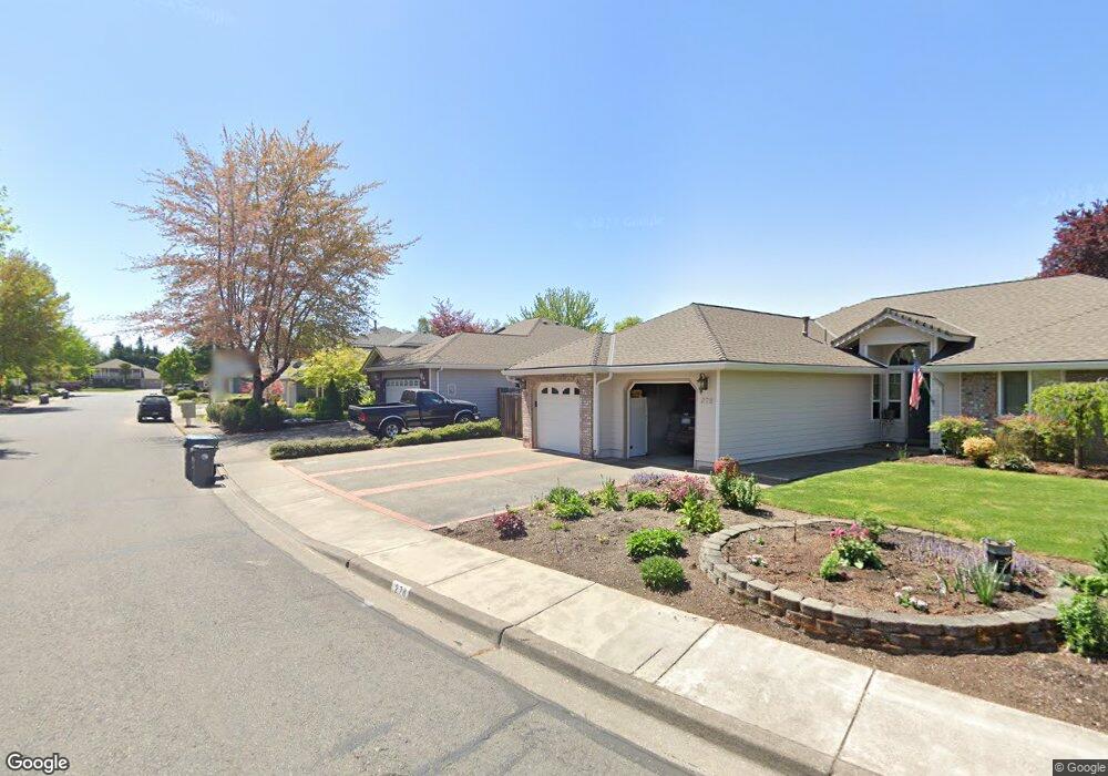
296 Brandon St Central Point, OR 97502
Estimated Value: $460,000 - $488,000
3
Beds
2
Baths
1,618
Sq Ft
$289/Sq Ft
Est. Value
About This Home
This home is located at 296 Brandon St, Central Point, OR 97502 and is currently estimated at $467,900, approximately $289 per square foot. 296 Brandon St is a home located in Jackson County with nearby schools including Richardson Elementary School, Scenic Middle School, and Crater High School.
Ownership History
Date
Name
Owned For
Owner Type
Purchase Details
Closed on
May 11, 1998
Sold by
Lakin Daniel P and Lakin Lisa D
Bought by
Hellmann William E and Hellmann Corrine K
Current Estimated Value
Home Financials for this Owner
Home Financials are based on the most recent Mortgage that was taken out on this home.
Original Mortgage
$153,062
Outstanding Balance
$29,986
Interest Rate
7.13%
Mortgage Type
VA
Estimated Equity
$437,914
Create a Home Valuation Report for This Property
The Home Valuation Report is an in-depth analysis detailing your home's value as well as a comparison with similar homes in the area
Home Values in the Area
Average Home Value in this Area
Purchase History
| Date | Buyer | Sale Price | Title Company |
|---|---|---|---|
| Hellmann William E | $158,800 | Crater Title Insurance |
Source: Public Records
Mortgage History
| Date | Status | Borrower | Loan Amount |
|---|---|---|---|
| Open | Hellmann William E | $153,062 |
Source: Public Records
Tax History Compared to Growth
Tax History
| Year | Tax Paid | Tax Assessment Tax Assessment Total Assessment is a certain percentage of the fair market value that is determined by local assessors to be the total taxable value of land and additions on the property. | Land | Improvement |
|---|---|---|---|---|
| 2025 | $4,829 | $290,420 | $102,280 | $188,140 |
| 2024 | $4,829 | $281,970 | $99,300 | $182,670 |
| 2023 | $4,673 | $273,760 | $96,410 | $177,350 |
| 2022 | $4,564 | $273,760 | $96,410 | $177,350 |
| 2021 | $4,434 | $265,790 | $93,610 | $172,180 |
| 2020 | $4,304 | $258,050 | $90,880 | $167,170 |
| 2019 | $4,198 | $243,250 | $85,660 | $157,590 |
| 2018 | $4,070 | $236,170 | $83,160 | $153,010 |
| 2017 | $3,968 | $236,170 | $83,160 | $153,010 |
| 2016 | $3,852 | $222,630 | $78,390 | $144,240 |
| 2015 | $3,691 | $222,630 | $78,390 | $144,240 |
| 2014 | $3,597 | $209,860 | $73,880 | $135,980 |
Source: Public Records
Map
Nearby Homes
- 465 Creekside Cir
- 487 Creekside Cir
- 21 Hickory Ln
- 659 Jackson Creek Dr
- 25 Donna Way
- 570 Bachand Cir
- 871 Holley Way
- 349 W Pine St
- 895 Holley Way
- 420 Mayberry Ln
- 3364 Snowy Butte Ln
- 429 Mayberry Ln
- 3642 Oak Pine Way
- 619 Palo Verde Way
- 3506 New Ray Rd
- 407 Silver Creek Dr
- 114 Cedar St
- 3220 Freeland Rd
- 3307 Freeland Rd
- 626 Griffin Oaks Dr
- 300 Brandon St
- 278 Brandon St
- 171 Rosewood Ln
- 191 Rosewood Ln
- 310 Brandon St
- 151 Rosewood Ln
- 262 Brandon St
- 297 Brandon St
- 111 Rosewood Ln
- 211 Rosewood Ln
- 281 Brandon St
- 324 Brandon St
- 131 Rosewood Ln
- 265 Brandon St
- 317 Brandon St
- 257 Brandon St
- 448 Creekside Cir
- 170 Rosewood Ln
- 340 Brandon St
- 353 Brandon St