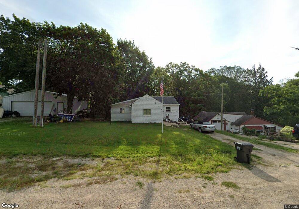
2963 N Center Point Rd Cedar Rapids, IA 52411
Estimated Value: $134,310 - $363,000
2
Beds
1
Bath
688
Sq Ft
$353/Sq Ft
Est. Value
About This Home
This home is located at 2963 N Center Point Rd, Cedar Rapids, IA 52411 and is currently estimated at $242,578, approximately $352 per square foot. 2963 N Center Point Rd is a home located in Linn County with nearby schools including Hiawatha Elementary School, Ponderosa Elementary School, and Bowling Green Learning Center.
Ownership History
Date
Name
Owned For
Owner Type
Purchase Details
Closed on
Apr 13, 2023
Sold by
Seedorf Donald Brian
Bought by
Bad Llc
Current Estimated Value
Purchase Details
Closed on
Mar 13, 2001
Sold by
Seedorf Bryan Donald
Bought by
Seedorf Donald Bryan
Create a Home Valuation Report for This Property
The Home Valuation Report is an in-depth analysis detailing your home's value as well as a comparison with similar homes in the area
Home Values in the Area
Average Home Value in this Area
Purchase History
| Date | Buyer | Sale Price | Title Company |
|---|---|---|---|
| Bad Llc | $30,000 | None Listed On Document | |
| Seedorf Donald Bryan | -- | -- |
Source: Public Records
Tax History Compared to Growth
Tax History
| Year | Tax Paid | Tax Assessment Tax Assessment Total Assessment is a certain percentage of the fair market value that is determined by local assessors to be the total taxable value of land and additions on the property. | Land | Improvement |
|---|---|---|---|---|
| 2025 | $1,508 | $112,700 | $23,500 | $89,200 |
| 2024 | $916 | $111,800 | $23,500 | $88,300 |
| 2023 | $916 | $111,800 | $23,500 | $88,300 |
| 2022 | $974 | $72,400 | $23,500 | $48,900 |
| 2021 | $986 | $72,400 | $23,500 | $48,900 |
| 2020 | $986 | $68,300 | $23,500 | $44,800 |
| 2019 | $922 | $65,400 | $23,500 | $41,900 |
| 2018 | $902 | $65,400 | $23,500 | $41,900 |
| 2017 | $936 | $65,300 | $23,500 | $41,800 |
| 2016 | $1,066 | $65,300 | $23,500 | $41,800 |
| 2015 | $990 | $60,700 | $23,500 | $37,200 |
| 2014 | $840 | $60,700 | $23,500 | $37,200 |
| 2013 | $816 | $60,700 | $23,500 | $37,200 |
Source: Public Records
Map
Nearby Homes
- 1935 Kaylin Ct
- 1940 Kaylin Ct
- 1920 Kaylin Ct
- 1970 Kaylin Ct
- 1975 Kaylin Ct
- 1917 Kaylin Ct
- 39.69 Acres M/L N Center Point Rd
- 28.72 Acres M/L N Center Point Rd
- 8.98 Acres M/L N Center Point Rd
- 1915 Kaylin Ct
- 0 28 72 Acres N Center Point Rd
- 405 Ascot Ln
- 2850 Twinleaf Rd
- 3355 Wild Rose Rd
- 3055 Forrest Hill Ct
- 0 8 98 Acres M L N Center Point Rd Unit 2507297
- 3056 Forrest Hill Ct
- 0 Rd
- 2477 Chloe Ln
- 850 Hemlock Ct
- 2959 N Center Point Rd
- 2969 N Center Point Rd
- 2973 N Center Point Rd
- 1850 Mackenzie Dr
- 1900 Mackenzie Dr
- 1800 Mackenzie Dr
- 2946 N Center Point Rd
- 3359 Singer Hill Ln
- 2937 N Center Point Rd
- 165 Morgan Ct
- 2982 N Center Point Rd
- 3355 Singer Hill Ln
- 3365 Singer Hill Ln
- 1725 Mackenzie Dr
- 1700 Mackenzie Dr
- 185 Morgan Ct
- 160 Morgan Ct
- 1685 Mackenzie Dr
- 1923 Kaylin Ct
- 1660 Mackenzie Dr