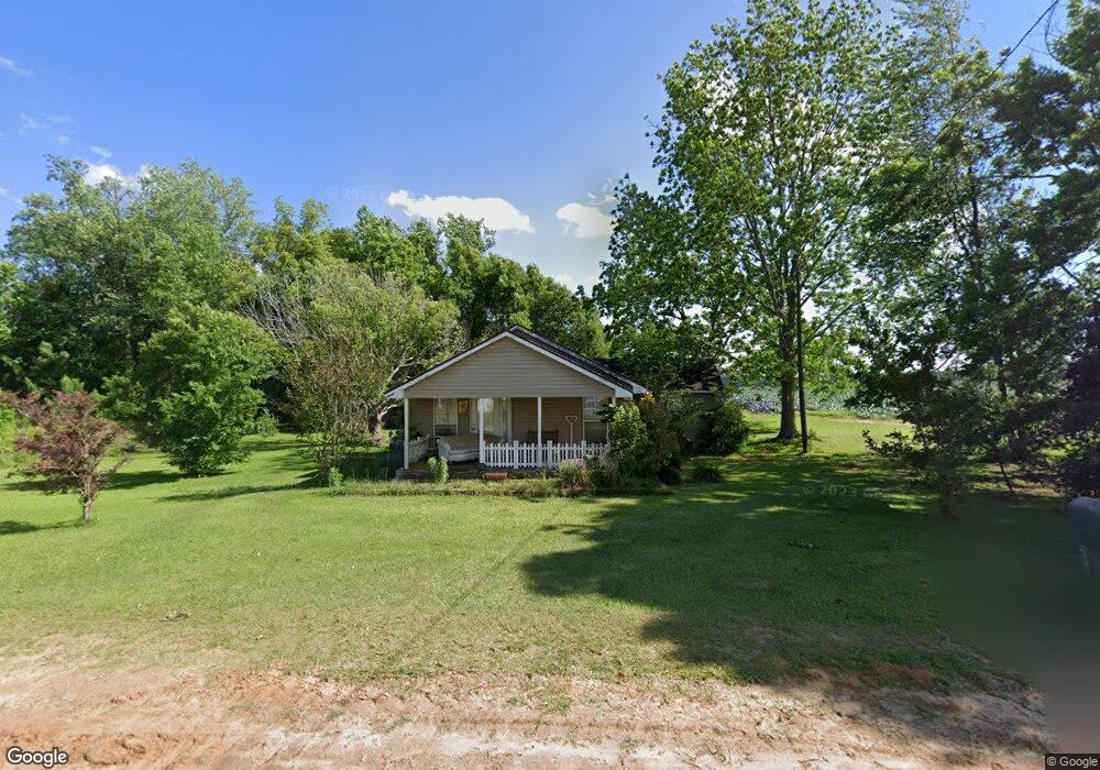
298 Croft Rd Moultrie, GA 31788
Estimated Value: $51,523 - $123,000
--
Bed
1
Bath
1,046
Sq Ft
$76/Sq Ft
Est. Value
About This Home
This home is located at 298 Croft Rd, Moultrie, GA 31788 and is currently estimated at $79,131, approximately $75 per square foot. 298 Croft Rd is a home located in Colquitt County with nearby schools including Odom Elementary School, Willie J. Williams Middle School, and C.A. Gray Junior High School.
Ownership History
Date
Name
Owned For
Owner Type
Purchase Details
Closed on
Jul 2, 2013
Sold by
Cardin Dustin
Bought by
Hopkins Sherrie D
Current Estimated Value
Purchase Details
Closed on
Feb 16, 2006
Sold by
Boyd Donald H
Bought by
Cardin Dustin
Home Financials for this Owner
Home Financials are based on the most recent Mortgage that was taken out on this home.
Original Mortgage
$17,234
Interest Rate
6.04%
Mortgage Type
New Conventional
Purchase Details
Closed on
Jan 27, 2004
Sold by
Boyd John I
Bought by
Boyd Donald H
Purchase Details
Closed on
Nov 24, 2003
Sold by
Boyd Elbert Life Estate
Bought by
Boyd John I
Purchase Details
Closed on
Oct 27, 2003
Bought by
Boyd Elbert Life Estate
Purchase Details
Closed on
Nov 26, 1980
Bought by
Boyd Elbert
Create a Home Valuation Report for This Property
The Home Valuation Report is an in-depth analysis detailing your home's value as well as a comparison with similar homes in the area
Home Values in the Area
Average Home Value in this Area
Purchase History
| Date | Buyer | Sale Price | Title Company |
|---|---|---|---|
| Hopkins Sherrie D | -- | -- | |
| Cardin Dustin | $10,160 | -- | |
| Boyd Donald H | $5,000 | -- | |
| Boyd John I | -- | -- | |
| Boyd Elbert Life Estate | -- | -- | |
| Boyd Elbert | -- | -- |
Source: Public Records
Mortgage History
| Date | Status | Borrower | Loan Amount |
|---|---|---|---|
| Previous Owner | Cardin Dustin | $17,234 |
Source: Public Records
Tax History Compared to Growth
Tax History
| Year | Tax Paid | Tax Assessment Tax Assessment Total Assessment is a certain percentage of the fair market value that is determined by local assessors to be the total taxable value of land and additions on the property. | Land | Improvement |
|---|---|---|---|---|
| 2024 | $267 | $14,644 | $1,883 | $12,761 |
| 2023 | $267 | $10,137 | $1,883 | $8,254 |
| 2022 | $181 | $9,593 | $1,674 | $7,919 |
| 2021 | $176 | $9,252 | $1,674 | $7,578 |
| 2020 | $170 | $8,881 | $1,674 | $7,207 |
| 2019 | $191 | $8,943 | $1,674 | $7,269 |
| 2018 | $229 | $8,943 | $1,674 | $7,269 |
| 2017 | $216 | $9,921 | $2,652 | $7,269 |
| 2016 | $218 | $9,921 | $2,652 | $7,269 |
| 2015 | $221 | $9,921 | $2,652 | $7,269 |
| 2014 | $271 | $9,921 | $2,652 | $7,269 |
| 2013 | -- | $6,562 | $2,652 | $3,910 |
Source: Public Records
Map
Nearby Homes
- 424/426 Martin Luther King Junior Dr
- 0 Southerland Ave
- 8774 Antioch Rd
- 0 Burton Rd Unit 23760976
- 0 Burton Road Barney Ga 31625 Unit 14029
- 0 Burton Rd Unit 23669194
- 182 Horseshoe Dr
- 900 Crosby Rd
- 421 Best Cir
- 0 Sardis Church Rd
- 2231 Nell Purvis Rd
- 916 Robinson Rd
- 693 Old Quitman Annex Rd
- 124 Flint Dr
- 289 Arthur Newbern Rd
- 3240 Tallokas Rd
- 3222 Tallokas Rd
- 2590 McConnell Bridge Rd
- 65 Packer Pride Dr SE
- 16343 Georgia 33
- 420 Croft Rd
- 117 Southerland Ave
- 197 Rogers St
- 420 N Langford St
- 158 Railroad St
- 250 Railroad St
- 425 Ashley St
- 210 Railroad St
- 385 N Langford St
- 138 Clinton Rd
- 385 Langford St
- 258 Railroad St
- 150 Clinton Rd
- 266 Railroad St
- 199 Southerland Ave
- 376 N Langford St
- 274 Railroad St
- 278 S Railroad St
- 209 Railroad St
- 110 Clinton Rd