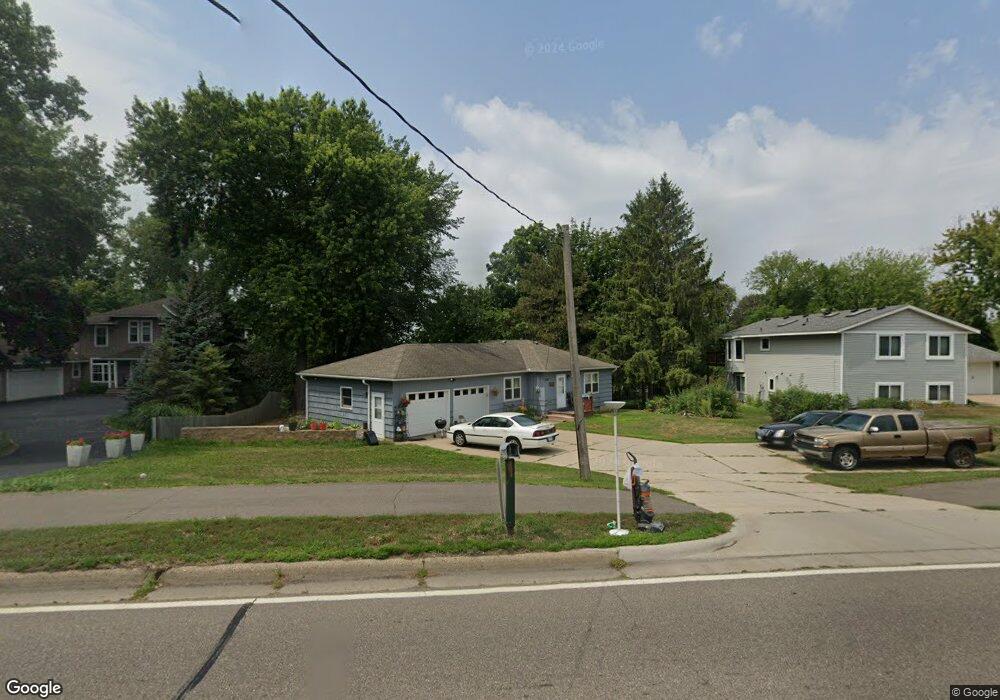
2987 Pilot Knob Rd Saint Paul, MN 55121
Estimated Value: $329,000 - $406,000
3
Beds
2
Baths
1,280
Sq Ft
$280/Sq Ft
Est. Value
About This Home
This home is located at 2987 Pilot Knob Rd, Saint Paul, MN 55121 and is currently estimated at $358,846, approximately $280 per square foot. 2987 Pilot Knob Rd is a home located in Dakota County with nearby schools including Pilot Knob STEM Magnet School, Friendly Hills Middle School, and Two Rivers High School.
Ownership History
Date
Name
Owned For
Owner Type
Purchase Details
Closed on
Nov 10, 2003
Sold by
River Run Properties Llc
Bought by
Regan Amy K
Current Estimated Value
Purchase Details
Closed on
Feb 14, 2003
Sold by
Perry Kenneth W and Perry Claire F
Bought by
River Run Properties Llc
Purchase Details
Closed on
Aug 30, 2002
Sold by
Palmateer Donald M and Palmateer Alice A
Bought by
Perry Kenneth W and Perry Claire F
Create a Home Valuation Report for This Property
The Home Valuation Report is an in-depth analysis detailing your home's value as well as a comparison with similar homes in the area
Home Values in the Area
Average Home Value in this Area
Purchase History
| Date | Buyer | Sale Price | Title Company |
|---|---|---|---|
| Regan Amy K | $187,900 | -- | |
| River Run Properties Llc | $205,000 | -- | |
| Perry Kenneth W | $185,000 | -- |
Source: Public Records
Tax History
| Year | Tax Paid | Tax Assessment Tax Assessment Total Assessment is a certain percentage of the fair market value that is determined by local assessors to be the total taxable value of land and additions on the property. | Land | Improvement |
|---|---|---|---|---|
| 2024 | $3,508 | $335,600 | $93,800 | $241,800 |
| 2023 | $3,508 | $339,000 | $94,100 | $244,900 |
| 2022 | $3,120 | $331,100 | $93,800 | $237,300 |
| 2021 | $2,944 | $279,400 | $81,600 | $197,800 |
| 2020 | $3,124 | $258,100 | $77,700 | $180,400 |
| 2019 | $3,112 | $260,400 | $74,000 | $186,400 |
| 2018 | $2,755 | $251,800 | $70,500 | $181,300 |
| 2017 | $2,179 | $223,900 | $67,100 | $156,800 |
| 2016 | $2,720 | $212,200 | $63,900 | $148,300 |
| 2015 | $2,387 | $196,565 | $58,557 | $138,008 |
| 2014 | -- | $193,186 | $56,841 | $136,345 |
| 2013 | -- | $182,831 | $51,073 | $131,758 |
Source: Public Records
Map
Nearby Homes
- 3016 Timberwood Trail Unit 2
- 3030 Shields Dr Unit 105
- 2891 Egan Ave
- 3050 Shields Dr Unit 103
- 1360 Lone Oak Rd
- 3062 Woodlark Ln
- 1700 Four Oaks Rd Unit 238
- 1700 Four Oaks Rd Unit 314B
- 1603 Raindrop Dr
- 3275 Hill Ridge Dr Unit 29
- 3259 Valley Ridge Dr Unit 10
- 3315 Donald Ave
- 1544 Greenwood Ct N
- 1654 Hunt Dr
- 1650 Hunt Dr
- 3582 Lemieux Cir
- 1302 Crestridge Ln
- 3425 Golfview Dr Unit 216
- 1249 Timbershore Ln Unit 407
- 3569 Blue Jay Way Unit 201
- 2983 Pilot Knob Rd
- 2993 Pilot Knob Rd
- 1408 Vince Trail
- 1404 Vince Trail
- 2981 Pilot Knob Rd
- 1400 Vince Trail
- 1412 Vince Trail
- 2997 Pilot Knob Rd
- 2973 Pilot Knob Rd
- 2988 Pilot Knob Rd
- 1415 Vince Trail
- 1437 Vince Trail
- 1415 Lone Oak Rd
- 1416 Vince Trail
- 2980 Pilot Knob Rd
- 1395 Lone Oak Rd
- 1441 Vince Trail
- 1433 Vince Trail
- 1420 Vince Trail
- 1425 1425 Lone Oak Rd
Your Personal Tour Guide
Ask me questions while you tour the home.