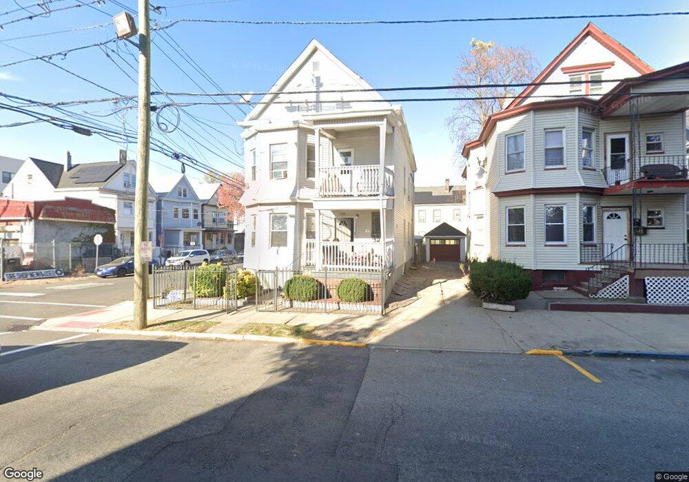
299 10th Ave Paterson, NJ 07524
Riverside NeighborhoodEstimated Value: $533,471 - $690,000
--
Bed
--
Bath
2,382
Sq Ft
$261/Sq Ft
Est. Value
About This Home
This home is located at 299 10th Ave, Paterson, NJ 07524 and is currently estimated at $622,618, approximately $261 per square foot. 299 10th Ave is a home located in Passaic County with nearby schools including Edward W. Kilpatrick School of Discovery, Dale Avenue Elementary School, and Paterson School 6.
Ownership History
Date
Name
Owned For
Owner Type
Purchase Details
Closed on
Sep 9, 2025
Sold by
Givens John D
Bought by
299 Avenue Ventures Llc
Current Estimated Value
Purchase Details
Closed on
Jul 30, 2018
Sold by
Byrd Cleo Carver and Byrd Shirley Jefferson
Bought by
Givens John D
Home Financials for this Owner
Home Financials are based on the most recent Mortgage that was taken out on this home.
Original Mortgage
$148,312
Interest Rate
4.5%
Mortgage Type
New Conventional
Purchase Details
Closed on
May 19, 1987
Bought by
Byrd Cleo Carver and Byrd Shirley J
Create a Home Valuation Report for This Property
The Home Valuation Report is an in-depth analysis detailing your home's value as well as a comparison with similar homes in the area
Home Values in the Area
Average Home Value in this Area
Purchase History
| Date | Buyer | Sale Price | Title Company |
|---|---|---|---|
| 299 Avenue Ventures Llc | -- | None Listed On Document | |
| Givens John D | $198,750 | Valley National Title Servic | |
| Givens John D | $198,750 | Valley National Title Svcs | |
| Byrd Cleo Carver | $29,000 | -- |
Source: Public Records
Mortgage History
| Date | Status | Borrower | Loan Amount |
|---|---|---|---|
| Previous Owner | Givens John D | $148,312 |
Source: Public Records
Tax History Compared to Growth
Tax History
| Year | Tax Paid | Tax Assessment Tax Assessment Total Assessment is a certain percentage of the fair market value that is determined by local assessors to be the total taxable value of land and additions on the property. | Land | Improvement |
|---|---|---|---|---|
| 2025 | $10,108 | $198,400 | $18,900 | $179,500 |
| 2024 | $9,728 | $198,400 | $18,900 | $179,500 |
| 2022 | $9,210 | $198,400 | $18,900 | $179,500 |
| 2021 | $9,346 | $208,800 | $18,900 | $189,900 |
| 2020 | $8,717 | $208,800 | $18,900 | $189,900 |
| 2019 | $8,437 | $204,100 | $18,600 | $185,500 |
| 2018 | $8,488 | $196,200 | $18,600 | $177,600 |
| 2017 | $8,095 | $194,600 | $18,500 | $176,100 |
| 2016 | $8,921 | $205,600 | $19,400 | $186,200 |
| 2015 | $8,446 | $205,600 | $19,400 | $186,200 |
| 2014 | $11,432 | $394,200 | $141,300 | $252,900 |
Source: Public Records
Map
Nearby Homes
- 235-237 Keen St
- 235 Keen St Unit 237
- 446 E 24th St
- 227 Lawrence St Unit 229
- 567 E 19th St
- 466 E 25th St
- 488-490 E 25th St
- 383 E 23rd St
- 488 - 490 E 25th St
- 229 Lawrence St
- 197 12th Ave
- 258 12th Ave Unit 260
- 410 E 26th St Unit 412
- 221 223 E 15th St Unit C
- 313 E 18th St Unit 315
- 311 12th Ave
- 474 E 26th St Unit 476
- 605 Madison Ave
- 192 12th Ave Unit 2
- 49 William St
- 301 10th Ave Unit 303
- 303 10th Ave Unit 305
- 307 10th Ave
- 480 E 19th St
- 467 E 19th St Unit 469
- 478 E 19th St
- 474 E 19th St
- 474 E 19th St Unit 3
- 476 E 19th St
- 478 Madison Ave
- 474 Madison Ave Unit 476
- 472 Madison Ave Unit 474
- 465 E 19th St
- 314 10th Ave Unit 2
- 314 10th Ave
- 470 Madison Ave
- 463 E 19th St
- 468 Madison Ave
- 472-474 Madison Ave
- 449 E 18th St