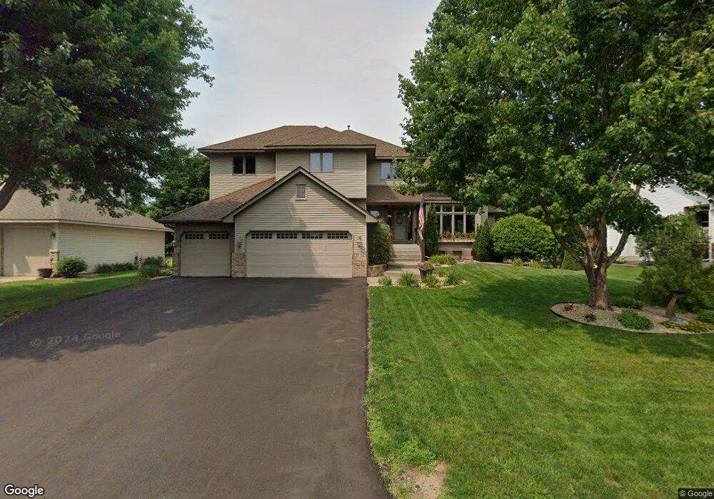
299 Kilbirnie Way Saint Paul, MN 55115
Estimated Value: $672,224 - $765,000
6
Beds
5
Baths
2,697
Sq Ft
$272/Sq Ft
Est. Value
About This Home
This home is located at 299 Kilbirnie Way, Saint Paul, MN 55115 and is currently estimated at $734,056, approximately $272 per square foot. 299 Kilbirnie Way is a home located in Washington County with nearby schools including O.H. Anderson Elementary School, Wildwood Elementary School, and Mahtomedi Middle School.
Ownership History
Date
Name
Owned For
Owner Type
Purchase Details
Closed on
Aug 20, 2003
Sold by
Nurmela David M and Nurmela Betsy A
Bought by
Brown Jason C and Brown Angela L
Current Estimated Value
Purchase Details
Closed on
Feb 14, 1997
Sold by
Max Homes Inc
Bought by
Nurmela David M and Nurmela Betsy A
Purchase Details
Closed on
Jan 26, 1996
Sold by
Diamond Developm
Bought by
Px Homes Inc
Create a Home Valuation Report for This Property
The Home Valuation Report is an in-depth analysis detailing your home's value as well as a comparison with similar homes in the area
Home Values in the Area
Average Home Value in this Area
Purchase History
| Date | Buyer | Sale Price | Title Company |
|---|---|---|---|
| Brown Jason C | $450,000 | -- | |
| Nurmela David M | $268,330 | -- | |
| Px Homes Inc | $35,000 | -- |
Source: Public Records
Mortgage History
| Date | Status | Borrower | Loan Amount |
|---|---|---|---|
| Closed | Px Homes Inc | -- |
Source: Public Records
Tax History Compared to Growth
Tax History
| Year | Tax Paid | Tax Assessment Tax Assessment Total Assessment is a certain percentage of the fair market value that is determined by local assessors to be the total taxable value of land and additions on the property. | Land | Improvement |
|---|---|---|---|---|
| 2024 | $7,214 | $603,300 | $161,800 | $441,500 |
| 2023 | $7,214 | $597,300 | $171,800 | $425,500 |
| 2022 | $6,510 | $583,100 | $171,500 | $411,600 |
| 2021 | $6,750 | $465,600 | $140,000 | $325,600 |
| 2020 | $6,670 | $499,100 | $175,000 | $324,100 |
| 2019 | $6,296 | $485,400 | $153,000 | $332,400 |
| 2018 | $5,548 | $462,000 | $160,000 | $302,000 |
| 2017 | $5,386 | $436,400 | $159,000 | $277,400 |
| 2016 | $5,584 | $402,200 | $149,400 | $252,800 |
| 2015 | $5,464 | $394,700 | $118,800 | $275,900 |
| 2013 | -- | $371,300 | $104,400 | $266,900 |
Source: Public Records
Map
Nearby Homes
- 78 Dunbar Way
- 941 Pineridge Ct
- 180 Bevins Ln
- 13 Echo Lake Blvd
- 907 Ledgestone Dr
- TBD Old Wildwood Rd
- 285 Old Wildwood Rd
- 3533 Long Lake Rd E
- 174 Wedgewood Dr
- 739 Echo Shores Ct
- 745 Sterling Ct
- 824 Woodland Dr
- 169 Wedgewood Dr
- 766 Sterling Ct
- 2728 Century Ct
- 2671 Sumac Ridge
- 2667 Sumac Ridge
- 5562 Golfview Ln N
- 2608 Sumac Ridge
- 3150 Glen Oaks Ave Unit 305
- 317 Kilbirnie Way
- 285 Kilbirnie Way
- 284 Windsor Ln
- 296 Windsor Ln
- 273 Kilbirnie Way
- 1303 Iverness Place
- 273 273 Kilbirnie Way
- 1302 1302 Iverness Place
- 272 Windsor Ln
- 302 Windsor Ln
- 1232 Hillswick Terrace
- 1220 Hillswick Terrace
- 263 Kilbirnie Way
- 1302 Iverness Place
- 314 Windsor Ln
- 1300 Hillswick Place
- 260 Windsor Ln
- 1315 Iverness Place
- 263 263 Kilbirnie Way
- 1221 1221 Hillswick-Terrace-