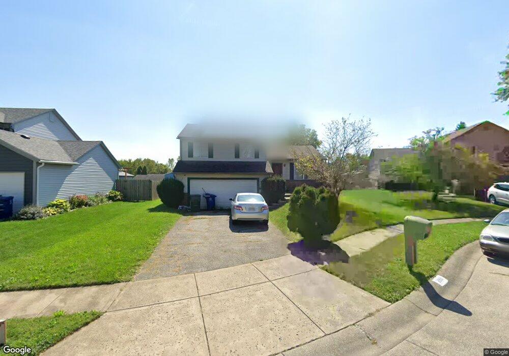
2993 Elspeth Ct Columbus, OH 43231
Brandywine NeighborhoodEstimated Value: $253,146 - $299,000
3
Beds
2
Baths
1,092
Sq Ft
$255/Sq Ft
Est. Value
About This Home
This home is located at 2993 Elspeth Ct, Columbus, OH 43231 and is currently estimated at $278,787, approximately $255 per square foot. 2993 Elspeth Ct is a home located in Franklin County with nearby schools including Mark Twain Elementary School, Walnut Springs Middle School, and Westerville South High School.
Ownership History
Date
Name
Owned For
Owner Type
Purchase Details
Closed on
Nov 4, 2008
Sold by
Williams Shirley S and Williams Shirley A
Bought by
Williams Charles A
Current Estimated Value
Home Financials for this Owner
Home Financials are based on the most recent Mortgage that was taken out on this home.
Original Mortgage
$139,587
Outstanding Balance
$91,038
Interest Rate
5.95%
Mortgage Type
New Conventional
Estimated Equity
$187,749
Purchase Details
Closed on
May 5, 1989
Create a Home Valuation Report for This Property
The Home Valuation Report is an in-depth analysis detailing your home's value as well as a comparison with similar homes in the area
Home Values in the Area
Average Home Value in this Area
Purchase History
| Date | Buyer | Sale Price | Title Company |
|---|---|---|---|
| Williams Charles A | -- | Land Sel Ti | |
| -- | $18,000 | -- |
Source: Public Records
Mortgage History
| Date | Status | Borrower | Loan Amount |
|---|---|---|---|
| Open | Williams Charles A | $139,587 |
Source: Public Records
Tax History Compared to Growth
Tax History
| Year | Tax Paid | Tax Assessment Tax Assessment Total Assessment is a certain percentage of the fair market value that is determined by local assessors to be the total taxable value of land and additions on the property. | Land | Improvement |
|---|---|---|---|---|
| 2024 | $3,754 | $75,330 | $20,130 | $55,200 |
| 2023 | $3,663 | $75,320 | $20,125 | $55,195 |
| 2022 | $3,098 | $48,620 | $10,960 | $37,660 |
| 2021 | $3,128 | $48,620 | $10,960 | $37,660 |
| 2020 | $3,193 | $48,620 | $10,960 | $37,660 |
| 2019 | $2,614 | $38,890 | $8,750 | $30,140 |
| 2018 | $2,647 | $38,890 | $8,750 | $30,140 |
| 2017 | $2,562 | $38,890 | $8,750 | $30,140 |
| 2016 | $2,734 | $37,870 | $8,330 | $29,540 |
| 2015 | $2,740 | $37,870 | $8,330 | $29,540 |
| 2014 | $2,743 | $37,870 | $8,330 | $29,540 |
| 2013 | $1,437 | $39,830 | $8,750 | $31,080 |
Source: Public Records
Map
Nearby Homes
- 3010 Bennington Ave
- 3098 Bennington Ave
- 3084 Omega Dr
- 2903 Kilbourne Ave
- 2977 Ironstone Dr
- 2691 Northwold Rd
- 2974 Footloose Dr
- 2901 Footloose Dr
- 0 Ashbury Rd
- 2576 Claridon Rd
- 0 Chester Rd
- 3378 Trail Lane Ct
- 0 Abington Rd Unit 224031739
- 0 Abington Rd Unit 224031704
- 0 Abington Rd Unit 224031738
- 0 Abington Rd Unit 224031699
- 2625 Clybourne Rd
- 3392 Trail Lane Ct
- 4279 Morsetown Ct
- 4266 Morsetown Ct
- 3001 Elspeth Ct
- 2985 Elspeth Ct
- 2976 Bretton Woods Dr
- 3009 Elspeth Ct
- 2984 Bretton Woods Dr
- 2968 Bretton Woods Dr
- 2977 Elspeth Ct
- 2992 Bretton Woods Dr
- 2960 Bretton Woods Dr
- 3015 Elspeth Ct
- 2994 Elspeth Ct
- 2988 Elspeth Ct
- 3000 Elspeth Ct
- 2980 Elspeth Ct
- 3000 Bretton Woods Dr
- 2952 Bretton Woods Dr
- 2974 Elspeth Ct
- 3021 Elspeth Ct
- 3008 Elspeth Ct
- 4619 Fox River Run