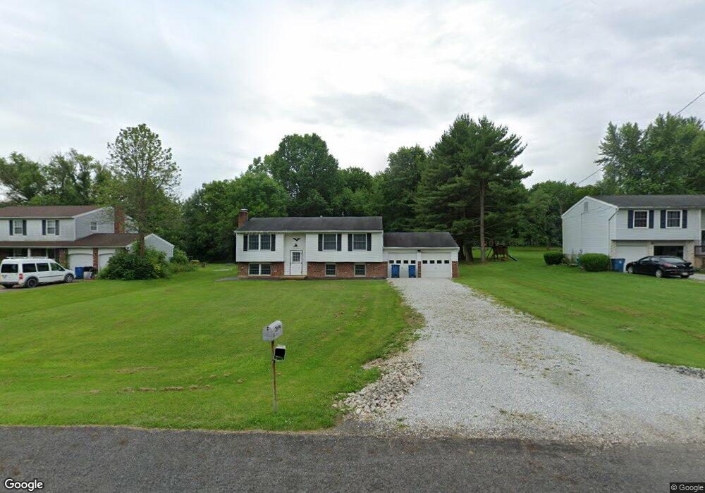
2994 Bronco Dr New Franklin, OH 44216
Estimated Value: $190,000 - $231,694
3
Beds
1
Bath
1,028
Sq Ft
$208/Sq Ft
Est. Value
About This Home
This home is located at 2994 Bronco Dr, New Franklin, OH 44216 and is currently estimated at $213,424, approximately $207 per square foot. 2994 Bronco Dr is a home located in Summit County with nearby schools including Norton Primary Elementary School, Norton Middle School, and Norton High School.
Ownership History
Date
Name
Owned For
Owner Type
Purchase Details
Closed on
Sep 27, 2021
Sold by
Trump David
Bought by
Link Michael Brian
Current Estimated Value
Home Financials for this Owner
Home Financials are based on the most recent Mortgage that was taken out on this home.
Original Mortgage
$162,011
Outstanding Balance
$147,739
Interest Rate
2.8%
Mortgage Type
FHA
Estimated Equity
$65,685
Purchase Details
Closed on
May 23, 2018
Sold by
Trump Catherine M
Bought by
Trump David
Create a Home Valuation Report for This Property
The Home Valuation Report is an in-depth analysis detailing your home's value as well as a comparison with similar homes in the area
Home Values in the Area
Average Home Value in this Area
Purchase History
| Date | Buyer | Sale Price | Title Company |
|---|---|---|---|
| Link Michael Brian | $165,000 | Fidelity National Title | |
| Trump David | -- | First Security Title |
Source: Public Records
Mortgage History
| Date | Status | Borrower | Loan Amount |
|---|---|---|---|
| Open | Link Michael Brian | $162,011 |
Source: Public Records
Tax History Compared to Growth
Tax History
| Year | Tax Paid | Tax Assessment Tax Assessment Total Assessment is a certain percentage of the fair market value that is determined by local assessors to be the total taxable value of land and additions on the property. | Land | Improvement |
|---|---|---|---|---|
| 2025 | $2,570 | $62,909 | $14,154 | $48,755 |
| 2024 | $2,570 | $62,909 | $14,154 | $48,755 |
| 2023 | $2,570 | $62,909 | $14,154 | $48,755 |
| 2022 | $2,494 | $49,602 | $11,144 | $38,458 |
| 2021 | $2,503 | $49,602 | $11,144 | $38,458 |
| 2020 | $2,455 | $49,600 | $11,140 | $38,460 |
| 2019 | $2,416 | $43,890 | $10,570 | $33,320 |
| 2018 | $2,376 | $43,890 | $10,570 | $33,320 |
| 2017 | $2,194 | $43,890 | $10,570 | $33,320 |
| 2016 | $2,170 | $36,360 | $10,570 | $25,790 |
| 2015 | $2,194 | $36,360 | $10,570 | $25,790 |
| 2014 | $2,176 | $36,360 | $10,570 | $25,790 |
| 2013 | $2,163 | $36,500 | $10,570 | $25,930 |
Source: Public Records
Map
Nearby Homes
- 0 Grill Rd
- 6163 N Oval Rd
- 3241 Grill Rd
- 3384 Lullaby Ln
- 2672 Lyman Dr
- 5251 Frederick St
- 5464 Taylor Rd
- V/L Monroe Square
- 5239 Monroe Square E
- 612 33rd St SW
- 2457 Bishop Oval
- V/L Bishop Oval
- 18592 Edwards Rd Unit 156
- 18592 Edwards Rd Unit 126
- 5264 Taylor Rd
- 1430 Harden Dr
- 5300 S Cleveland Massillon Rd
- 15081 Oak Grove Dr
- 1638 Harden Dr
- 202 37th St SW
- 2984 Bronco Dr
- 3004 Bronco Dr
- 3012 Bronco Dr
- 2974 Bronco Dr
- 2991 Bronco Dr
- 3001 Bronco Dr
- 2981 Bronco Dr
- 6176 S Cleveland Massillon Rd
- 6176 S Cleveland Massillon Rd
- 3020 Bronco Dr
- 3009 Bronco Dr
- 2971 Bronco Dr
- 6188 S Cleveland Massillon Rd
- 3019 Bronco Dr
- 5931 Mustang Dr
- 6196 S Cleveland Massillon Rd
- 5943 Mustang Dr
- 3029 Bronco Dr
- 5955 Mustang Dr
- 6206 S Cleveland Massillon Rd