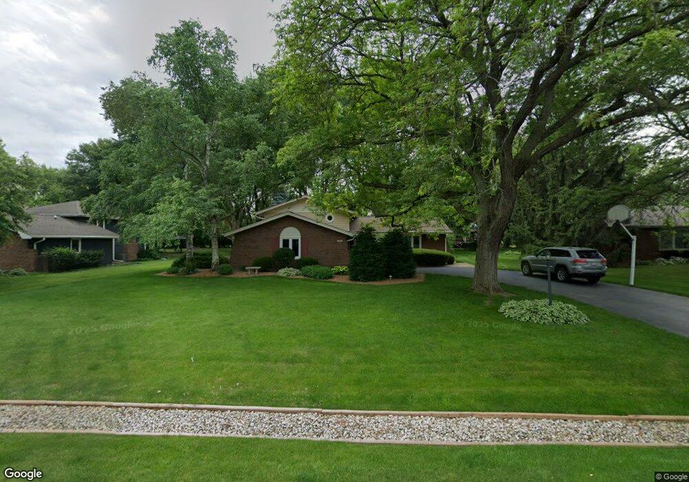
29W281 Andermann Dr Naperville, IL 60564
Wheatland South NeighborhoodEstimated Value: $457,224 - $575,000
--
Bed
--
Bath
1,695
Sq Ft
$301/Sq Ft
Est. Value
About This Home
This home is located at 29W281 Andermann Dr, Naperville, IL 60564 and is currently estimated at $510,056, approximately $300 per square foot. 29W281 Andermann Dr is a home located in Will County with nearby schools including Ellsworth Elementary School, Clifford Crone Middle School, and Neuqua Valley High School.
Ownership History
Date
Name
Owned For
Owner Type
Purchase Details
Closed on
Jun 2, 2015
Sold by
Baker Larry H and Baker Dale A
Bought by
Larry & Dale Baker Living Trust
Current Estimated Value
Purchase Details
Closed on
Jun 25, 1999
Sold by
Raven Dane C and Raven Lorraine D
Bought by
Lindstrom Kurt D and Lindstrom Theresa A
Home Financials for this Owner
Home Financials are based on the most recent Mortgage that was taken out on this home.
Original Mortgage
$166,500
Outstanding Balance
$45,289
Interest Rate
7.43%
Estimated Equity
$464,767
Purchase Details
Closed on
May 5, 1995
Sold by
Heck Michael R and Heck Cheri L
Bought by
Baker Larry H and Baker Dale A
Home Financials for this Owner
Home Financials are based on the most recent Mortgage that was taken out on this home.
Original Mortgage
$90,800
Interest Rate
8.27%
Create a Home Valuation Report for This Property
The Home Valuation Report is an in-depth analysis detailing your home's value as well as a comparison with similar homes in the area
Home Values in the Area
Average Home Value in this Area
Purchase History
| Date | Buyer | Sale Price | Title Company |
|---|---|---|---|
| Larry & Dale Baker Living Trust | -- | Attorney | |
| Lindstrom Kurt D | $185,000 | -- | |
| Baker Larry H | $180,000 | -- |
Source: Public Records
Mortgage History
| Date | Status | Borrower | Loan Amount |
|---|---|---|---|
| Open | Lindstrom Kurt D | $166,500 | |
| Previous Owner | Baker Larry H | $90,800 |
Source: Public Records
Tax History Compared to Growth
Tax History
| Year | Tax Paid | Tax Assessment Tax Assessment Total Assessment is a certain percentage of the fair market value that is determined by local assessors to be the total taxable value of land and additions on the property. | Land | Improvement |
|---|---|---|---|---|
| 2024 | $7,950 | $148,970 | $25,941 | $123,029 |
| 2023 | $7,950 | $131,599 | $22,916 | $108,683 |
| 2022 | $6,720 | $112,600 | $21,679 | $90,921 |
| 2021 | $6,377 | $107,238 | $20,647 | $86,591 |
| 2020 | $6,252 | $105,539 | $20,320 | $85,219 |
| 2019 | $6,133 | $102,564 | $19,747 | $82,817 |
| 2018 | $5,618 | $93,144 | $19,312 | $73,832 |
| 2017 | $5,530 | $90,739 | $18,813 | $71,926 |
| 2016 | $5,860 | $88,786 | $18,408 | $70,378 |
| 2015 | $5,247 | $85,371 | $17,700 | $67,671 |
| 2014 | $5,247 | $75,050 | $17,700 | $57,350 |
| 2013 | $5,247 | $75,050 | $17,700 | $57,350 |
Source: Public Records
Map
Nearby Homes
- 29W316 Andermann Dr
- 2255 Wendt Cir
- 1804 Princess Cir
- 1736 Robert Ln
- 3616 Eliot Ln
- 3707 Junebreeze Ln
- 3105 Saganashkee Ln
- 2949 Brossman St
- 3432 Caine Dr
- 2207 Sisters Ave
- 2711 Wait Rd
- 1112 Saratoga Ct
- 2866 Stonewater Dr Unit 102
- 3816 Rosada Dr
- 3432 Redwing Dr Unit 2
- 3003 Kingbird Ct Unit IV
- 1116 Hollingswood Ave
- 3420 Sunnyside Ct
- 3349 Rosecroft Ln Unit 2
- 2736 Bluewater Cir
- 29W267 Andermann Dr
- 29W303 Andermann Dr
- 29W253 Andermann Dr
- 29W280 Andermann Dr
- 29W317 Andermann Dr
- 29W266 Andermann Dr
- 29W304 Andermann Dr
- 29W304 Mark Dr
- 29W280 Mark Dr
- 29W254 Andermann Dr
- 29W266 Mark Dr
- 29W331 Andermann Dr
- 29W316 Mark Dr
- 29W254 Mark Dr
- 11S678 Schillinger Dr
- 29W240 Andermann Dr Unit 4
- 29W242 Mark Dr
- 29W332 Mark Dr
- 29W332 Andermann Dr
- 11S671 Mcgrath Ln