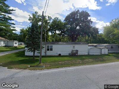
3 Aeroplane Ln Council Bluffs, IA 51503
Estimated Value: $392,000 - $602,000
3
Beds
2
Baths
1,613
Sq Ft
$333/Sq Ft
Est. Value
About This Home
This home is located at 3 Aeroplane Ln, Council Bluffs, IA 51503 and is currently estimated at $536,450, approximately $332 per square foot. 3 Aeroplane Ln is a home with nearby schools including College View Elementary School, Gerald W. Kirn Middle School, and Abraham Lincoln High School.
Ownership History
Date
Name
Owned For
Owner Type
Purchase Details
Closed on
Mar 4, 2022
Sold by
Royalty Denise G
Bought by
Smothers Timothy Ray and Smothers Jamie Lynn
Current Estimated Value
Home Financials for this Owner
Home Financials are based on the most recent Mortgage that was taken out on this home.
Original Mortgage
$185,000
Interest Rate
3.15%
Mortgage Type
New Conventional
Create a Home Valuation Report for This Property
The Home Valuation Report is an in-depth analysis detailing your home's value as well as a comparison with similar homes in the area
Home Values in the Area
Average Home Value in this Area
Purchase History
| Date | Buyer | Sale Price | Title Company |
|---|---|---|---|
| Smothers Timothy Ray | -- | Peters Law Firm Pc |
Source: Public Records
Mortgage History
| Date | Status | Borrower | Loan Amount |
|---|---|---|---|
| Open | Smothers Jamie Lynn | $350,000 | |
| Closed | Smothers Timothy Ray | $150,000 | |
| Closed | Smothers Timothy Ray | $100,000 | |
| Closed | Smothers Jamie Lynn | $185,000 | |
| Previous Owner | Smothers Timothy R | $167,500 | |
| Previous Owner | Smothers Timothy Ray | $170,000 | |
| Previous Owner | Smothers Timothy R | $160,000 |
Source: Public Records
Tax History Compared to Growth
Tax History
| Year | Tax Paid | Tax Assessment Tax Assessment Total Assessment is a certain percentage of the fair market value that is determined by local assessors to be the total taxable value of land and additions on the property. | Land | Improvement |
|---|---|---|---|---|
| 2024 | $6,440 | $482,700 | $131,300 | $351,400 |
| 2023 | $6,440 | $482,700 | $131,300 | $351,400 |
| 2022 | $6,520 | $351,000 | $93,300 | $257,700 |
| 2021 | $9,852 | $351,000 | $93,300 | $257,700 |
| 2020 | $7,038 | $325,300 | $93,300 | $232,000 |
| 2019 | $7,434 | $325,300 | $93,300 | $232,000 |
| 2018 | $7,864 | $325,300 | $93,300 | $232,000 |
| 2017 | $7,864 | $329,500 | $137,000 | $192,500 |
| 2015 | $8,758 | $329,500 | $137,000 | $192,500 |
| 2014 | $8,310 | $300,000 | $39,170 | $260,830 |
Source: Public Records
Map
Nearby Homes
- LOT 12 Mcpherson Ave
- 85.69 Acres Eastern Hills Dr
- 114 Antioch Dr
- 415 Cloverdale Dr
- 204 Marinda Dr
- 201 Woodcliff Cir
- 1301 Afton Cir
- LOT 13 Fannin Cir
- 4019 Gladbrook Dr
- 4105 Gladbrook Dr
- 1409 Aster Dr
- LOT 12 Fannin Cir
- 1601 Tipton Dr
- 204 Upland Dr
- 4103 Briarwood Dr
- LOT 10 Fannin Cir
- LOT 20 Ardmore St
- LOT 6 Ardmore St
- LOT 16 Ardmore St
- LOT 18 Ardmore St
- 3 Aeroplane Ln
- 1 Aeroplane Ln
- 20946 Mcpherson Ave
- 20968 Mcpherson Ave
- 20854 Mcpherson Ave
- 17400 Sunnydale Rd
- 20825 Mcpherson Ave
- 20848 Mcpherson Ave
- 21020 Mcpherson Ave
- 20697 Mcpherson Ave
- 17440 Sunnydale Rd
- 20830 Mcpherson Ave
- 17474 Sunnydale Rd
- 17510 Sunnydale Rd
- 20790 Mcpherson Ave
- 21024 Mcpherson Ave
- 20798 Mcpherson Ave
- 21054 Mcpherson Ave
- 21096 Mcpherson Ave
- 20740 Mcpherson Ave