Estimated Value: $474,465 - $535,000
3
Beds
1
Bath
1,092
Sq Ft
$467/Sq Ft
Est. Value
About This Home
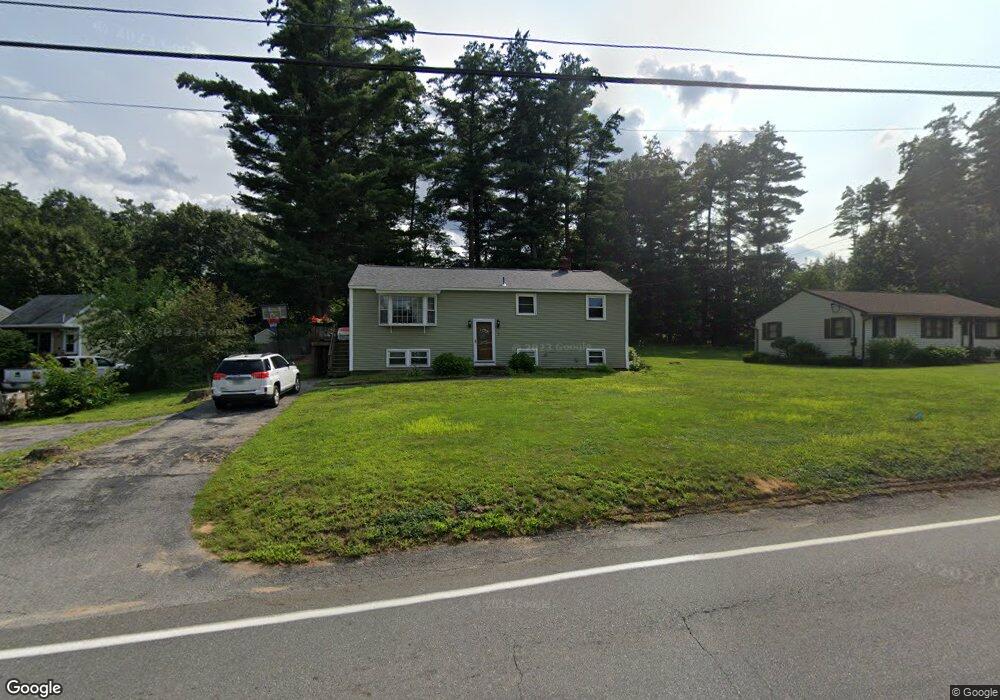
This home is located at 3 Bluff St, Salem, NH 03079 and is currently estimated at $510,366, approximately $467 per square foot. 3 Bluff St is a home located in Rockingham County with nearby schools including William E. Lancaster School, Woodbury School, and Salem High School.
Ownership History
Date
Name
Owned For
Owner Type
Purchase Details
Closed on
Jul 16, 2004
Sold by
Gazda Gertrude
Bought by
Masson Ronald C
Current Estimated Value
Home Financials for this Owner
Home Financials are based on the most recent Mortgage that was taken out on this home.
Original Mortgage
$257,950
Interest Rate
6.25%
Mortgage Type
Purchase Money Mortgage
Create a Home Valuation Report for This Property
The Home Valuation Report is an in-depth analysis detailing your home's value as well as a comparison with similar homes in the area
Purchase History
| Date | Buyer | Sale Price | Title Company |
|---|---|---|---|
| Masson Ronald C | $260,000 | -- |
Source: Public Records
Mortgage History
| Date | Status | Borrower | Loan Amount |
|---|---|---|---|
| Open | Masson Ronald C | $220,400 | |
| Closed | Masson Ronald C | $232,000 | |
| Closed | Masson Ronald C | $20,500 | |
| Closed | Masson Ronald C | $257,950 |
Source: Public Records
Tax History
| Year | Tax Paid | Tax Assessment Tax Assessment Total Assessment is a certain percentage of the fair market value that is determined by local assessors to be the total taxable value of land and additions on the property. | Land | Improvement |
|---|---|---|---|---|
| 2024 | $6,595 | $374,700 | $153,200 | $221,500 |
| 2023 | $6,355 | $374,700 | $153,200 | $221,500 |
| 2022 | $6,014 | $374,700 | $153,200 | $221,500 |
| 2021 | $5,988 | $374,700 | $153,200 | $221,500 |
| 2020 | $5,404 | $245,400 | $109,500 | $135,900 |
| 2019 | $5,394 | $245,400 | $109,500 | $135,900 |
| 2018 | $5,303 | $245,400 | $109,500 | $135,900 |
| 2017 | $5,114 | $245,400 | $109,500 | $135,900 |
| 2016 | $5,014 | $245,400 | $109,500 | $135,900 |
| 2015 | $4,789 | $223,900 | $112,300 | $111,600 |
| 2014 | $4,655 | $223,900 | $112,300 | $111,600 |
| 2013 | $4,581 | $223,900 | $112,300 | $111,600 |
Source: Public Records
Map
Nearby Homes
- 8 Arcadia Ln
- 12 Field Ave
- 384 Main St Unit 203
- 384 Main St Unit 102
- 5 Highland Ave
- 7 Douglas Dr
- 5 Canterbury Ct
- 4 Therriault Ave
- 17 Canterbury Ct
- 40 Stanwood Rd Unit 9
- 3 Longview Dr Unit 305
- 10 Town Village Dr
- 1 Longview Dr Unit 110
- 1 Longview Dr Unit 203
- 1 Longview Dr Unit 101
- 1 Longview Dr Unit 108
- 1 Longview Dr Unit 401
- 1 Longview Dr Unit 306
- 1 Longview Dr Unit 205
- 1 Longview Dr Unit 106
Your Personal Tour Guide
Ask me questions while you tour the home.