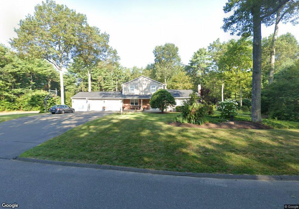
3 Daden Ln West Simsbury, CT 06092
Estimated Value: $633,000 - $738,145
4
Beds
3
Baths
3,295
Sq Ft
$214/Sq Ft
Est. Value
About This Home
This home is located at 3 Daden Ln, West Simsbury, CT 06092 and is currently estimated at $704,286, approximately $213 per square foot. 3 Daden Ln is a home located in Hartford County with nearby schools including Tootin' Hills School, Henry James Memorial School, and Simsbury High School.
Ownership History
Date
Name
Owned For
Owner Type
Purchase Details
Closed on
May 6, 2014
Sold by
Morrison Edward K
Bought by
Morrison Karen Y
Current Estimated Value
Purchase Details
Closed on
Sep 14, 1993
Sold by
Mccarthy Sharon and Donaghy Susan
Bought by
Morrison Edward and Morrison Karen
Create a Home Valuation Report for This Property
The Home Valuation Report is an in-depth analysis detailing your home's value as well as a comparison with similar homes in the area
Home Values in the Area
Average Home Value in this Area
Purchase History
| Date | Buyer | Sale Price | Title Company |
|---|---|---|---|
| Morrison Karen Y | -- | -- | |
| Morrison Edward K | -- | -- | |
| Morrison Edward | $140,000 | -- |
Source: Public Records
Mortgage History
| Date | Status | Borrower | Loan Amount |
|---|---|---|---|
| Previous Owner | Morrison Edward | $285,262 | |
| Previous Owner | Morrison Edward | $312,000 |
Source: Public Records
Tax History Compared to Growth
Tax History
| Year | Tax Paid | Tax Assessment Tax Assessment Total Assessment is a certain percentage of the fair market value that is determined by local assessors to be the total taxable value of land and additions on the property. | Land | Improvement |
|---|---|---|---|---|
| 2025 | $13,197 | $386,330 | $81,200 | $305,130 |
| 2024 | $11,446 | $343,630 | $81,200 | $262,430 |
| 2023 | $10,934 | $343,630 | $81,200 | $262,430 |
| 2022 | $10,776 | $278,960 | $88,200 | $190,760 |
| 2021 | $10,776 | $278,960 | $88,200 | $190,760 |
| 2020 | $10,347 | $278,960 | $88,200 | $190,760 |
| 2019 | $10,411 | $278,960 | $88,200 | $190,760 |
| 2018 | $10,486 | $278,960 | $88,200 | $190,760 |
| 2017 | $10,199 | $263,120 | $88,200 | $174,920 |
| 2016 | $9,767 | $263,120 | $88,200 | $174,920 |
| 2015 | $9,767 | $263,120 | $88,200 | $174,920 |
| 2014 | $9,772 | $263,120 | $88,200 | $174,920 |
Source: Public Records
Map
Nearby Homes
- 269 W Mountain Rd
- 395 Bushy Hill Rd
- 301 Bushy Hill Rd
- 302 Bushy Hill Rd
- 10 Sachems Trail
- 8 Quorn Hunt Rd
- 8 Crane Place
- 121 Gracey Rd
- 370A W Mountain Rd
- 1 Alcima Dr
- 3 Minister Brook Dr
- 14 Nod Brook Dr
- 23 Red Fox Run
- 15 Red Fox Run
- 6 Highwood Rd
- 26 Red Stone Dr
- 4 Adams Rd
- 41 Applegate Ln
- 3 Applegate Ln Unit 3
- 31 Applegate Ln Unit 31