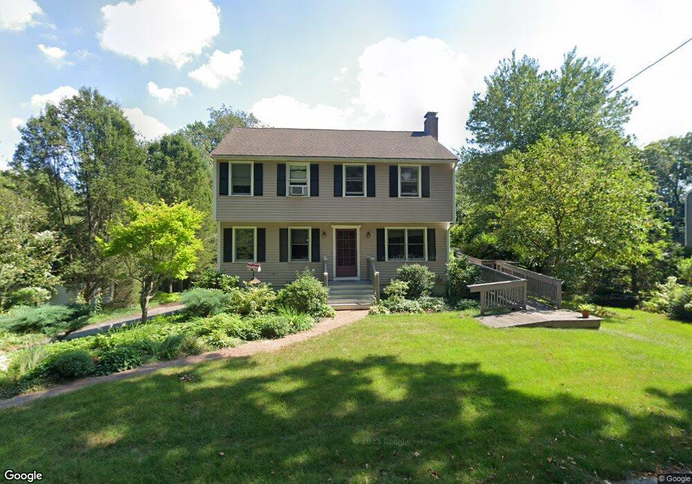
3 Eben St Milford, MA 01757
Estimated Value: $603,000 - $732,000
3
Beds
3
Baths
2,194
Sq Ft
$303/Sq Ft
Est. Value
About This Home
This home is located at 3 Eben St, Milford, MA 01757 and is currently estimated at $663,947, approximately $302 per square foot. 3 Eben St is a home located in Worcester County with nearby schools including Milford High School.
Ownership History
Date
Name
Owned For
Owner Type
Purchase Details
Closed on
Sep 26, 2022
Sold by
Richardson Norman J Est and Pruett
Bought by
Pruett Mia
Current Estimated Value
Purchase Details
Closed on
Jul 9, 2001
Sold by
Esselstyn Peter J
Bought by
Richardson Norman J and Pruett Mildred M
Purchase Details
Closed on
Jun 26, 1998
Sold by
Baxendale Richard J and Baxendale Tammy J
Bought by
Esselstyn Peter J
Purchase Details
Closed on
Sep 29, 1995
Sold by
Worsham Alfred and Worsham Barbara
Bought by
F&D Central Realty Co
Purchase Details
Closed on
Aug 30, 1993
Sold by
Glazier Douglas and Glazier Jane
Bought by
Baxendale Richard J and Baxendale Tammy
Purchase Details
Closed on
Aug 20, 1993
Sold by
Gamble Vincent
Bought by
Dunster Homes Inc
Create a Home Valuation Report for This Property
The Home Valuation Report is an in-depth analysis detailing your home's value as well as a comparison with similar homes in the area
Home Values in the Area
Average Home Value in this Area
Purchase History
| Date | Buyer | Sale Price | Title Company |
|---|---|---|---|
| Pruett Mia | -- | None Available | |
| Richardson Norman J | $319,900 | -- | |
| Esselstyn Peter J | $212,000 | -- | |
| F&D Central Realty Co | $81,500 | -- | |
| Baxendale Richard J | $178,000 | -- | |
| Dunster Homes Inc | $60,000 | -- |
Source: Public Records
Mortgage History
| Date | Status | Borrower | Loan Amount |
|---|---|---|---|
| Previous Owner | Dunster Homes Inc | $155,000 | |
| Previous Owner | Dunster Homes Inc | $174,000 |
Source: Public Records
Tax History Compared to Growth
Tax History
| Year | Tax Paid | Tax Assessment Tax Assessment Total Assessment is a certain percentage of the fair market value that is determined by local assessors to be the total taxable value of land and additions on the property. | Land | Improvement |
|---|---|---|---|---|
| 2025 | $7,022 | $548,600 | $220,100 | $328,500 |
| 2024 | $7,073 | $532,200 | $211,400 | $320,800 |
| 2023 | $6,653 | $460,400 | $183,000 | $277,400 |
| 2022 | $6,251 | $406,200 | $167,700 | $238,500 |
| 2021 | $6,013 | $376,300 | $167,700 | $208,600 |
| 2020 | $5,947 | $372,600 | $167,700 | $204,900 |
| 2019 | $5,784 | $349,700 | $167,700 | $182,000 |
| 2018 | $5,720 | $345,400 | $163,400 | $182,000 |
| 2017 | $5,556 | $330,900 | $163,400 | $167,500 |
| 2016 | $5,470 | $318,400 | $163,400 | $155,000 |
| 2015 | $5,321 | $303,200 | $154,700 | $148,500 |
Source: Public Records
Map
Nearby Homes
- 1 Tyler St
- 44 Silver Hill Rd
- 9 Robin Rd
- 21 Shadowbrook Ln Unit 13
- 18 Shadowbrook Ln Unit 40
- 13 Hemlock Ln
- 19 Shadowbrook Ln Unit 13
- 10 Shadowbrook Ln Unit 24
- 4 Shadowbrook Ln Unit 31
- 8 Shadowbrook Ln Unit 39
- 4 Kennedy Ln Unit 49
- 56 Village Cir
- 11 Shadowbrook Ln Unit 9
- 9 Shadowbrook Ln Unit 27
- 54 Village Cir Unit 54
- 3 Shadowbrook Ln Unit 3
- 5 Shadowbrook Ln Unit 32
- 31 Haven St
- 24 Camp St
- 250 Congress St