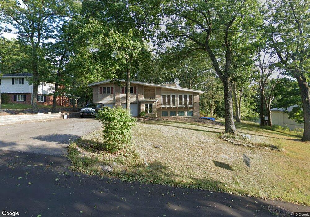
3 Forest Dr Cumberland, MD 21502
Estimated Value: $242,000 - $306,000
Studio
3
Baths
1,736
Sq Ft
$164/Sq Ft
Est. Value
About This Home
This home is located at 3 Forest Dr, Cumberland, MD 21502 and is currently estimated at $284,785, approximately $164 per square foot. 3 Forest Dr is a home located in Allegany County with nearby schools including Parkside Elementary School, Braddock Middle School, and Allegany High School.
Ownership History
Date
Name
Owned For
Owner Type
Purchase Details
Closed on
Apr 23, 2013
Sold by
Westfall Brian P and Westfall Valerie E
Bought by
Westfall Brian P and Westfall Valerie E
Current Estimated Value
Home Financials for this Owner
Home Financials are based on the most recent Mortgage that was taken out on this home.
Original Mortgage
$103,500
Interest Rate
3.6%
Mortgage Type
Stand Alone Second
Purchase Details
Closed on
Jun 7, 2005
Sold by
Melody Matthew O and Melody Theresa F
Bought by
Westfall Brian
Home Financials for this Owner
Home Financials are based on the most recent Mortgage that was taken out on this home.
Original Mortgage
$140,000
Interest Rate
5.79%
Mortgage Type
New Conventional
Purchase Details
Closed on
Aug 7, 2002
Sold by
Nadeau Oliver H
Bought by
Melody Matthew O and Melody Theresa F
Create a Home Valuation Report for This Property
The Home Valuation Report is an in-depth analysis detailing your home's value as well as a comparison with similar homes in the area
Purchase History
| Date | Buyer | Sale Price | Title Company |
|---|---|---|---|
| Westfall Brian P | -- | None Available | |
| Westfall Brian | $175,000 | -- | |
| Melody Matthew O | $142,000 | -- |
Source: Public Records
Mortgage History
| Date | Status | Borrower | Loan Amount |
|---|---|---|---|
| Closed | Westfall Brian P | $103,500 | |
| Closed | Westfall Brian | $140,000 | |
| Closed | Melody Matthew O | -- |
Source: Public Records
Tax History
| Year | Tax Paid | Tax Assessment Tax Assessment Total Assessment is a certain percentage of the fair market value that is determined by local assessors to be the total taxable value of land and additions on the property. | Land | Improvement |
|---|---|---|---|---|
| 2025 | $2,989 | $242,600 | $0 | $0 |
| 2024 | $2,729 | $225,200 | $38,100 | $187,100 |
| 2023 | $2,253 | $207,233 | $0 | $0 |
| 2022 | $2,294 | $189,267 | $0 | $0 |
| 2021 | $2,074 | $171,300 | $38,100 | $133,200 |
| 2020 | $2,093 | $171,300 | $38,100 | $133,200 |
| 2019 | $2,057 | $171,300 | $38,100 | $133,200 |
| 2018 | $2,136 | $179,100 | $38,100 | $141,000 |
| 2017 | $2,099 | $178,100 | $0 | $0 |
| 2016 | $1,059 | $177,100 | $0 | $0 |
| 2015 | $2,118 | $176,100 | $0 | $0 |
| 2014 | $2,118 | $176,100 | $0 | $0 |
Source: Public Records
Map
Nearby Homes
- 0 0 Sunset Drive Extended #2
- 0 Sunset View Extended
- 1074 Braddock Rd
- 438 Carr Dr
- LOT 2 Cherrywood Ave
- 4 Cherrywood Ave
- 1107 Cherrywood Ave
- 1039 Longwood Ave
- 122 Mustaphal Dr
- 0 Richwood Ave Unit MDAL2014202
- 1045 Bishop Walsh Rd
- 678 National Hwy
- 312 Skyview Dr
- 810 Arrowhead Trail
- 11902 Mcmullen Hwy SW
- 19 Arrowhead Trail
- 9 Arrowhead Trail
- 536 National Hwy
- 73 Lavale Ct
- 529 B St
Your Personal Tour Guide
Ask me questions while you tour the home.