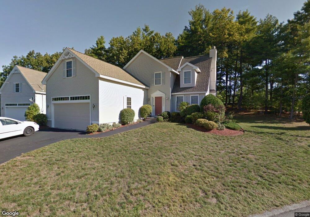
3 Heathrow Ct Unit U452 Nashua, NH 03063
Northwest Nashua NeighborhoodEstimated Value: $564,332 - $661,000
3
Beds
2
Baths
1,788
Sq Ft
$331/Sq Ft
Est. Value
About This Home
This home is located at 3 Heathrow Ct Unit U452, Nashua, NH 03063 and is currently estimated at $592,583, approximately $331 per square foot. 3 Heathrow Ct Unit U452 is a home located in Hillsborough County with nearby schools including Broad Street Elementary School, Pennichuck Middle School, and Nashua High School North.
Ownership History
Date
Name
Owned For
Owner Type
Purchase Details
Closed on
Jul 16, 2025
Sold by
Magee Erin K
Bought by
Erin K Magee Ret and Magee
Current Estimated Value
Purchase Details
Closed on
Apr 28, 2011
Sold by
Lockwood Joanne S
Bought by
Magee Erin K
Home Financials for this Owner
Home Financials are based on the most recent Mortgage that was taken out on this home.
Original Mortgage
$234,300
Interest Rate
4.82%
Mortgage Type
Unknown
Create a Home Valuation Report for This Property
The Home Valuation Report is an in-depth analysis detailing your home's value as well as a comparison with similar homes in the area
Home Values in the Area
Average Home Value in this Area
Purchase History
| Date | Buyer | Sale Price | Title Company |
|---|---|---|---|
| Erin K Magee Ret | -- | -- | |
| Erin K Magee Ret | -- | -- | |
| Magee Erin K | $293,500 | -- | |
| Magee Erin K | $293,500 | -- |
Source: Public Records
Mortgage History
| Date | Status | Borrower | Loan Amount |
|---|---|---|---|
| Previous Owner | Magee Erin K | $200,000 | |
| Previous Owner | Magee Erin K | $234,300 | |
| Previous Owner | Magee Erin K | $234,300 |
Source: Public Records
Tax History Compared to Growth
Tax History
| Year | Tax Paid | Tax Assessment Tax Assessment Total Assessment is a certain percentage of the fair market value that is determined by local assessors to be the total taxable value of land and additions on the property. | Land | Improvement |
|---|---|---|---|---|
| 2024 | $8,462 | $532,200 | $0 | $532,200 |
| 2023 | $8,016 | $439,700 | $0 | $439,700 |
| 2022 | $7,945 | $439,700 | $0 | $439,700 |
| 2021 | $8,018 | $345,300 | $0 | $345,300 |
| 2020 | $7,807 | $345,300 | $0 | $345,300 |
| 2019 | $7,514 | $345,300 | $0 | $345,300 |
| 2018 | $7,324 | $345,300 | $0 | $345,300 |
| 2017 | $6,981 | $270,700 | $0 | $270,700 |
| 2016 | $6,786 | $270,700 | $0 | $270,700 |
| 2015 | $6,640 | $270,700 | $0 | $270,700 |
| 2014 | $6,510 | $270,700 | $0 | $270,700 |
Source: Public Records
Map
Nearby Homes
- 26 Andover Down Unit 276
- 38 Highbridge Hill Rd Unit 186
- 66 Tinker Rd
- 5 Dumaine Ave Unit B
- 5 Dumaine Ave Unit N
- 75 Deerwood Dr Unit B
- 218 Millwright Dr Unit 218
- 77 Deerwood Dr Unit E
- 201 Millwright Dr
- 2 New Haven Dr Unit E303
- 3 Roedean Dr Unit C-207
- 123 Cannongate III
- 47 Hanna Cir Unit 47
- 47 Hanna Cir
- 58 Profile Cir
- 74 Profile Cir
- 9 Cambridge Dr
- 18 Swift Ln
- 40 Merrimack Dr
- 28 Merrimack Dr
- 5 Heathrow Ct Unit U451
- 8 Castlegate Way Unit U457
- 10 Castlegate Way Unit U453
- 7 Heathrow Ct Unit U450
- 5 Glencliff Way Unit U483
- 3 Castlegate Way Unit U459
- 10 Heathrow Ct Unit U447
- 7 Glencliff Way Unit U482
- 9 Heathrow Ct Unit U448
- 3 Glencliff Way Unit U484
- 3 Glencliff Way Unit 3
- 7 Castlegate Way Unit U456
- 4 Ascot Park Unit U485
- 11 Heathrow Ct Unit U446
- 9 Glencliff Way Unit U481
- 20 Heathrow Ct Unit U444
- 5 Castlegate Way Unit U458
- 6 Ascot Park Unit U486
- 11 Glencliff Way Unit U480
- 16 Glencliff Way Unit U460