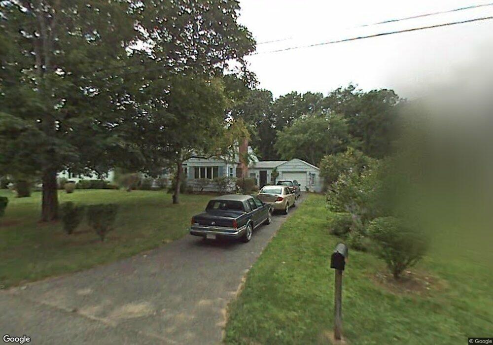
3 Leemond St Wilbraham, MA 01095
Estimated Value: $474,667 - $598,000
3
Beds
2
Baths
1,771
Sq Ft
$293/Sq Ft
Est. Value
About This Home
This home is located at 3 Leemond St, Wilbraham, MA 01095 and is currently estimated at $519,417, approximately $293 per square foot. 3 Leemond St is a home located in Hampden County with nearby schools including Minnechaug Regional High School, Springfield International Charter School, and Wilbraham & Monson Academy.
Ownership History
Date
Name
Owned For
Owner Type
Purchase Details
Closed on
Sep 23, 2022
Sold by
Post Susan J and Post John B
Bought by
Post Susan J
Current Estimated Value
Home Financials for this Owner
Home Financials are based on the most recent Mortgage that was taken out on this home.
Original Mortgage
$148,000
Outstanding Balance
$141,057
Interest Rate
5.13%
Mortgage Type
New Conventional
Estimated Equity
$378,360
Purchase Details
Closed on
Jul 3, 2009
Sold by
Post Jenine A
Bought by
Post Susan J and Post John B
Create a Home Valuation Report for This Property
The Home Valuation Report is an in-depth analysis detailing your home's value as well as a comparison with similar homes in the area
Home Values in the Area
Average Home Value in this Area
Purchase History
| Date | Buyer | Sale Price | Title Company |
|---|---|---|---|
| Post Susan J | -- | None Available | |
| Post Susan J | -- | None Available | |
| Post Susan J | -- | -- | |
| Post Susan J | -- | -- |
Source: Public Records
Mortgage History
| Date | Status | Borrower | Loan Amount |
|---|---|---|---|
| Open | Post Susan J | $148,000 | |
| Closed | Post Susan J | $148,000 | |
| Previous Owner | Post Susan J | $7,625 | |
| Previous Owner | Post Susan J | $10,000 |
Source: Public Records
Tax History Compared to Growth
Tax History
| Year | Tax Paid | Tax Assessment Tax Assessment Total Assessment is a certain percentage of the fair market value that is determined by local assessors to be the total taxable value of land and additions on the property. | Land | Improvement |
|---|---|---|---|---|
| 2025 | $7,588 | $424,400 | $96,600 | $327,800 |
| 2024 | $7,407 | $400,400 | $96,600 | $303,800 |
| 2023 | $65 | $370,000 | $96,600 | $273,400 |
| 2022 | $6,547 | $319,500 | $96,600 | $222,900 |
| 2021 | $6,107 | $266,000 | $103,700 | $162,300 |
| 2020 | $5,953 | $266,000 | $103,700 | $162,300 |
| 2019 | $5,801 | $266,100 | $103,700 | $162,400 |
| 2018 | $5,447 | $240,600 | $103,700 | $136,900 |
| 2017 | $5,293 | $240,600 | $103,700 | $136,900 |
| 2016 | $5,130 | $237,500 | $115,300 | $122,200 |
| 2015 | $4,959 | $237,500 | $115,300 | $122,200 |
Source: Public Records
Map
Nearby Homes
- 28 Decorie Dr
- 2 Bayberry Dr Unit 51
- 79 High Pine Cir
- 69 High Pine Cir
- 8 Patriot Ridge Ln
- 54 High Pine Cir
- 20 Old Orchard Rd
- 35 Lake Dr
- 46 Washington Rd
- 4 Hillcrest Dr
- 2 Vista Rd
- 6 Teak Terrace Unit 24
- 474 Mountain Rd
- 99 Sandalwood Dr Unit site 00
- 103 Sandalwood Dr Unit site 00
- 57 Sandalwood Dr Unit site 61
- 111 Sandalwood Dr Unit site 00
- 474-480 Mountain Rd
- 10 Forest Glade Dr
- 19 Linwood Dr