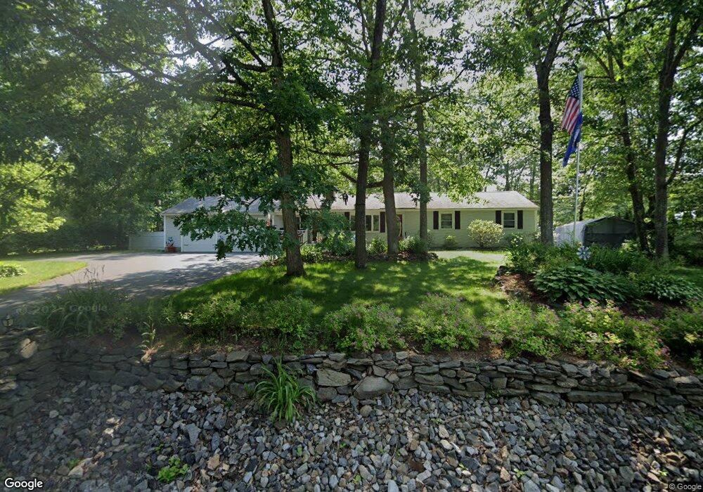
3 Mike Ln Litchfield, NH 03052
Estimated Value: $541,139 - $614,000
3
Beds
2
Baths
2,429
Sq Ft
$233/Sq Ft
Est. Value
About This Home
This home is located at 3 Mike Ln, Litchfield, NH 03052 and is currently estimated at $566,785, approximately $233 per square foot. 3 Mike Ln is a home with nearby schools including Griffin Memorial School and St. Francis of Assisi School.
Ownership History
Date
Name
Owned For
Owner Type
Purchase Details
Closed on
Apr 24, 2024
Sold by
Simard George E and Simard Doris A
Bought by
Simard Ft and Simard
Current Estimated Value
Create a Home Valuation Report for This Property
The Home Valuation Report is an in-depth analysis detailing your home's value as well as a comparison with similar homes in the area
Home Values in the Area
Average Home Value in this Area
Purchase History
| Date | Buyer | Sale Price | Title Company |
|---|---|---|---|
| Simard Ft | -- | None Available | |
| Simard Ft | -- | None Available |
Source: Public Records
Tax History Compared to Growth
Tax History
| Year | Tax Paid | Tax Assessment Tax Assessment Total Assessment is a certain percentage of the fair market value that is determined by local assessors to be the total taxable value of land and additions on the property. | Land | Improvement |
|---|---|---|---|---|
| 2024 | $7,267 | $349,700 | $154,700 | $195,000 |
| 2023 | $7,289 | $348,100 | $154,700 | $193,400 |
| 2022 | $6,624 | $348,100 | $154,700 | $193,400 |
| 2021 | $6,419 | $348,100 | $154,700 | $193,400 |
| 2020 | $6,473 | $348,400 | $154,700 | $193,700 |
| 2019 | $6,849 | $289,600 | $123,300 | $166,300 |
| 2017 | $7,868 | $289,000 | $123,300 | $165,700 |
| 2016 | $6,242 | $289,000 | $123,300 | $165,700 |
| 2015 | $5,890 | $289,000 | $123,300 | $165,700 |
| 2014 | $5,059 | $244,400 | $127,100 | $117,300 |
| 2013 | $5,017 | $243,900 | $127,100 | $116,800 |
Source: Public Records
Map
Nearby Homes
- 25 Chatfield Dr
- 31 Garden Dr
- 490 Charles Bancroft Hwy
- 1 Tallarico St Unit 14
- 0 Tallarico St Unit 3 5032471
- 0 Tallarico St Unit 5 5032751
- 0 Tallarico St Unit 26
- 0 Tallarico St Unit 10 5044310
- 0 Tallarico St Unit 12 5033131
- 0 Tallarico St Unit Lot 11 5056385
- 1 Pleasant St
- 9 Mustang Dr Unit C
- 9 Mustang Dr Unit B
- 7 Mustang Dr Unit C
- 7 Mustang Dr Unit END UNIT-A
- 3-C Mustang Dr Unit MODEL
- 11 Essex Green Ct
- 10 Kingston Ct Unit 10
- 22 Essex Green Ct
- 12 Clinton Ct