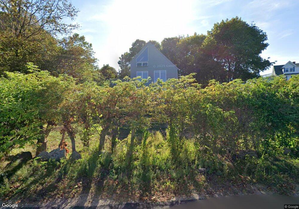
3 Nautilus Rd Gloucester, MA 01930
East Gloucester NeighborhoodEstimated Value: $781,000 - $1,982,292
2
Beds
2
Baths
1,087
Sq Ft
$1,297/Sq Ft
Est. Value
About This Home
This home is located at 3 Nautilus Rd, Gloucester, MA 01930 and is currently estimated at $1,409,764, approximately $1,296 per square foot. 3 Nautilus Rd is a home located in Essex County with nearby schools including East Gloucester Elementary School, Ralph B O'maley Middle School, and Gloucester High School.
Ownership History
Date
Name
Owned For
Owner Type
Purchase Details
Closed on
Feb 27, 2020
Sold by
Graham Patricia A
Bought by
Graham Ft
Current Estimated Value
Purchase Details
Closed on
Nov 15, 2001
Sold by
Ivy Douglas Ft
Bought by
Bogart Paul R and Bogart Edward J
Home Financials for this Owner
Home Financials are based on the most recent Mortgage that was taken out on this home.
Original Mortgage
$240,000
Interest Rate
6.7%
Mortgage Type
Purchase Money Mortgage
Purchase Details
Closed on
Jan 1, 1973
Bought by
Graham Robert E and Graham Patricia A
Create a Home Valuation Report for This Property
The Home Valuation Report is an in-depth analysis detailing your home's value as well as a comparison with similar homes in the area
Home Values in the Area
Average Home Value in this Area
Purchase History
| Date | Buyer | Sale Price | Title Company |
|---|---|---|---|
| Graham Ft | -- | None Available | |
| Bogart Paul R | $300,000 | -- | |
| Graham Robert E | -- | -- |
Source: Public Records
Mortgage History
| Date | Status | Borrower | Loan Amount |
|---|---|---|---|
| Previous Owner | Graham Robert E | $240,000 | |
| Previous Owner | Graham Robert E | $40,000 | |
| Previous Owner | Graham Robert E | $85,000 |
Source: Public Records
Tax History
| Year | Tax Paid | Tax Assessment Tax Assessment Total Assessment is a certain percentage of the fair market value that is determined by local assessors to be the total taxable value of land and additions on the property. | Land | Improvement |
|---|---|---|---|---|
| 2025 | $19,685 | $2,025,200 | $1,626,100 | $399,100 |
| 2024 | $18,229 | $1,873,500 | $1,505,200 | $368,300 |
| 2023 | $16,875 | $1,593,500 | $1,285,100 | $308,400 |
| 2022 | $16,261 | $1,386,300 | $1,117,400 | $268,900 |
| 2021 | $13,332 | $1,071,700 | $827,000 | $244,700 |
| 2020 | $13,250 | $1,074,600 | $827,000 | $247,600 |
| 2019 | $13,139 | $1,035,400 | $788,500 | $246,900 |
| 2018 | $11,129 | $860,700 | $647,600 | $213,100 |
| 2017 | $10,944 | $829,700 | $616,600 | $213,100 |
| 2016 | $10,633 | $781,300 | $590,100 | $191,200 |
| 2015 | $10,306 | $755,000 | $576,700 | $178,300 |
Source: Public Records
Map
Nearby Homes
- 70 Bass Ave
- 26 Marina Dr
- 3 Mondello Square
- 78 Thatcher Rd Unit 6
- 11 Wall St Unit R
- 36 Eastern Ave
- 25 Salt Island Rd
- 32 Witham St Unit B
- 197 E Main St Unit 1
- 21 Marble Rd
- 23 Mount Vernon St
- 14R Spring St Unit 3
- 10 Seaview Rd
- 60 Rocky Neck Ave Unit 202
- 73 Rocky Neck Ave Unit 2
- 50 Warner St
- 191 Main St Unit 3
- 191 Main St Unit 2A
- 1 Wonson St
- 113 Pleasant St
Your Personal Tour Guide
Ask me questions while you tour the home.