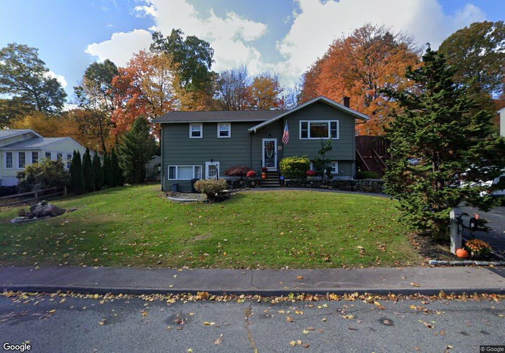
3 Trinity Dr Milford, MA 01757
Estimated Value: $569,169 - $626,000
3
Beds
3
Baths
2,284
Sq Ft
$263/Sq Ft
Est. Value
About This Home
This home is located at 3 Trinity Dr, Milford, MA 01757 and is currently estimated at $600,292, approximately $262 per square foot. 3 Trinity Dr is a home located in Worcester County with nearby schools including Milford High School and Mendon Mennonite School.
Ownership History
Date
Name
Owned For
Owner Type
Purchase Details
Closed on
Mar 2, 2018
Sold by
Atchue Dana W and Atchue Innocenza
Bought by
Atchue Innocenza
Current Estimated Value
Purchase Details
Closed on
Sep 16, 2003
Sold by
Atchue Dana W and Agresta Innocenza
Bought by
Atchue Dana W and Atchue Innocenza
Purchase Details
Closed on
May 1, 1996
Sold by
Tumolo Angela
Bought by
Atchue Dana and Agresta Innocenza
Home Financials for this Owner
Home Financials are based on the most recent Mortgage that was taken out on this home.
Original Mortgage
$112,000
Interest Rate
7.82%
Mortgage Type
Purchase Money Mortgage
Purchase Details
Closed on
Apr 1, 1991
Sold by
Tomlin Samuel
Bought by
Tumolo Angela
Home Financials for this Owner
Home Financials are based on the most recent Mortgage that was taken out on this home.
Original Mortgage
$100,000
Interest Rate
9.17%
Mortgage Type
Purchase Money Mortgage
Create a Home Valuation Report for This Property
The Home Valuation Report is an in-depth analysis detailing your home's value as well as a comparison with similar homes in the area
Home Values in the Area
Average Home Value in this Area
Purchase History
| Date | Buyer | Sale Price | Title Company |
|---|---|---|---|
| Atchue Innocenza | -- | -- | |
| Atchue Dana W | -- | -- | |
| Atchue Dana | $140,000 | -- | |
| Tumolo Angela | $127,500 | -- |
Source: Public Records
Mortgage History
| Date | Status | Borrower | Loan Amount |
|---|---|---|---|
| Previous Owner | Tumolo Angela | $112,000 | |
| Previous Owner | Tumolo Angela | $100,000 | |
| Previous Owner | Tumolo Angela | $100,000 | |
| Previous Owner | Tumolo Angela | $114,400 |
Source: Public Records
Tax History
| Year | Tax Paid | Tax Assessment Tax Assessment Total Assessment is a certain percentage of the fair market value that is determined by local assessors to be the total taxable value of land and additions on the property. | Land | Improvement |
|---|---|---|---|---|
| 2025 | $6,194 | $483,900 | $181,500 | $302,400 |
| 2024 | $6,012 | $452,400 | $174,200 | $278,200 |
| 2023 | $5,608 | $388,100 | $145,200 | $242,900 |
| 2022 | $5,363 | $348,500 | $134,300 | $214,200 |
| 2021 | $5,313 | $332,500 | $134,300 | $198,200 |
| 2020 | $5,174 | $324,200 | $134,300 | $189,900 |
| 2019 | $4,770 | $288,400 | $134,300 | $154,100 |
| 2018 | $4,562 | $275,500 | $128,900 | $146,600 |
| 2017 | $4,433 | $264,000 | $128,900 | $135,100 |
| 2016 | $4,268 | $248,400 | $128,900 | $119,500 |
| 2015 | $4,165 | $237,300 | $123,400 | $113,900 |
Source: Public Records
Map
Nearby Homes
- 10 Yale Dr
- 20 Cornell Dr
- 8 Bandy Ln
- 14 C Country Club Ln
- 3 Fordham Dr
- 37 Godfrey Ln
- 14 Country Club Ln Unit C
- 11 Country Club Ln Unit D
- 8 Country Club Ln Unit B
- 9 Packard Rd
- 0 West St
- 11 Deluca Rd
- 130 Purchase St
- 59 Lawrence St
- 9 Robin Rd
- 2 Lee St Unit B
- 44 Silver Hill Rd
- 14 Lawrence St
- 2 Northrop St
- 4 Kennedy Ln Unit 47
Your Personal Tour Guide
Ask me questions while you tour the home.