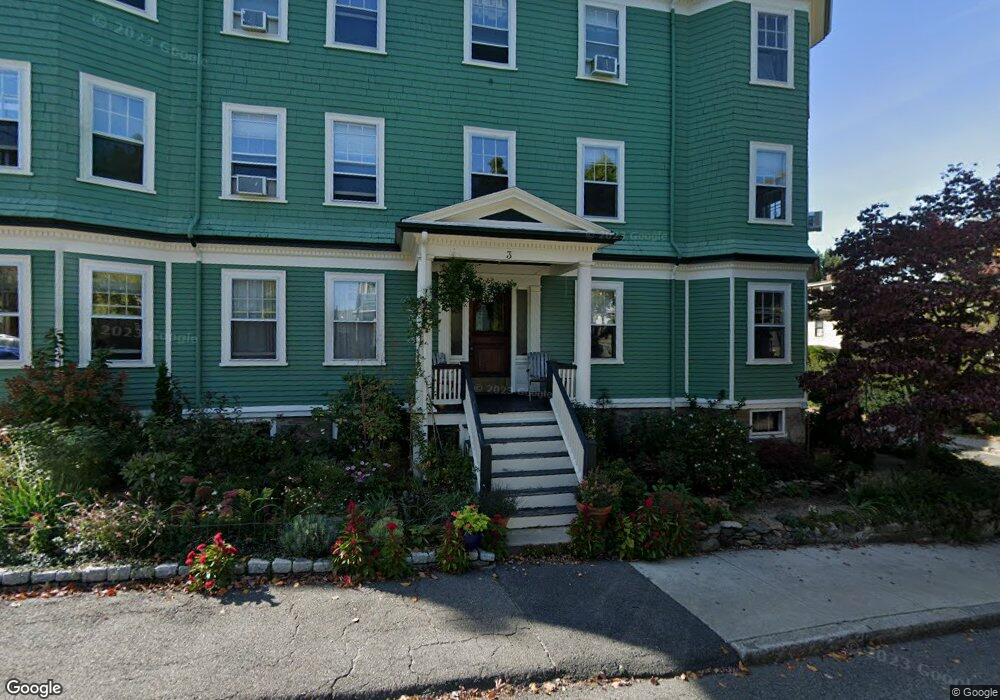
3 Upland Rd Unit 1 Brookline, MA 02445
Brookline Village NeighborhoodEstimated Value: $998,000 - $1,294,000
4
Beds
2
Baths
1,655
Sq Ft
$670/Sq Ft
Est. Value
About This Home
This home is located at 3 Upland Rd Unit 1, Brookline, MA 02445 and is currently estimated at $1,108,560, approximately $669 per square foot. 3 Upland Rd Unit 1 is a home located in Norfolk County with nearby schools including William H. Lincoln School, Brookline High School, and Roxbury Preparatory Charter School.
Ownership History
Date
Name
Owned For
Owner Type
Purchase Details
Closed on
Oct 3, 2025
Sold by
Ennis Reita
Bought by
Reita C Ennis Irt and Adams
Current Estimated Value
Purchase Details
Closed on
Jun 30, 1994
Sold by
Reese Anita M
Bought by
Ennis Philip H
Home Financials for this Owner
Home Financials are based on the most recent Mortgage that was taken out on this home.
Original Mortgage
$100,000
Interest Rate
8.55%
Mortgage Type
Purchase Money Mortgage
Create a Home Valuation Report for This Property
The Home Valuation Report is an in-depth analysis detailing your home's value as well as a comparison with similar homes in the area
Home Values in the Area
Average Home Value in this Area
Purchase History
| Date | Buyer | Sale Price | Title Company |
|---|---|---|---|
| Reita C Ennis Irt | -- | -- | |
| Ennis Philip H | $230,000 | -- | |
| Ennis Philip H | $230,000 | -- |
Source: Public Records
Mortgage History
| Date | Status | Borrower | Loan Amount |
|---|---|---|---|
| Previous Owner | Ennis Philip H | $100,000 |
Source: Public Records
Tax History
| Year | Tax Paid | Tax Assessment Tax Assessment Total Assessment is a certain percentage of the fair market value that is determined by local assessors to be the total taxable value of land and additions on the property. | Land | Improvement |
|---|---|---|---|---|
| 2025 | $9,822 | $995,100 | $0 | $995,100 |
| 2024 | $9,532 | $975,600 | $0 | $975,600 |
| 2023 | $8,932 | $895,900 | $0 | $895,900 |
| 2022 | $8,864 | $869,900 | $0 | $869,900 |
| 2021 | $8,441 | $861,300 | $0 | $861,300 |
| 2020 | $8,059 | $852,800 | $0 | $852,800 |
| 2019 | $7,610 | $812,200 | $0 | $812,200 |
| 2018 | $7,317 | $773,500 | $0 | $773,500 |
| 2017 | $7,076 | $716,200 | $0 | $716,200 |
| 2016 | $6,784 | $651,100 | $0 | $651,100 |
| 2015 | $6,321 | $591,900 | $0 | $591,900 |
| 2014 | $6,354 | $557,900 | $0 | $557,900 |
Source: Public Records
Map
Nearby Homes
- 3 Upland Rd Unit 2
- 75-83 Boylston St Unit R3
- 69 Walnut St Unit 2
- 69 Walnut St Unit 1
- 38 Juniper St Unit 108
- 8 Leverett St Unit 3
- 6 Juniper St Unit 16
- 99 Pond Ave Unit 409
- 99 Pond Ave Unit 608
- 12 Thayer St
- 44 Washington St Unit 505
- 33 Pond Ave Unit 603
- 33 Pond Ave Unit 1106
- 236 Walnut St
- 77 Pond Ave Unit 1103
- 77 Pond Ave Unit 1506
- 77 Pond Ave Unit 401
- 77 Pond Ave Unit 1009
- 77 Pond Ave Unit 805
- 12 Goodwin Place Unit 12-1
- 3 Upland Rd
- 148 Walnut St
- 9 Upland Rd
- 150 Walnut St Unit 1
- 150 Walnut St Unit 3
- 150 Walnut St Unit 2
- 150 Walnut St Unit 2 150
- 4 Upland Rd Unit 2
- 4 Upland Rd Unit 1
- 4 Upland Rd Unit 2,4
- 8 Upland Rd Unit 2
- 8 Upland Rd Unit 1
- 8 Upland Rd Unit 5
- 8 Upland Rd
- 6 Irving St
- 133 Walnut St Unit 1
- 137 Walnut St
- 137 Walnut St Unit 3
- 137 Walnut St Unit 2
- 137 Walnut St Unit 1
Your Personal Tour Guide
Ask me questions while you tour the home.