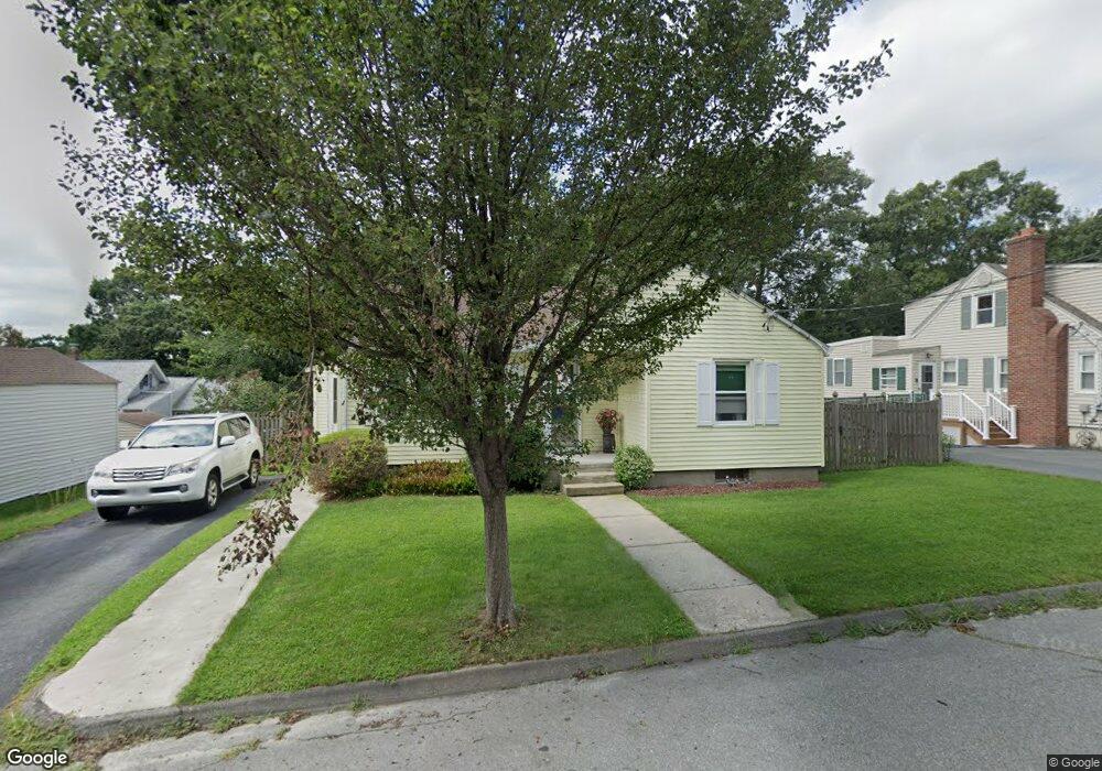
3 Woodridge Rd Worcester, MA 01606
Greendale NeighborhoodEstimated Value: $359,000 - $388,713
2
Beds
1
Bath
1,064
Sq Ft
$349/Sq Ft
Est. Value
About This Home
This home is located at 3 Woodridge Rd, Worcester, MA 01606 and is currently estimated at $371,178, approximately $348 per square foot. 3 Woodridge Rd is a home located in Worcester County with nearby schools including Jacob Hiatt Magnet School, Chandler Magnet, and Thorndyke Road School.
Ownership History
Date
Name
Owned For
Owner Type
Purchase Details
Closed on
Dec 28, 1999
Sold by
Canavan Clifford and Canavan Kristie L
Bought by
Marculitis Cynthia A
Current Estimated Value
Purchase Details
Closed on
May 30, 1997
Sold by
Kilcoyne Peter F and Kilcoyne Maureen L
Bought by
Canavan Cilfford and Widberg Kristi L
Purchase Details
Closed on
Sep 27, 1989
Sold by
Maloof Philip
Bought by
Kilcoyne Peter
Create a Home Valuation Report for This Property
The Home Valuation Report is an in-depth analysis detailing your home's value as well as a comparison with similar homes in the area
Home Values in the Area
Average Home Value in this Area
Purchase History
| Date | Buyer | Sale Price | Title Company |
|---|---|---|---|
| Marculitis Cynthia A | $114,900 | -- | |
| Canavan Cilfford | $80,000 | -- | |
| Kilcoyne Peter | $109,500 | -- |
Source: Public Records
Mortgage History
| Date | Status | Borrower | Loan Amount |
|---|---|---|---|
| Open | Kilcoyne Peter | $114,000 | |
| Open | Kilcoyne Peter | $219,000 |
Source: Public Records
Tax History Compared to Growth
Tax History
| Year | Tax Paid | Tax Assessment Tax Assessment Total Assessment is a certain percentage of the fair market value that is determined by local assessors to be the total taxable value of land and additions on the property. | Land | Improvement |
|---|---|---|---|---|
| 2025 | $4,109 | $311,500 | $115,600 | $195,900 |
| 2024 | $4,043 | $294,000 | $115,600 | $178,400 |
| 2023 | $4,035 | $281,400 | $100,500 | $180,900 |
| 2022 | $3,568 | $234,600 | $80,400 | $154,200 |
| 2021 | $3,419 | $210,000 | $64,300 | $145,700 |
| 2020 | $3,298 | $194,000 | $64,300 | $129,700 |
| 2019 | $3,103 | $172,400 | $57,800 | $114,600 |
| 2018 | $3,024 | $159,900 | $57,800 | $102,100 |
| 2017 | $3,052 | $158,800 | $57,800 | $101,000 |
| 2016 | $2,941 | $142,700 | $42,400 | $100,300 |
| 2015 | $2,864 | $142,700 | $42,400 | $100,300 |
| 2014 | $2,788 | $142,700 | $42,400 | $100,300 |
Source: Public Records
Map
Nearby Homes
- 18 Claffey Ave
- 3 Granville Ave
- 134 Whitmarsh Ave
- 40 Francis St
- 34 King Philip Rd
- 314 Burncoat St
- 14 Fales St
- 43 Fales St
- 48 Wilkinson St
- 28 Brooks St
- 15 Ericsson St
- 80 Clark St
- 14 Mary Ann Dr
- 113 Bay State Rd
- 29 E Mountain
- 120 Bay State Rd
- 15 Inwood Rd
- 14 Housatonic St
- 68 Housatonic St
- 126 Brooks St
- 5 Woodridge Rd
- 95 Kendrick Ave
- 91 Kendrick Ave
- 4 Cheshire Rd
- 6 Cheshire Rd
- 87 Kendrick Ave
- 87 Kendrick Ave Unit 87
- 7 Woodridge Rd
- 105 Kendrick Ave
- 8 Cheshire Rd
- 4 Woodridge Rd
- 6 Woodridge Rd
- 8 Woodridge Rd
- 9 Woodridge Rd
- 10 Cheshire Rd
- 109 Kendrick Ave
- 10 Woodridge Rd
- 94 Kendrick Ave
- 71 Kendrick Ave
- 90 Kendrick Ave