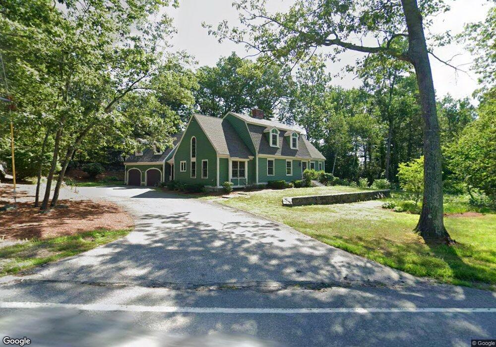
30 Bush Hill Rd Pelham, NH 03076
Estimated Value: $760,980 - $898,000
4
Beds
3
Baths
2,976
Sq Ft
$284/Sq Ft
Est. Value
About This Home
This home is located at 30 Bush Hill Rd, Pelham, NH 03076 and is currently estimated at $844,245, approximately $283 per square foot. 30 Bush Hill Rd is a home with nearby schools including Pelham Elementary School, Pelham Memorial School, and Pelham High School.
Ownership History
Date
Name
Owned For
Owner Type
Purchase Details
Closed on
Oct 4, 2000
Sold by
Miocchi Dennis P and Miocchi Cynthia M
Bought by
Palome Elaine M
Current Estimated Value
Home Financials for this Owner
Home Financials are based on the most recent Mortgage that was taken out on this home.
Original Mortgage
$252,700
Interest Rate
7.96%
Create a Home Valuation Report for This Property
The Home Valuation Report is an in-depth analysis detailing your home's value as well as a comparison with similar homes in the area
Home Values in the Area
Average Home Value in this Area
Purchase History
| Date | Buyer | Sale Price | Title Company |
|---|---|---|---|
| Palome Elaine M | $325,000 | -- |
Source: Public Records
Mortgage History
| Date | Status | Borrower | Loan Amount |
|---|---|---|---|
| Open | Palome Elaine M | $231,800 | |
| Closed | Palome Elaine M | $252,700 |
Source: Public Records
Tax History Compared to Growth
Tax History
| Year | Tax Paid | Tax Assessment Tax Assessment Total Assessment is a certain percentage of the fair market value that is determined by local assessors to be the total taxable value of land and additions on the property. | Land | Improvement |
|---|---|---|---|---|
| 2024 | $11,253 | $613,600 | $152,300 | $461,300 |
| 2023 | $11,161 | $613,600 | $152,300 | $461,300 |
| 2022 | $10,689 | $613,600 | $152,300 | $461,300 |
| 2021 | $9,793 | $613,600 | $152,300 | $461,300 |
| 2020 | $9,351 | $462,900 | $121,800 | $341,100 |
| 2019 | $8,608 | $443,700 | $121,800 | $321,900 |
| 2018 | $8,601 | $400,800 | $121,800 | $279,000 |
| 2017 | $8,597 | $400,800 | $121,800 | $279,000 |
| 2016 | $8,397 | $400,800 | $121,800 | $279,000 |
| 2015 | $8,334 | $358,300 | $115,600 | $242,700 |
| 2014 | $8,194 | $358,300 | $115,600 | $242,700 |
| 2013 | $8,194 | $358,300 | $115,600 | $242,700 |
Source: Public Records
Map
Nearby Homes
- 10 Oakland Ridge Rd Unit 11
- 446 Mammoth Rd
- 436 Mammoth Rd
- 19 Melissa Cir
- 5 Stephanie Dr
- 118 Jeremy Hill Rd
- 290 Mammoth Rd
- 11 Windsor Ln Unit B
- 14 Lincoln St
- 38 Settlers Way
- Lot 6 Carmel Rd
- 11 Brown Ave
- 1 Redwood Rd
- 10 Dutton Rd
- 2 Fletcher Dr
- 9 Cornstalk Ln
- 73 Mammoth Rd Unit A&B
- 73 Mammoth Rd
- 73 A&B Mammoth Rd
- 78 Gowing Rd