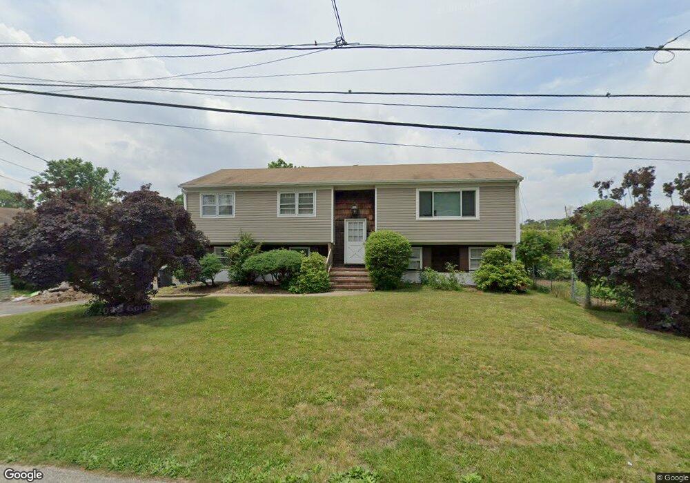
30 Cedar Tree Ln Toms River, NJ 08753
Estimated Value: $432,000 - $599,000
3
Beds
2
Baths
1,951
Sq Ft
$270/Sq Ft
Est. Value
About This Home
This home is located at 30 Cedar Tree Ln, Toms River, NJ 08753 and is currently estimated at $526,627, approximately $269 per square foot. 30 Cedar Tree Ln is a home located in Ocean County.
Ownership History
Date
Name
Owned For
Owner Type
Purchase Details
Closed on
Feb 28, 2018
Sold by
Huff Roy J
Bought by
Huff Daniel Everett and Huff Roy John
Current Estimated Value
Home Financials for this Owner
Home Financials are based on the most recent Mortgage that was taken out on this home.
Original Mortgage
$203,250
Outstanding Balance
$174,661
Interest Rate
4.5%
Mortgage Type
FHA
Estimated Equity
$351,966
Purchase Details
Closed on
Feb 10, 2012
Sold by
Huff Roy J
Bought by
Huff Roy J
Home Financials for this Owner
Home Financials are based on the most recent Mortgage that was taken out on this home.
Original Mortgage
$85,700
Interest Rate
3.93%
Mortgage Type
New Conventional
Purchase Details
Closed on
Feb 16, 1996
Sold by
Sammut Arthur
Bought by
Huff Roy and Huff Beth
Home Financials for this Owner
Home Financials are based on the most recent Mortgage that was taken out on this home.
Original Mortgage
$120,000
Interest Rate
7.02%
Create a Home Valuation Report for This Property
The Home Valuation Report is an in-depth analysis detailing your home's value as well as a comparison with similar homes in the area
Home Values in the Area
Average Home Value in this Area
Purchase History
| Date | Buyer | Sale Price | Title Company |
|---|---|---|---|
| Huff Daniel Everett | -- | -- | |
| Huff Roy J | -- | Stewart Title Guaranty Co | |
| Huff Roy | $127,000 | -- |
Source: Public Records
Mortgage History
| Date | Status | Borrower | Loan Amount |
|---|---|---|---|
| Open | Huff Daniel Everett | $203,250 | |
| Closed | Huff Roy J | $85,700 | |
| Closed | Huff Roy | $120,000 |
Source: Public Records
Tax History Compared to Growth
Tax History
| Year | Tax Paid | Tax Assessment Tax Assessment Total Assessment is a certain percentage of the fair market value that is determined by local assessors to be the total taxable value of land and additions on the property. | Land | Improvement |
|---|---|---|---|---|
| 2025 | $6,107 | $335,200 | $118,000 | $217,200 |
| 2024 | $5,802 | $335,200 | $118,000 | $217,200 |
| 2023 | $5,591 | $335,200 | $118,000 | $217,200 |
| 2022 | $5,591 | $335,200 | $118,000 | $217,200 |
| 2021 | $4,999 | $200,100 | $81,000 | $119,100 |
| 2020 | $4,976 | $200,100 | $81,000 | $119,100 |
| 2019 | $4,760 | $200,100 | $81,000 | $119,100 |
| 2018 | $4,712 | $200,100 | $81,000 | $119,100 |
| 2017 | $4,680 | $200,100 | $81,000 | $119,100 |
| 2016 | $4,570 | $200,100 | $81,000 | $119,100 |
| 2015 | $4,406 | $200,100 | $81,000 | $119,100 |
| 2014 | $4,188 | $200,100 | $81,000 | $119,100 |
Source: Public Records
Map
Nearby Homes
- 6 Cedar Tree Ln
- 99 Silver Bay Rd
- 2 Cedar Tree Ln
- 133 Mello Ln
- 139 Mello Ln
- 230 Christoffer Terrace
- 1201 Lighthouse Ln Unit 1fm
- 46 Clarkson Dr
- 190 Bay Stream Dr
- 200 Silver Bay Rd
- 72 Shasta Ln
- 193 Bay Stream Dr
- 98 Maine St
- 35 Heather Rd
- 88 Circle Dr
- 92 Blossom Dr
- 231 Bay Stream Dr
- 169 S Shore Dr
- 59 11th St
- 125 Sherwood Ln
- 34 Cedar Tree Ln
- 114 Holly Tree Ln
- 116 Holly Tree Ln
- 113 Silver Bay Rd
- 9 Evergreen Dr
- 15 Evergreen Dr
- 17 Evergreen Dr
- 33 Cedar Tree Ln
- 31 Cedar Tree Ln
- 111 Silver Bay Rd
- 29 Cedar Tree Ln
- 116 Silver Bay Rd
- 25 Cedar Tree Ln
- 11 Evergreen Dr
- 107 Holly Tree Ln
- 23 Cedar Tree Ln
- 131 Silver Bay Rd
- 22 Cedar Tree Ln
- 102 Holly Tree Ln
- 97 Oak Tree Ln