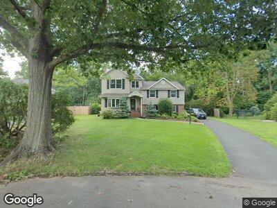
30 Fieldcrest Dr Scotch Plains, NJ 07076
Estimated Value: $731,892 - $1,130,000
--
Bed
--
Bath
1,619
Sq Ft
$611/Sq Ft
Est. Value
About This Home
This home is located at 30 Fieldcrest Dr, Scotch Plains, NJ 07076 and is currently estimated at $989,973, approximately $611 per square foot. 30 Fieldcrest Dr is a home located in Union County with nearby schools including William J. McGinn Elementary School, Terrill Middle School, and Scotch Plains-Fanwood High School.
Ownership History
Date
Name
Owned For
Owner Type
Purchase Details
Closed on
May 29, 2001
Sold by
Digiacomo Thomas A and Digiacomo Ruth A
Bought by
Digiacomo Ruth A
Current Estimated Value
Home Financials for this Owner
Home Financials are based on the most recent Mortgage that was taken out on this home.
Original Mortgage
$270,000
Interest Rate
7.15%
Mortgage Type
Purchase Money Mortgage
Purchase Details
Closed on
Apr 23, 1998
Sold by
Ramos Richard J and Ramos Nikki
Bought by
Digiacomo Thomas A and Digiacomo Ruth A
Home Financials for this Owner
Home Financials are based on the most recent Mortgage that was taken out on this home.
Original Mortgage
$223,920
Interest Rate
7.05%
Create a Home Valuation Report for This Property
The Home Valuation Report is an in-depth analysis detailing your home's value as well as a comparison with similar homes in the area
Home Values in the Area
Average Home Value in this Area
Purchase History
| Date | Buyer | Sale Price | Title Company |
|---|---|---|---|
| Digiacomo Ruth A | -- | -- | |
| Digiacomo Thomas A | $279,900 | -- |
Source: Public Records
Mortgage History
| Date | Status | Borrower | Loan Amount |
|---|---|---|---|
| Open | Giacomo Ruth A Di | $208,000 | |
| Closed | Digiacomo Ruth A | $126,000 | |
| Closed | Digiacomo Ruth A | $270,000 | |
| Closed | Digiacomo Thomas A | $223,920 |
Source: Public Records
Tax History Compared to Growth
Tax History
| Year | Tax Paid | Tax Assessment Tax Assessment Total Assessment is a certain percentage of the fair market value that is determined by local assessors to be the total taxable value of land and additions on the property. | Land | Improvement |
|---|---|---|---|---|
| 2024 | $15,898 | $139,200 | $41,100 | $98,100 |
| 2023 | $15,898 | $139,200 | $41,100 | $98,100 |
| 2022 | $15,709 | $139,200 | $41,100 | $98,100 |
| 2021 | $15,682 | $139,200 | $41,100 | $98,100 |
| 2020 | $15,607 | $139,200 | $41,100 | $98,100 |
| 2019 | $15,492 | $139,200 | $41,100 | $98,100 |
| 2018 | $15,231 | $139,200 | $41,100 | $98,100 |
| 2017 | $14,893 | $139,200 | $41,100 | $98,100 |
| 2016 | $14,606 | $139,200 | $41,100 | $98,100 |
| 2015 | $14,367 | $139,200 | $41,100 | $98,100 |
| 2014 | $13,894 | $139,200 | $41,100 | $98,100 |
Source: Public Records
Map
Nearby Homes
- 2042 W Broad St
- 119 Lamberts Mill Rd
- 770 Austin St
- 731 1st St
- 2221 Elizabeth Ave
- 717 1st St
- 210 Hazel Ave
- 2212 Shady Ln
- 530 Hort St
- 2381 Whittier Ave
- 834 Shackamaxon Dr
- 520 Dorian Ct
- 6 Shady Ln
- 2397 Channing Ave
- 1700 King St
- 23 Beech Ave
- 527 Coleman Place
- 1661 Cooper Rd
- 213 Belvidere Ave
- 56 Rambling Dr
- 30 Fieldcrest Dr
- 32 Fieldcrest Dr
- 28 Fieldcrest Dr
- 34 Fieldcrest Dr
- 26 Fieldcrest Dr
- 24 Fieldcrest Dr
- 29 Fieldcrest Dr
- 36 Fieldcrest Dr
- 1300 Hetfield Ave
- 1306 Hetfield Ave
- 22 Fieldcrest Dr
- 2119 W Broad St
- 2123 W Broad St
- 2129 W Broad St
- 1289 Woodside Rd
- 38 Fieldcrest Dr
- 1314 Hetfield Ave
- 1283 Woodside Rd
- 19 Fieldcrest Dr
- 2135 W Broad St