30 Foreside Common Unit 30 Falmouth, ME 04105
Falmouth Foreside NeighborhoodEstimated Value: $626,211 - $710,000
2
Beds
2
Baths
1,670
Sq Ft
$394/Sq Ft
Est. Value
About This Home
This home is located at 30 Foreside Common Unit 30, Falmouth, ME 04105 and is currently estimated at $657,553, approximately $393 per square foot. 30 Foreside Common Unit 30 is a home located in Cumberland County with nearby schools including Falmouth Middle School, Falmouth High School, and Baxter Academy for Tech & Sciences.
Ownership History
Date
Name
Owned For
Owner Type
Purchase Details
Closed on
Sep 12, 2022
Sold by
Kurkjian Charles R
Bought by
Taylor Barbara S and Taylor Robert G
Current Estimated Value
Home Financials for this Owner
Home Financials are based on the most recent Mortgage that was taken out on this home.
Original Mortgage
$624,000
Outstanding Balance
$603,871
Interest Rate
4.88%
Mortgage Type
Purchase Money Mortgage
Purchase Details
Closed on
Jul 31, 2015
Sold by
Kurkjian T
Bought by
Kurkjian Charles R
Create a Home Valuation Report for This Property
The Home Valuation Report is an in-depth analysis detailing your home's value as well as a comparison with similar homes in the area
Home Values in the Area
Average Home Value in this Area
Purchase History
| Date | Buyer | Sale Price | Title Company |
|---|---|---|---|
| Taylor Barbara S | -- | None Available | |
| Kurkjian Charles R | -- | -- |
Source: Public Records
Mortgage History
| Date | Status | Borrower | Loan Amount |
|---|---|---|---|
| Open | Taylor Barbara S | $624,000 |
Source: Public Records
Tax History Compared to Growth
Tax History
| Year | Tax Paid | Tax Assessment Tax Assessment Total Assessment is a certain percentage of the fair market value that is determined by local assessors to be the total taxable value of land and additions on the property. | Land | Improvement |
|---|---|---|---|---|
| 2023 | $5,672 | $448,700 | $73,300 | $375,400 |
| 2022 | $5,349 | $448,700 | $73,300 | $375,400 |
| 2021 | $5,208 | $298,800 | $116,000 | $182,800 |
| 2020 | $5,095 | $298,800 | $116,000 | $182,800 |
| 2019 | $5,041 | $298,800 | $116,000 | $182,800 |
| 2018 | $4,921 | $298,800 | $116,000 | $182,800 |
| 2017 | $4,667 | $298,800 | $116,000 | $182,800 |
| 2016 | $4,509 | $298,800 | $116,000 | $182,800 |
| 2015 | $4,371 | $298,800 | $116,000 | $182,800 |
| 2014 | -- | $298,800 | $116,000 | $182,800 |
| 2012 | -- | $298,800 | $116,000 | $182,800 |
Source: Public Records
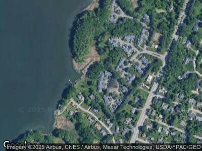
Map
Nearby Homes
- 5 Cobblestone St Unit 53
- 72 Us Route 1
- 56 Carroll St
- 9 Phillips Rd
- 11 Mckinley Rd
- 17 Us Route 1
- 16 U S 1
- 66 Colonial Village
- 1040 Ocean Ave
- 75 Clearwater Dr Unit 305
- 48 Ridge Rd Unit 3
- 42 Wordsworth St
- 8 Joshua Way
- 178 Ridge Rd Unit 26
- 784 Ocean Ave
- 157 Veranda St
- 12 Cleaves Farm Rd
- 121 Providence St
- 17 Wildwood Cir
- 7 Apple Ledge Dr Unit 7A
- 30 Foreside Common Unit 30
- 30 Foreside Common Dr
- 31 Foreside Common Dr
- 31 Foreside Common Rd Unit 31
- 29 Foreside Common Dr
- 32 Foreside Common Rd Unit 32
- 32 Foreside Common Unit 32
- 32 Foreside Common Dr
- 32 Foreside Common Dr Unit 32
- 28 Foreside Common Rd Unit 28
- 28 Foreside Common Dr
- 27 Foreside Common Dr
- 33 Foreside Common Dr
- 26 Foreside Common Dr
- 25 Foreside Common Dr
- 34 Foreside Common
- 34 Foreside Common Dr
- 35 Foreside Common Unit 35
- 35 Foreside Common Dr
- 24 Foreside Common Dr