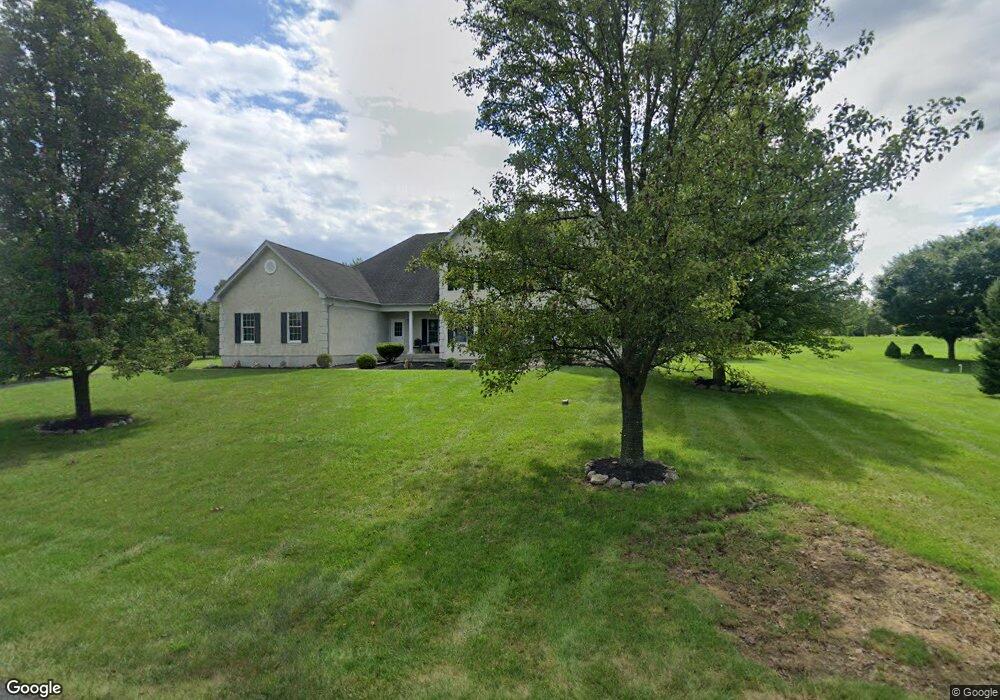
30 Forrest Stand Dr Easton, PA 18042
Estimated Value: $932,000 - $1,035,000
4
Beds
5
Baths
4,734
Sq Ft
$208/Sq Ft
Est. Value
About This Home
This home is located at 30 Forrest Stand Dr, Easton, PA 18042 and is currently estimated at $982,324, approximately $207 per square foot. 30 Forrest Stand Dr is a home located in Northampton County with nearby schools including Wilson Area High School.
Ownership History
Date
Name
Owned For
Owner Type
Purchase Details
Closed on
Sep 30, 2005
Sold by
Toll Pa L P
Bought by
Sesay Abdul K
Current Estimated Value
Home Financials for this Owner
Home Financials are based on the most recent Mortgage that was taken out on this home.
Original Mortgage
$510,223
Outstanding Balance
$272,406
Interest Rate
5.72%
Mortgage Type
New Conventional
Estimated Equity
$709,918
Create a Home Valuation Report for This Property
The Home Valuation Report is an in-depth analysis detailing your home's value as well as a comparison with similar homes in the area
Home Values in the Area
Average Home Value in this Area
Purchase History
| Date | Buyer | Sale Price | Title Company |
|---|---|---|---|
| Sesay Abdul K | $637,779 | -- |
Source: Public Records
Mortgage History
| Date | Status | Borrower | Loan Amount |
|---|---|---|---|
| Open | Sesay Abdul K | $510,223 |
Source: Public Records
Tax History Compared to Growth
Tax History
| Year | Tax Paid | Tax Assessment Tax Assessment Total Assessment is a certain percentage of the fair market value that is determined by local assessors to be the total taxable value of land and additions on the property. | Land | Improvement |
|---|---|---|---|---|
| 2025 | $2,120 | $196,300 | $33,100 | $163,200 |
| 2024 | $14,314 | $196,300 | $33,100 | $163,200 |
| 2023 | $13,858 | $196,300 | $33,100 | $163,200 |
| 2022 | $14,197 | $196,300 | $33,100 | $163,200 |
| 2021 | $14,278 | $196,300 | $33,100 | $163,200 |
| 2020 | $14,278 | $196,300 | $33,100 | $163,200 |
| 2019 | $14,052 | $196,300 | $33,100 | $163,200 |
| 2018 | $13,713 | $196,300 | $33,100 | $163,200 |
| 2017 | $13,373 | $196,300 | $33,100 | $163,200 |
| 2016 | -- | $196,300 | $33,100 | $163,200 |
| 2015 | -- | $196,300 | $33,100 | $163,200 |
| 2014 | -- | $196,300 | $33,100 | $163,200 |
Source: Public Records
Map
Nearby Homes
- 55 Forrest Stand Dr
- 465 Royal Manor Rd Unit LOT 4
- 465 Royal Manor Rd Unit LOT 2
- 465 Royal Manor Rd Unit LOT 7
- 465 Royal Manor Rd
- 325 Raubsville Rd
- 93 Coffeetown Rd
- 135 Coffeetown Rd
- 138 River Rd
- 120 Fox Run
- 60 Melchor Dr
- 410 Bougher Hill Rd
- 26 Manor Rd
- 545 River Rd
- 175 Durham Rd
- 820 Spring Hill Rd
- 596 Carpentersville Rd
- 191 Mount Joy Rd
- 215 Stouts Valley Rd
- 0 Durham Rd Unit 12 Acres
- 20 Forrest Stand Dr
- 35 Forrest Stand Dr
- 40 Forrest Stand Dr
- 25 Forrest Stand Dr
- 45 Forrest Stand Dr
- 10 Forrest Stand Dr
- 45 Longhill Dr
- 50 Forrest Stand Dr
- 55 Longhill Dr
- 95 Woodside Dr
- 95 Woodshire Dr
- 35 Longhill Dr
- 25 Hidden Meadow Dr
- 65 Longhill Dr
- 30 Longhill Dr
- 25 Longhill Dr
- 40 Longhill Dr
- 10 Longhill Dr
- 60 Woodside Dr