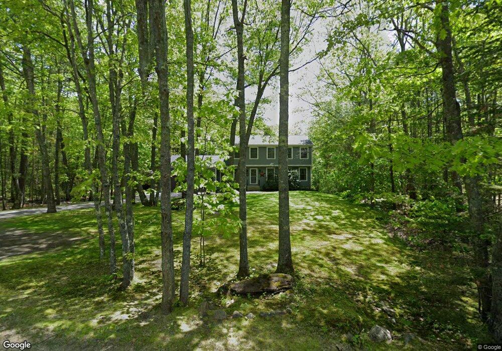
30 Kings Point Rd West Bath, ME 04530
Estimated Value: $492,000 - $676,000
4
Beds
3
Baths
1,890
Sq Ft
$305/Sq Ft
Est. Value
About This Home
This home is located at 30 Kings Point Rd, West Bath, ME 04530 and is currently estimated at $576,179, approximately $304 per square foot. 30 Kings Point Rd is a home located in Sagadahoc County with nearby schools including Morse High School and Hyde School.
Ownership History
Date
Name
Owned For
Owner Type
Purchase Details
Closed on
Aug 27, 2019
Sold by
Underwood Todd R
Bought by
Todd R & P C Underwood Lt and Underwood
Current Estimated Value
Create a Home Valuation Report for This Property
The Home Valuation Report is an in-depth analysis detailing your home's value as well as a comparison with similar homes in the area
Home Values in the Area
Average Home Value in this Area
Purchase History
| Date | Buyer | Sale Price | Title Company |
|---|---|---|---|
| Todd R & P C Underwood Lt | -- | -- | |
| Todd R & P C Underwood Lt | -- | -- |
Source: Public Records
Tax History Compared to Growth
Tax History
| Year | Tax Paid | Tax Assessment Tax Assessment Total Assessment is a certain percentage of the fair market value that is determined by local assessors to be the total taxable value of land and additions on the property. | Land | Improvement |
|---|---|---|---|---|
| 2024 | $3,440 | $419,500 | $109,600 | $309,900 |
| 2023 | $2,853 | $419,500 | $109,600 | $309,900 |
| 2022 | $2,766 | $258,500 | $70,500 | $188,000 |
| 2021 | $2,779 | $264,700 | $76,700 | $188,000 |
| 2020 | $2,779 | $264,700 | $76,700 | $188,000 |
| 2019 | $2,711 | $258,200 | $76,700 | $181,500 |
| 2018 | $2,866 | $258,200 | $76,700 | $181,500 |
| 2017 | $2,892 | $258,200 | $76,700 | $181,500 |
| 2016 | $2,634 | $258,200 | $76,700 | $181,500 |
| 2015 | $2,685 | $258,200 | $76,700 | $181,500 |
| 2014 | $2,634 | $258,200 | $76,700 | $181,500 |
| 2013 | $2,621 | $258,200 | $76,700 | $181,500 |
Source: Public Records
Map
Nearby Homes
- 60 Rosedale Rd
- Lot 27 Howards Point Ln
- Lot 18 Beacon Dr
- Lot 11 Beacon Dr
- Lot 23 Beacon Dr
- 47 Cluf Bay Rd
- 11 Beacon Dr
- 19 Ward Cir
- 31 Beacon Dr
- 38 Ward Cir
- 45 Harding Rd
- 106 Rita Way
- 6 Balsam Ave
- 69 Long St
- 2 Chickadee Cir Unit 2
- 17 James St
- 15 James St
- Lot #13 Tonal Ln
- 42 Guadalcanal St Unit 42
- 11 Neptune Dr
- 22 Kings Point Rd
- 17 Checkerberry Ln
- 33 Kings Point Rd
- 0 Kings Point Rd
- 47 Kings Point Rd
- Lot A Kings Point Rd
- 1 Checkerberry Ln
- Lot 8 Checkerberry Ln
- 16 Checkerberry Ln
- 428 Kings Point Rd
- 17 West St
- 17 West St
- 17 West St
- 2 Kings Point Rd
- 2 King's Pt Rd
- Lot10 Checkerberry
- Lot 10 Checkerberry Ln
- 240 Fosters Point Rd
- 0000 King's Point
- 00 Kings Point Rd