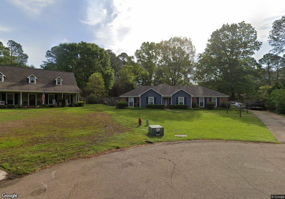
30 River Birch Cir Madison, MS 39110
Estimated Value: $316,000 - $354,797
4
Beds
2
Baths
2,341
Sq Ft
$145/Sq Ft
Est. Value
About This Home
This home is located at 30 River Birch Cir, Madison, MS 39110 and is currently estimated at $338,449, approximately $144 per square foot. 30 River Birch Cir is a home located in Madison County with nearby schools including Madison Avenue Upper Elementary School, Madison Avenue Elementary, and Madison Middle School.
Ownership History
Date
Name
Owned For
Owner Type
Purchase Details
Closed on
Apr 5, 2021
Sold by
Hayes Tammy Lynn and Estate Of Frankie Earline Haye
Bought by
Hayes Tammy Lynn
Current Estimated Value
Purchase Details
Closed on
Mar 30, 2021
Sold by
Hayes Frankie Earline
Bought by
Hayes Tammy Lynn
Purchase Details
Closed on
Feb 16, 2007
Sold by
Wilbanks Keith R and Wilbanks Victoria S
Bought by
Hayes Frankie
Home Financials for this Owner
Home Financials are based on the most recent Mortgage that was taken out on this home.
Original Mortgage
$195,500
Interest Rate
6.16%
Mortgage Type
Purchase Money Mortgage
Purchase Details
Closed on
Apr 6, 2006
Sold by
Long John M and Long Paula W
Bought by
Wilbanks Keith R and Wilbanks Victoria S
Create a Home Valuation Report for This Property
The Home Valuation Report is an in-depth analysis detailing your home's value as well as a comparison with similar homes in the area
Home Values in the Area
Average Home Value in this Area
Purchase History
| Date | Buyer | Sale Price | Title Company |
|---|---|---|---|
| Hayes Tammy Lynn | -- | None Available | |
| Hayes Tammy Lynn | -- | None Listed On Document | |
| Hayes Frankie | -- | None Available | |
| Wilbanks Keith R | -- | None Available |
Source: Public Records
Mortgage History
| Date | Status | Borrower | Loan Amount |
|---|---|---|---|
| Previous Owner | Hayes Frankie | $195,500 |
Source: Public Records
Tax History Compared to Growth
Tax History
| Year | Tax Paid | Tax Assessment Tax Assessment Total Assessment is a certain percentage of the fair market value that is determined by local assessors to be the total taxable value of land and additions on the property. | Land | Improvement |
|---|---|---|---|---|
| 2024 | $2,206 | $21,509 | $0 | $0 |
| 2023 | $2,206 | $21,509 | $0 | $0 |
| 2022 | $2,206 | $21,509 | $0 | $0 |
| 2021 | $3,627 | $31,121 | $0 | $0 |
| 2020 | $1,544 | $20,747 | $0 | $0 |
| 2019 | $1,544 | $20,747 | $0 | $0 |
| 2018 | $1,544 | $20,747 | $0 | $0 |
| 2017 | $1,508 | $20,441 | $0 | $0 |
| 2016 | $1,391 | $19,441 | $0 | $0 |
| 2015 | $1,391 | $19,441 | $0 | $0 |
| 2014 | $1,285 | $18,530 | $0 | $0 |
Source: Public Records
Map
Nearby Homes
- 0 Chestnut Hill Unit 4126407
- 22 Chestnut Dr
- 14 Peachtree Ln
- 15 Peachtree Ln
- 60 Chestnut Dr
- 119 Bayberry Ln
- 434 Laural Ct
- 108 Woods Crossing Blvd
- 0 Woodbridge Dr Unit 4124242
- 226 Wright's Mill Dr
- 3104 Bridgeport Ln
- 0 St Augustine Dr Unit 4129175
- 1001 Bridgeport Dr
- 407 Saint Augustine Dr
- 415 Saint Augustine Dr
- 00 Saint Augustine Dr
- 0 Saint Augustine Dr
- 153 Wrights Mill Dr
- 701 Welford Ct
- 508 Pawnee Way
- 29 River Birch Cir
- 114 Sugar Maple Ln
- 31 River Birch Cir
- 113 Sugar Maple Ln
- 28 River Birch Cir
- 0 Chestnut Hill Unit 64 304870
- 0 Chestnut Dr Unit Lot 12 190770
- 0 Chestnut Dr Unit Lot 11 190769
- 0 Chestnut Dr Unit Lot 3 192729
- 0 Chestnut Dr Unit LOT 69 192592
- 0 Chestnut Dr Unit LOT 22 192591
- 0 Chestnut Dr Unit Lot 12 195736
- 0 Chestnut Dr Unit Lot 11 195733
- 0 Chestnut Dr Unit LOT 11 201421
- 0 Chestnut Dr Unit LOT 12 201396
- 0 Chestnut Dr Unit LOT 15 216610
- 0 Chestnut Dr Unit LOT 15 226079
- 0 Chestnut Dr Unit 59
- 0 Chestnut Hill Unit 4091432
- 0 Chestnut Hill Unit 64 1304870