
Seller's Agent in 2025
Deanna Faucher
Lamacchia Realty, Inc.
(508) 425-7372
1 in this area
149 Total Sales
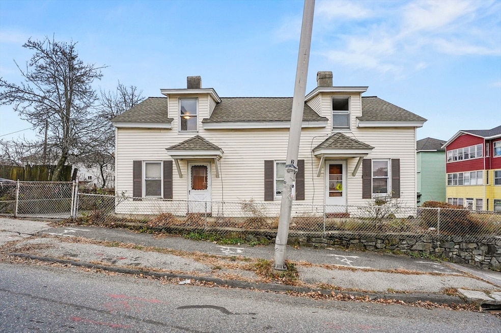
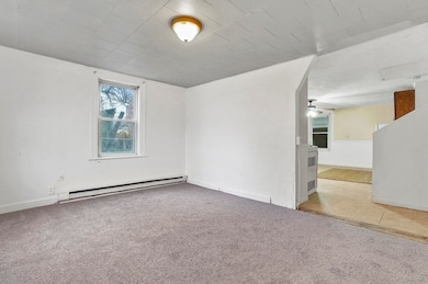
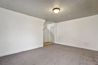
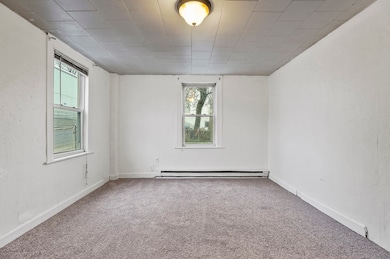
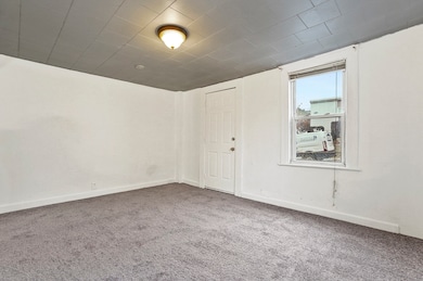
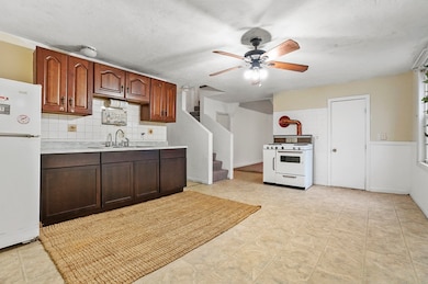
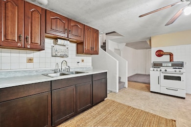
Discover the perfect opportunity for investors or owner occupants with this well-maintained two-family home in Worcester! Each unit offers two levels of living with 2 bedrooms, a full bath, a living room, and a kitchen. Unit 1 features a spacious living room, a large kitchen with a classic subway tile backsplash and gas stove, and two plush-carpeted bedrooms on the second level. Unit 2 offers a bright living room with hardwood floors and a kitchen equipped with a breakfast bar and abundant countertop and cabinet space. The fully fenced lot includes off-street parking and a covered outdoor area in the back—ideal for relaxing or storage. All this just minutes from Route 290 and a variety of local amenities. Don’t miss this fantastic multi-family opportunity!
Last Buyer's Agent
Jasmine Ortiz
HestiaLiving Corporation
| Date | Type | Sale Price | Title Company |
|---|---|---|---|
| Quit Claim Deed | $500,000 | -- | |
| Quit Claim Deed | -- | -- | |
| Deed | $240,000 | -- |
| Date | Status | Loan Amount | Loan Type |
|---|---|---|---|
| Open | $490,943 | FHA | |
| Closed | $490,943 | FHA | |
| Previous Owner | $192,000 | Purchase Money Mortgage |
| Date | Event | Price | List to Sale | Price per Sq Ft |
|---|---|---|---|---|
| 12/29/2025 12/29/25 | Sold | $500,000 | +1.0% | $288 / Sq Ft |
| 12/09/2025 12/09/25 | Pending | -- | -- | -- |
| 12/05/2025 12/05/25 | For Sale | $494,900 | -- | $285 / Sq Ft |
| Year | Tax Paid | Tax Assessment Tax Assessment Total Assessment is a certain percentage of the fair market value that is determined by local assessors to be the total taxable value of land and additions on the property. | Land | Improvement |
|---|---|---|---|---|
| 2025 | $4,403 | $333,800 | $74,900 | $258,900 |
| 2024 | $4,279 | $311,200 | $74,900 | $236,300 |
| 2023 | $3,889 | $271,200 | $65,100 | $206,100 |
| 2022 | $3,927 | $258,200 | $52,100 | $206,100 |
| 2021 | $3,362 | $206,500 | $41,700 | $164,800 |
| 2020 | $2,900 | $170,600 | $41,400 | $129,200 |
| 2019 | $2,875 | $159,700 | $36,200 | $123,500 |
| 2018 | $2,956 | $156,300 | $36,200 | $120,100 |
| 2017 | $2,968 | $154,400 | $36,200 | $118,200 |
| 2016 | $2,879 | $139,700 | $26,400 | $113,300 |
| 2015 | $2,804 | $139,700 | $26,400 | $113,300 |
| 2014 | $2,730 | $139,700 | $26,400 | $113,300 |
Seller's Agent in 2025
Deanna Faucher
Lamacchia Realty, Inc.
(508) 425-7372
1 in this area
149 Total Sales
J
Buyer's Agent in 2025
Jasmine Ortiz
HestiaLiving Corporation
Source: MLS Property Information Network (MLS PIN)
MLS Number: 73460168
APN: WORC-000004-000011-000041
Disclaimer: Certain information contained herein is derived from information provided by parties other than Homes.com. All information provided is deemed reliable, but is not guaranteed to be accurate and should be independently verified.
![]() The property listing data and information, or the Images, set forth herein were provided to MLS Property Information Network, Inc. from third party sources, including sellers, lessors and public records, and were compiled by MLS Property Information Network, Inc. The property listing data and information, and the Images, are for the personal, non-commercial use of consumers having a good faith interest in purchasing or leasing listed properties of the type displayed to them and may not be used for any purpose other than to identify prospective properties which such consumers may have a good faith interest in purchasing or leasing. MLS Property Information Network, Inc. and its subscribers disclaim any and all representations and warranties as to the accuracy of the property listing data and information, or as to the accuracy of any of the Images, set forth herein.
The property listing data and information, or the Images, set forth herein were provided to MLS Property Information Network, Inc. from third party sources, including sellers, lessors and public records, and were compiled by MLS Property Information Network, Inc. The property listing data and information, and the Images, are for the personal, non-commercial use of consumers having a good faith interest in purchasing or leasing listed properties of the type displayed to them and may not be used for any purpose other than to identify prospective properties which such consumers may have a good faith interest in purchasing or leasing. MLS Property Information Network, Inc. and its subscribers disclaim any and all representations and warranties as to the accuracy of the property listing data and information, or as to the accuracy of any of the Images, set forth herein.
Ask me questions while you tour the home.