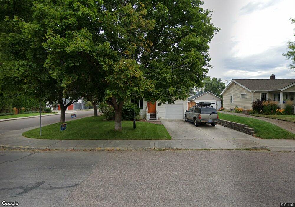
300 E Kent Ave Missoula, MT 59801
University District NeighborhoodEstimated Value: $884,000 - $938,340
5
Beds
4
Baths
2,204
Sq Ft
$414/Sq Ft
Est. Value
About This Home
This home is located at 300 E Kent Ave, Missoula, MT 59801 and is currently estimated at $913,335, approximately $414 per square foot. 300 E Kent Ave is a home located in Missoula County with nearby schools including Paxson School, Washington Middle School, and Sentinel High School.
Ownership History
Date
Name
Owned For
Owner Type
Purchase Details
Closed on
Aug 8, 2006
Sold by
Fleming Alice M
Bought by
Fleming Robert E
Current Estimated Value
Purchase Details
Closed on
Mar 30, 2005
Sold by
Fleming Alice M and Fleming Robert E
Bought by
Fleming Alice M
Home Financials for this Owner
Home Financials are based on the most recent Mortgage that was taken out on this home.
Original Mortgage
$358,000
Interest Rate
5.6%
Mortgage Type
Fannie Mae Freddie Mac
Purchase Details
Closed on
Oct 6, 2004
Sold by
Fleming Robert E and Fleming Alice M
Bought by
Fleming Alice M
Create a Home Valuation Report for This Property
The Home Valuation Report is an in-depth analysis detailing your home's value as well as a comparison with similar homes in the area
Home Values in the Area
Average Home Value in this Area
Purchase History
We collect this data history from publicly available records. To have your information removed, we recommend requesting removal directly through your county’s website.
| Date | Buyer | Sale Price | Title Company |
|---|---|---|---|
| Fleming Robert E | -- | None Available | |
| Fleming Alice M | -- | -- | |
| Fleming Alice M | -- | -- | |
| Fleming Alice M | -- | -- |
Source: Public Records
Mortgage History
We collect this data history from publicly available records. To have your information removed, we recommend requesting removal directly through your county’s website.
| Date | Status | Borrower | Loan Amount |
|---|---|---|---|
| Previous Owner | Fleming Alice M | $358,000 |
Source: Public Records
Tax History
| Year | Tax Paid | Tax Assessment Tax Assessment Total Assessment is a certain percentage of the fair market value that is determined by local assessors to be the total taxable value of land and additions on the property. | Land | Improvement |
|---|---|---|---|---|
| 2025 | $9,456 | $927,200 | $290,190 | $637,010 |
| 2024 | $9,074 | $745,700 | $258,960 | $486,740 |
| 2023 | $8,743 | $745,700 | $258,960 | $486,740 |
| 2022 | $7,579 | $560,800 | $0 | $0 |
| 2021 | $6,813 | $560,800 | $0 | $0 |
| 2020 | $6,108 | $467,000 | $0 | $0 |
| 2019 | $6,088 | $467,000 | $0 | $0 |
| 2018 | $6,361 | $474,500 | $0 | $0 |
| 2017 | $6,289 | $474,500 | $0 | $0 |
| 2016 | $5,289 | $416,100 | $0 | $0 |
| 2015 | $4,895 | $416,100 | $0 | $0 |
| 2014 | $3,999 | $191,065 | $0 | $0 |
Source: Public Records
Map
Nearby Homes
- 325 North Ave E
- 220 North Ave E
- 1900 Ronald Ave
- 117 W Central Ave
- 420 Hastings Ave
- 1700 Arthur Ave
- 222 Evans Ave
- 715 Beverly Ave
- 436 Keith Ave
- 101 Mary Ave
- 2118 Queen St
- 307 Benton Ave
- 921 E Beckwith Ave
- 106 Sentinel St
- 470 Strand Ave
- 1005 Gerald Ave
- 300 Connell Ave
- 327 Tremont St
- 110 Hillcrest Loop
- 225 Eddy Ave
Your Personal Tour Guide
Ask me questions while you tour the home.