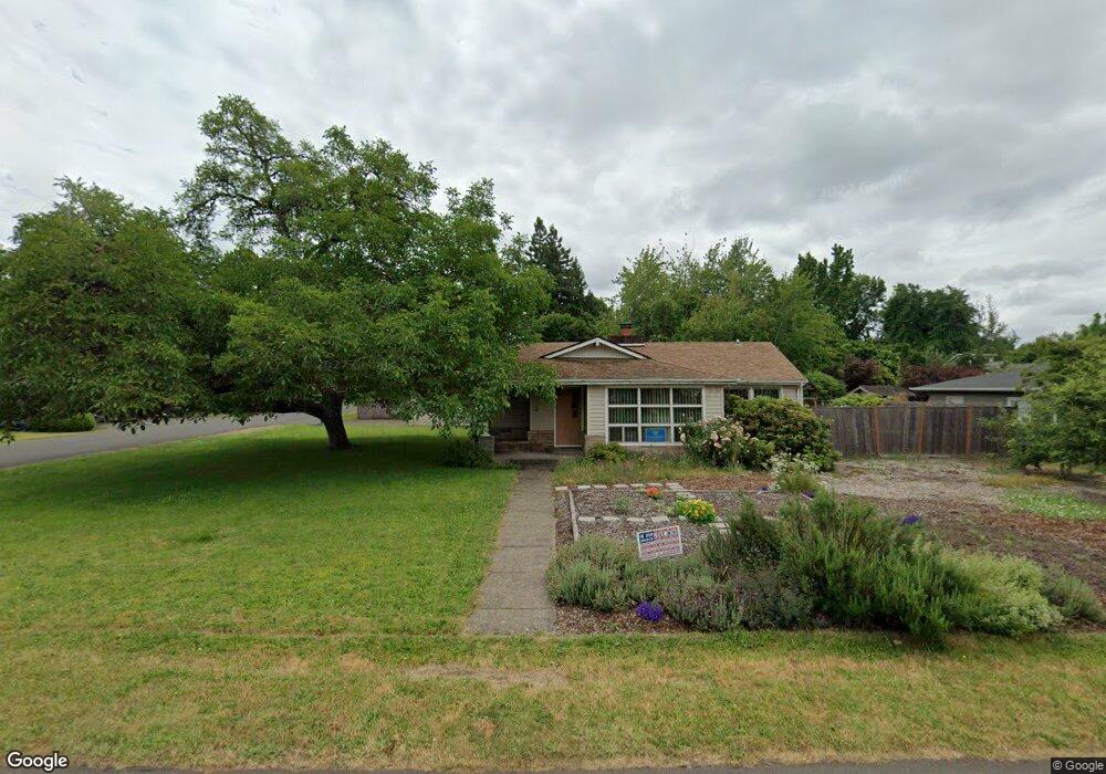
300 Hawthorne Ave Eugene, OR 97404
River Road NeighborhoodEstimated Value: $409,000 - $460,000
3
Beds
2
Baths
1,259
Sq Ft
$340/Sq Ft
Est. Value
About This Home
This home is located at 300 Hawthorne Ave, Eugene, OR 97404 and is currently estimated at $428,608, approximately $340 per square foot. 300 Hawthorne Ave is a home located in Lane County with nearby schools including River Road/El Camino del Río Elementary School, Kelly Middle School, and North Eugene High School.
Ownership History
Date
Name
Owned For
Owner Type
Purchase Details
Closed on
Feb 25, 2010
Sold by
Anderson Jerome Kermit
Bought by
Dewein Jordan F and Dewein Jill M
Current Estimated Value
Home Financials for this Owner
Home Financials are based on the most recent Mortgage that was taken out on this home.
Original Mortgage
$218,960
Outstanding Balance
$146,582
Interest Rate
5.5%
Mortgage Type
FHA
Estimated Equity
$282,026
Purchase Details
Closed on
Feb 24, 2010
Sold by
Anderson Jerome Kermit and Anderson Kermit Walter
Bought by
Anderson Jerome Kermit and Mildred W Anderson Revokable Trust
Home Financials for this Owner
Home Financials are based on the most recent Mortgage that was taken out on this home.
Original Mortgage
$218,960
Outstanding Balance
$146,582
Interest Rate
5.5%
Mortgage Type
FHA
Estimated Equity
$282,026
Purchase Details
Closed on
Aug 18, 1994
Sold by
Anderson Kermit Walter and Anderson Mildred W
Bought by
Anderson Kermit Walter and Anderson Mildred W
Create a Home Valuation Report for This Property
The Home Valuation Report is an in-depth analysis detailing your home's value as well as a comparison with similar homes in the area
Home Values in the Area
Average Home Value in this Area
Purchase History
| Date | Buyer | Sale Price | Title Company |
|---|---|---|---|
| Dewein Jordan F | $223,000 | Western Title & Escrow | |
| Anderson Jerome Kermit | -- | Western Title & Escrow | |
| Anderson Kermit Walter | -- | Western Title & Escrow Co |
Source: Public Records
Mortgage History
| Date | Status | Borrower | Loan Amount |
|---|---|---|---|
| Open | Dewein Jordan F | $218,960 |
Source: Public Records
Tax History
| Year | Tax Paid | Tax Assessment Tax Assessment Total Assessment is a certain percentage of the fair market value that is determined by local assessors to be the total taxable value of land and additions on the property. | Land | Improvement |
|---|---|---|---|---|
| 2025 | $3,894 | $231,790 | -- | -- |
| 2024 | $3,852 | $225,039 | -- | -- |
| 2023 | $3,852 | $218,485 | $0 | $0 |
| 2022 | $3,623 | $212,122 | $0 | $0 |
| 2021 | $3,369 | $205,944 | $0 | $0 |
| 2020 | $3,373 | $199,946 | $0 | $0 |
| 2019 | $3,207 | $194,123 | $0 | $0 |
| 2018 | $2,933 | $182,980 | $0 | $0 |
| 2017 | $2,779 | $182,980 | $0 | $0 |
| 2016 | $2,649 | $177,650 | $0 | $0 |
| 2015 | $2,587 | $172,476 | $0 | $0 |
| 2014 | $2,573 | $167,452 | $0 | $0 |
Source: Public Records
Map
Nearby Homes
- 157 Hansen Ln
- 820 Park Terrace
- 0 River Rd Unit 634143722
- 780 Cherry Ave
- 805 River Rd
- 734 Filbert Ave
- 882 Jackies Ln
- 32 Marion Ln
- 144 Briarcliff Dr
- 111 Holeman Ave
- 104 Holeman Ave
- 172 Oakleigh Ln Unit 513
- 172 Oakleigh Ln Unit 221
- 325 River Rd
- 168 150 N Cleveland St
- 168 N Cleveland St
- 150 N Cleveland St
- 2494 Roosevelt Blvd
- 1010 Horn Ln
- 1035 Madera St
- 326 Hawthorne Ave
- 326 S Hawthorne
- 298 Hawthorne Ave
- 315 Knoop Ln
- 338 Hawthorne Ave
- 315 Hawthorne Ave
- 655 Mayfair Ln
- 337 Knoop Ln
- 331 Hawthorne Ave
- 282 Hawthorne Ave
- 297 Hawthorne Ave
- 350 Hawthorne Ave
- 275 Knoop Ln
- 347 Hawthorne Ave
- 353 Knoop Ln
- 281 Hawthorne Ave
- 266 Hawthorne Ave
- 310 Hardy Ave
- 265 Knoop Ln
Your Personal Tour Guide
Ask me questions while you tour the home.