Estimated Value: $364,000 - $440,000
3
Beds
2
Baths
2,280
Sq Ft
$176/Sq Ft
Est. Value
About This Home
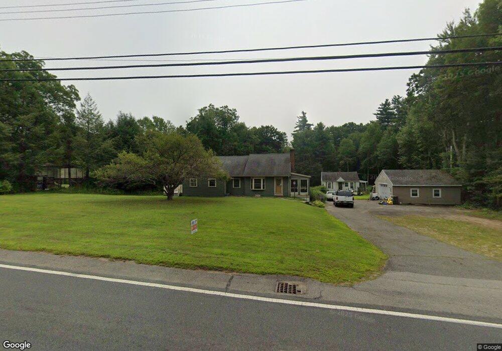
This home is located at 300 Palmer Rd, Ware, MA 01082 and is currently estimated at $400,257, approximately $175 per square foot. 300 Palmer Rd is a home located in Hampshire County with nearby schools including Stanley M. Koziol Elementary School, Ware Middle School, and Ware Junior/Senior High School.
Ownership History
Date
Name
Owned For
Owner Type
Purchase Details
Closed on
Dec 17, 2025
Sold by
Kruckas Keith J
Bought by
Bho Realty Llc
Current Estimated Value
Home Financials for this Owner
Home Financials are based on the most recent Mortgage that was taken out on this home.
Original Mortgage
$344,500
Outstanding Balance
$344,500
Interest Rate
6.22%
Mortgage Type
Purchase Money Mortgage
Estimated Equity
$55,757
Purchase Details
Closed on
Nov 6, 2018
Sold by
Kruckas Keith J
Bought by
Joan M Pajak Lt and Pajak
Purchase Details
Closed on
Dec 1, 2016
Sold by
Kruckas Dwight E Est and Green
Bought by
Kruckas Keith J
Purchase Details
Closed on
Jun 30, 2000
Sold by
Ando Suzanne
Bought by
Kruckas Dwight E and Kurckas Gdn Louise
Home Financials for this Owner
Home Financials are based on the most recent Mortgage that was taken out on this home.
Original Mortgage
$137,750
Interest Rate
8.59%
Mortgage Type
Purchase Money Mortgage
Create a Home Valuation Report for This Property
The Home Valuation Report is an in-depth analysis detailing your home's value as well as a comparison with similar homes in the area
Home Values in the Area
Average Home Value in this Area
Purchase History
| Date | Buyer | Sale Price | Title Company |
|---|---|---|---|
| Bho Realty Llc | $250,000 | -- | |
| Joan M Pajak Lt | $30,000 | -- | |
| Kruckas Keith J | -- | -- | |
| Kruckas Dwight E | $145,000 | -- |
Source: Public Records
Mortgage History
| Date | Status | Borrower | Loan Amount |
|---|---|---|---|
| Open | Bho Realty Llc | $344,500 | |
| Previous Owner | Kruckas Dwight E | $137,750 |
Source: Public Records
Tax History Compared to Growth
Tax History
| Year | Tax Paid | Tax Assessment Tax Assessment Total Assessment is a certain percentage of the fair market value that is determined by local assessors to be the total taxable value of land and additions on the property. | Land | Improvement |
|---|---|---|---|---|
| 2025 | $4,455 | $295,800 | $52,900 | $242,900 |
| 2024 | $4,265 | $261,200 | $49,900 | $211,300 |
| 2023 | $5,723 | $331,600 | $48,100 | $283,500 |
| 2022 | $5,450 | $281,800 | $44,500 | $237,300 |
| 2021 | $5,227 | $259,000 | $44,500 | $214,500 |
| 2020 | $5,042 | $244,400 | $44,500 | $199,900 |
| 2019 | $5,065 | $250,600 | $50,700 | $199,900 |
| 2018 | $4,836 | $233,500 | $49,500 | $184,000 |
| 2017 | $4,590 | $221,000 | $49,500 | $171,500 |
| 2016 | $4,466 | $221,000 | $49,500 | $171,500 |
| 2015 | $4,272 | $217,400 | $49,500 | $167,900 |
| 2014 | $4,248 | $232,000 | $53,500 | $178,500 |
Source: Public Records
Map
Nearby Homes
- 201 West St
- LOT 3 Monson Turnpike Rd
- 28 Gould St
- 201 Belchertown Rd
- 14 Laurel Dr
- 67 Babcock Tavern Rd
- 375 Belchertown Rd
- Lot 16 Coldbrook Dr
- Lot 20 Coldbrook Dr
- Lot 22 Coldbrook Dr
- Lot 13 Coldbrook Dr
- Lot 25 Coldbrook Dr
- 87 W Main St
- 378 Rondeau St
- 23 West St Unit 25
- 7 Webb Ct
- 44 South St
- 48 North St Unit 1
- 57 Babcock Tavern Rd
- 49 Babcock Tavern Rd
- 298 Palmer Rd
- 304 Palmer Rd
- 295 Palmer Rd
- 296 Palmer Rd
- 2 Woodland Heights
- 349 Palmer Rd
- 4 Woodland Heights
- 16 Skyview Dr
- 291 Palmer Rd
- 308 Palmer Rd
- 3 Woodland Heights
- 313 Palmer Rd
- 287 Palmer Rd
- 294 Palmer Rd
- 279 Palmer Rd
- 6 Woodland Heights
- 5 Woodland Heights
- 310 Palmer Rd
- 2 Longview Ave
- 9 Sunnyhill Dr